Tried out their "free sample" download for a 20x20-min area. It
looks very smooth, as if highly filtered.
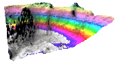
Compared to the contemporary ETOPO2 dataset, GEBCO
appears to be actually less detailed despite being higher precision and
less noisy.
There are some different viewpoints and interesting history on the GEBCO data. A series of
postings from the GMT mailing list by Walter Smith (of
the Smith&Sandwell altimetry-based bathymetry dataset):
post1,
post2
their ocean floor data is referred to as "u/w" for "underway"
has collected and made available bathymetry from many cruises over
the years, although it is very difficult and confusing to find actual
data on their site
a touched up and generalized version of
SRTM30 Plus, global combined sea floor and land elevation data
specifically, the artifacts remaining from the 1997
Smith and Sandwell bathymetry have been manually "cleaned up", with
a more visually appealing result
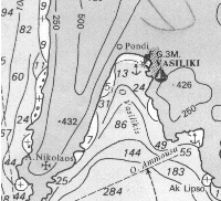
if you can't find any digital data, it may be possible to acquire
nautical charts and digitize the contours
Imray is a major publisher of
Nautical Books and Charts; you can buy charts of Europe, the
Mediterranean and the Caribbean
at least one VTP user has taken this approach, modelling the Islands
of Greece
File Formats
bathymetry is sometimes available in the same
DEM
formats as above-sea elevation, although more commonly it is not
CDF
developed at the NASA Space Science Data Center at Goddard, and is
freely available
was originally a FORTRAN interface for scientific data access
Unidata re-implemented the library and designed the CDL (network
Common Dataform Language) text representation for netCDF data
CDF and netCDF have evolved independently, and they are not
compatible
the public-domain UNIX package
GMT can handle netCDF by
using the NetCDF
Library
when a bathymetry CDF (netCDF) is encountered, it:
has a 1468 byte header containing a descriptive title, any
additional comments, units of the x, y, z, dimensions, number of
nodes in the x, y dimensions, minimum and maximum values of x, y, z,
node spacing in the x, y directions, a scale factor, and offset
the grid array is IEEE 32-bit floating point numbers, consisting
of sequential rows from top to bottom. Each row contains values from
left to right.
HDF
an extensible data format for self-describing files, developed by
NCSA, freely available
consists of three arrays containing:
the depths for each grid node (32-bit IEEE floating point
numbers)
a good site for material about the confluence of GIS and
oceanography, by Dr. Dawn Wright of OSU
Global
Bathymetric Prediction for Ocean Modelling and Marine Geophysics
they are constructing a complete bathymetric map of the oceans at a
3-10 km resolution by combining all of the available
depth soundings collected over the past 30 years with high resolution
marine
gravity information provided by the Geosat, ERS-1/2, and
Topex/Poseidon altimeters