Overview
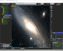
Aladin is an interactive sky atlas allowing the user to visualize digitized astronomical images or full surveys, superimpose entries from astronomical catalogues or databases, and interactively access related data and information from the Simbad database, the VizieR service and other archives for all known astronomical objects in the field.
 |
Download Aladin Desktop on your machine |
|
Preview with Aladin Lite in your browser |
||
|
|
Install ipyaladin for Python notebooks |
The Aladin sky atlas is available in two modes:
- Aladin Desktop, a regular Desktop application
- Aladin Lite a Javascript Web application.
Aladin Desktop
Aladin Desktop is a widely-used java tool capable of addressing challenges such as locating data of interest, accessing and exploring distributed datasets, visualizing multi-wavelength data. Compliance with existing or emerging VO standards, interconnection with other visualisation or analysis tools, ability to easily compare heterogeneous data are key topics allowing Aladin to be a powerful data exploration and integration tool as well as a science enabler. Aladin Desktop is based on Java techonology. It requires a classical installation on the user machine.
Aladin Lite
Aladin Lite is a lightweight version of the Aladin tool, running in the browser and geared towards simple visualization of a sky region. Aladin Lite is powered by the WebGL technology, currently supported by any modern browser. Aladin Lite is easily embeddable on any web page and can also be controlled through a Javacript API.
We also offer an experimental viewer to visualize planetary surfaces HiPS datasets
If you are you a developer interested in integrating Aladin Lite in your project, have a look at the dedicated documentation.
Aladin Lite is also available as a widget for Python notebooks: ipyaladin.
Access ipyaladin documentation
Available data
Aladin Desktop & Aladin Lite use reprocessed data based on HiPS technology (Hierarchical Progressive Survey) with the capability to zoom and pan on any regions of the surveys. There are about 1100+ HiPS surveys available for 500TB of pixels provided by several collaborative servers.
Aladin Desktop provides direct data access to most of the astronomical servers over the world (CDS, NED, ESO,
Documentation
- Aladin Desktop documentation, notably the FAQ
- Aladin Lite documentation, notably the API
- HiPS documentation
Mailing list
- Subscribe the Aladin mailing list by sending an e-mail to
sympa@unistra.fr with this unique subject
subscribe astro-aladin. - Browse the Aladin mailing archive through this link.
Copyright
Aladin Desktop & Aladin Lite are developed by the Centre de Données astronomiques de Strasbourg.Both are distributed under GPL v3 licence.
Acknowledgement
If the Aladin Sky Atlas was helpful for your research work, the following citation would be appreciated: This research has made use of "Aladin sky atlas" developed at CDS, Strasbourg Observatory, France→ 2000A&AS..143...33B (Aladin Desktop), 2014ASPC..485..277B (Aladin Lite v2), and 2022ASPC..532....7B (Aladin Lite v3).