Grønland er Jordens største ø. Geografisk hører Grønland til det nordamerikanske kontinent, men geopolitisk til Europa. Kalaallit Nunaat, er ligesom Færøerne en del af det danske rige og indgår i det danske rigsfællesskab.
Greenland is an autonomous territory and a constituent part of the Kingdom of Denmark. Though geographically and ethnically an Arctic island nation associated with the continent of North America, located east of ► Canada, politically and historically Greenland is closely tied to Europe. To the east of Greenland are ► Iceland, ► Jan Mayen, and ► Svalbard.
This section holds a short summary of the history of the area of present-day Greenland, illustrated with maps, including historical maps of former countries and empires that included present-day Greenland.
The island of Greenland was inhabited by the Inuit since the eighth century. In 981 Vikings explored and colonized the west coast of what is now Greenland. They formed a more or less separate state that disappeared in 1410.
This map shows Scandinavian settlement in the eighth (dark red), ninth (red), tenth (orange), and eleventh (yellow) centuries. Southwestern Greenland is colored in orange.
Erik the Red (950–1000), in Old Norse, Eiríkur rauði, founded the first Nordic settlement in Greenland. This map shows Erik's Greenland
Maps showing the different cultures in Greenland, Labrador, Newfoundland, and the Canadian arctic islands in the years 900, 1100, 1300, and 1500. The green color shows the Dorset culture, blue the Thule culture, red the Norse culture, yellow the Innu culture, and orange the Beothuk culture. The Norse settlements along the southwest coast eventually disappeared after about 450 years. The Inuit survived and developed a society to fit the increasingly forbidding climate.
This map shows Greenland as part of Denmark-Norway. After several centuries of no contact between the Norse Greenlanders and the Scandinavian motherland, it was feared that the inhabitants had lapsed back into paganism, so in 1721 a missionary expedition was sent out to reinstate Christianity. However, since none of the lost Norse Greenlanders were found, Denmark-Norway, instead, proceeded to baptize the local Inuit Greenlanders and develop trading colonies along the coast as part of its aspirations to be a colonial power. Colonial privileges were retained, such as a monopoly on trade. The colony of Greenland was established in 1775.
This map shows Denmark-Norway, including Greenland in 1780
From 1917 on, the whole of Greenland was under Danish control. Norway annexed the eastern part of Greenland (shown on the map) in 1932 and named it Erik the Red's Land. In 1933 the International Court of Justice ruled in favor of Denmark, and Norway withdrew.
During World War II, from 1941 to 1945, the United States protected the colony. In 1953 Greenland became a constituent part of the Kingdom of Denmark. Greenland was granted autonomy in 1979.
Old maps
This section holds copies of original general maps more than 70 years old.
17th century map of Greenland
Satellite maps
Satellite image
Notes and references
General remarks:
The WIKIMEDIA COMMONS Atlas of the World is an organized and commented collection of geographical, political and historical maps available at Wikimedia Commons. The main page is therefore the portal to maps and cartography on Wikimedia. That page contains links to entries by country, continent and by topic as well as general notes and references.
Every entry has an introduction section in English. If other languages are native and/or official in an entity, introductions in other languages are added in separate sections. The text of the introduction(s) is based on the content of the Wikipedia encyclopedia. For sources of the introduction see therefore the Wikipedia entries linked to. The same goes for the texts in the history sections.
Historical maps are included in the continent, country and dependency entries.
The status of various entities is disputed. See the content for the entities concerned.
The maps of former countries that are more or less continued by a present-day country or had a territory included in only one or two countries are included in the atlas of the present-day country. For example the Ottoman Empire can be found in the Atlas of Turkey.


.svg)


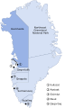 Avannaata municipality
 Qeqertalik municipality
 Qeqqata municipality
 Sermersooq municipality
 Kujalleq municipality


