Search results
Jump to navigation
Jump to search
Help • Search categories • Show other tools
|
Help
|
|
Browse
|
Search
|
There is a page named "Saarland" on this wiki
- Сарланд; Saarland; Saarland; Saarland; Saar; Saarland; سارلاند; Saarland;
沙 亞 ; Саар; Saarland; Sarre; Saarland; Saarland; Saarland; Saarland; An tSárlainn;...3 KB (647 words) - 23:37, 14 April 2024  truetrue English URL: https://commons.wikimedia.org/wiki/user:SaarlandTransit author name string: SaarlandTransit Wikimedia username: SaarlandTransit...(10,972 × 7,779 (495 KB)) - 01:46, 4 October 2023
- Saara; Saarland; Saarland; חבל הסאר; Саар; Saarland; Saarland; సార్లాండ్; Saarland; Saarlönj; Սաարլանդ; Saarland; Саар; Saarland; Saarland; Saarland; Saarlande;...45 members (40 subcategories, 3 files) - 17:14, 1 August 2023
 following images: Image:Saarland_map.png licensed with GFDL 2005-07-25T06:03:21Z Giro720 315x250 (7514 Bytes) Map of Saarland {{GDFL}} Uploaded with derivativeFX...(731 × 578 (6 KB)) - 05:48, 23 November 2020
 Image:Standarte_de-saarland.png licensed with PD-Coa-Germany 2007-09-18T08:58:04Z Rosentod 511x511 (40405 Bytes) [[Image:coa_de-saarland_300px.png|thumb|Original]]...(503 × 503 (120 KB)) - 22:36, 7 January 2024
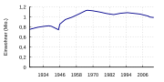 |Beschreibung = Bevölkerungsentwicklung Saarland |Quelle = selbst mit Gnuplot anhand der Daten aus [[Saarland]] |Urheber = ~~~ |Datum = 22.03.2012 |Genehmigung...(400 × 200 (18 KB)) - 09:41, 12 September 2020
 (del) (cur) 11:37, 26 February 2003 . . Cordyph (Talk | contribs) . . 315×250 (7,514 bytes) (Map of Saarland) English...(315 × 250 (7 KB)) - 23:48, 30 September 2020
 English of: Landesmedienanstalt Saarland author name string: Lantus Wikimedia username: Lantus URL: http://commons.wikimedia.org/wiki/User:Lantus...(216 × 80 (2 KB)) - 18:47, 12 November 2022
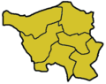 Map Template Saarland Author: de:Benutzer:Baldhur English...(315 × 250 (4 KB)) - 05:42, 3 October 2020
 English of: SPD Saarland...(550 × 550 (4 KB)) - 07:57, 28 September 2020
 administrative Ebene wie Saarland) 2008-07-05T17:34:03Z Lantus 826x679 (40088 Bytes) Position map of the state of Saarland with the six disticts and...(566 × 731 (142 KB)) - 10:49, 25 October 2020
 Deutsch: Bundesland Saarland in Deutschland. English: State Saarland in Germany. Français : Land Sarre en Allemagne. Based on a map by de:Benutzer:Jack...(668 × 910 (12 KB)) - 07:38, 1 October 2020
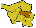 user names refer to en.wikipedia. 2003-04-28 21:20 Ahoerstemeier 221×175× (18509 bytes) Map of Saarland highlighting the Neunkirchen district English...(221 × 175 (18 KB)) - 05:48, 23 November 2020
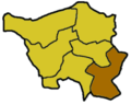 following user names refer to en.wikipedia. 2003-04-30 20:32 Ahoerstemeier 221×175× (6912 bytes) Map of Saarland highlighting the Saarpfalz district English...(221 × 175 (7 KB)) - 05:48, 23 November 2020
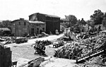 https://creativecommons.org/publicdomain/mark/1.0/PDMCreative Commons Public Domain Mark 1.0falsefalse English Victoria Mine Saarland Germany June 1945...(1,860 × 1,182 (315 KB)) - 16:23, 8 September 2022
 following user names refer to en.wikipedia. 2003-04-30 12:10 Ahoerstemeier 221×175× (6936 bytes) Map of Saarland highlighting the Saarlouis district English...(221 × 175 (7 KB)) - 05:48, 23 November 2020
 user names refer to en.wikipedia. 2003-04-29 19:27 Ahoerstemeier 221×175× (6949 bytes) Map of the Saarland highlighting the Saarbrücken district English...(221 × 175 (7 KB)) - 05:48, 23 November 2020
 user names refer to en.wikipedia. 2003-04-30 22:15 Ahoerstemeier 221×175× (6944 bytes) Map of Saarland highlighting the Sankt Wendel district English...(221 × 175 (7 KB)) - 05:48, 23 November 2020
 Taken the coa from Coa_de-saarland.svg and modified the colors in order to match the originals mentionned above. Adapted the units of the file in order...(1,063 × 1,063 (117 KB)) - 16:01, 31 March 2023
 user names refer to en.wikipedia. 2003-04-27 20:03 Ahoerstemeier 221×175× (6902 bytes) Map of the Saarland highlight the Merzig-Wadern district English...(221 × 175 (7 KB)) - 05:48, 23 November 2020


