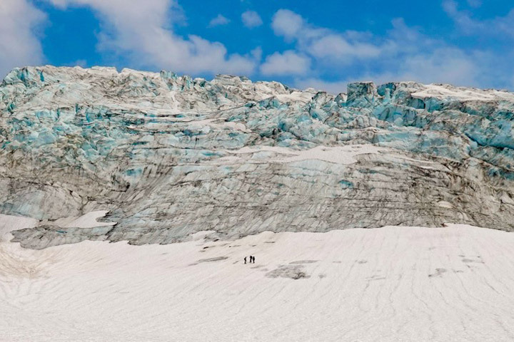
Scientists use satellites in orbit and boots on the ice to monitor glacial changes on the flanks of Mount Baker and elsewhere in Washington state.
The storm, which drenched coastal British Columbia and southeastern Alaska, may be among the region’s most intense in the past couple of decades.
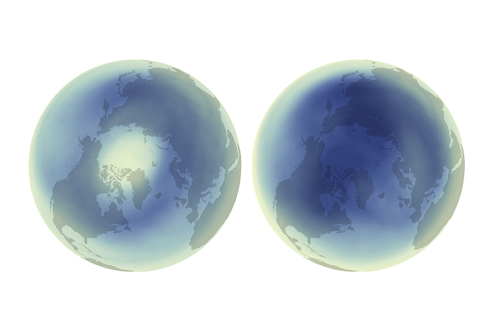
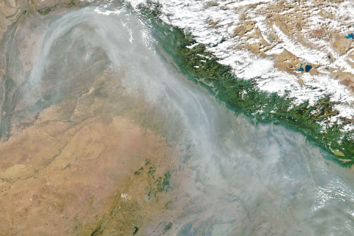
An active atmosphere at northern latitudes contributed to the highest monthly Arctic ozone concentrations measured in the satellite era.
Published Sep 26, 2024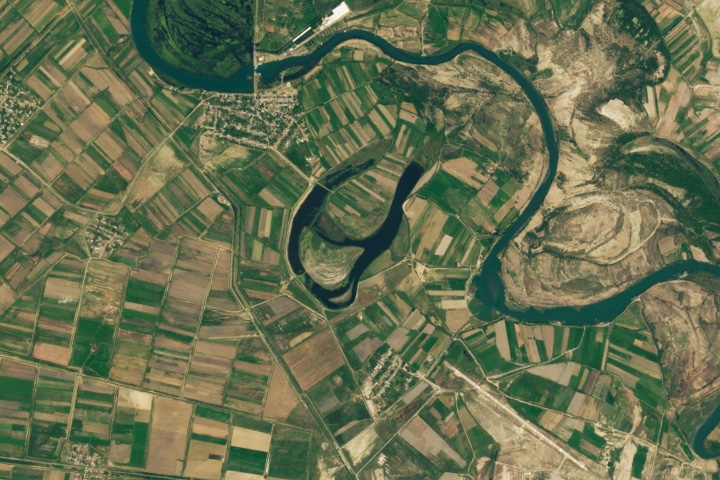
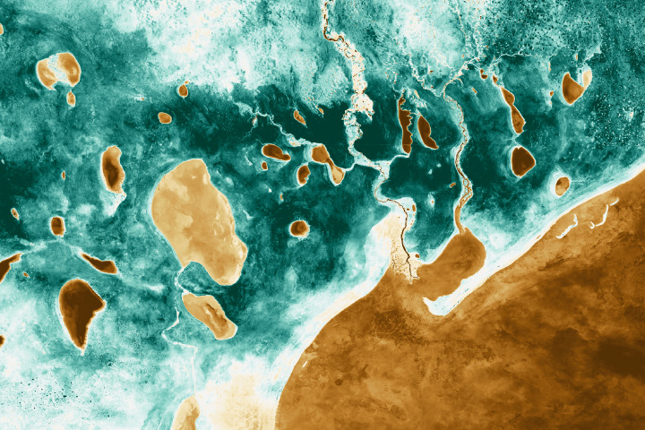
A meandering river birthed an oxbow lake that happens to be shaped like the first letter of the English alphabet.
Published Sep 25, 2024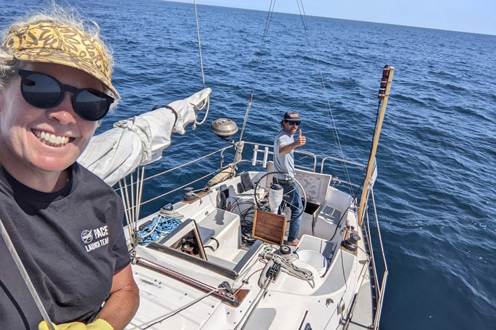
Off the coast of southern California, a research team sails for science on the Research Vessel Blissfully.
Published Sep 24, 2024
Torrential rain from a stalled storm system caused flooding in countries such as Poland and Slovakia.
Published Sep 23, 2024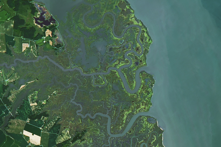
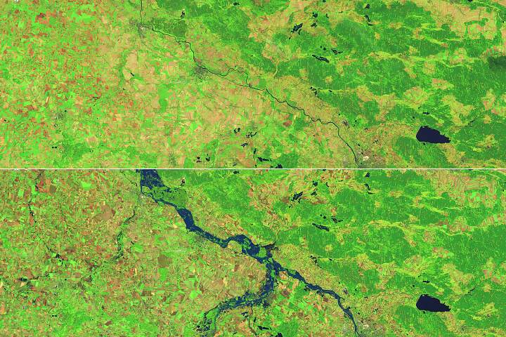
Water inundates the marshes along Delaware Bay, which provide protection against flooding and erosion, as well as habitat for migrating birds.
Published Sep 23, 2024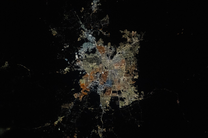
Lights in Chile’s central city display an array of colors and densities, reflecting various land uses and differences between the region’s communes.
Published Sep 22, 2024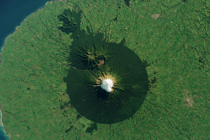
The precise geometry of the protected area encompassing an iconic New Zealand volcano is unmistakable from space.
Published Sep 21, 2024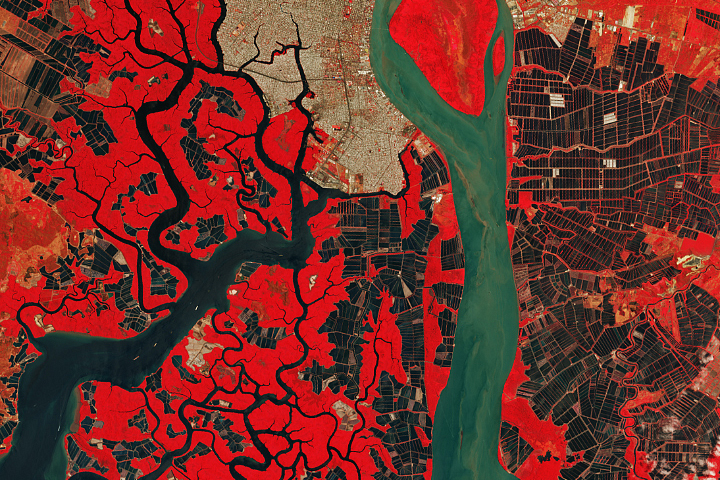
Large numbers of rectangular holding ponds lie amid mangrove forests in southern Ecuador.
Published Sep 20, 2024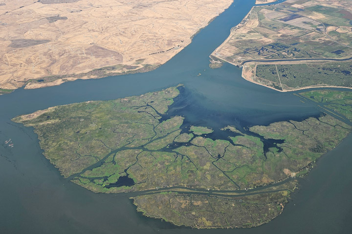
Airborne observations will help scientists validate measurements from NASA's PACE satellite.
Published Sep 18, 2024
Satellite imagery and local data helped researchers assess how landscape features, such as watering holes and vegetation, influence elephant movement.
Published Sep 18, 2024
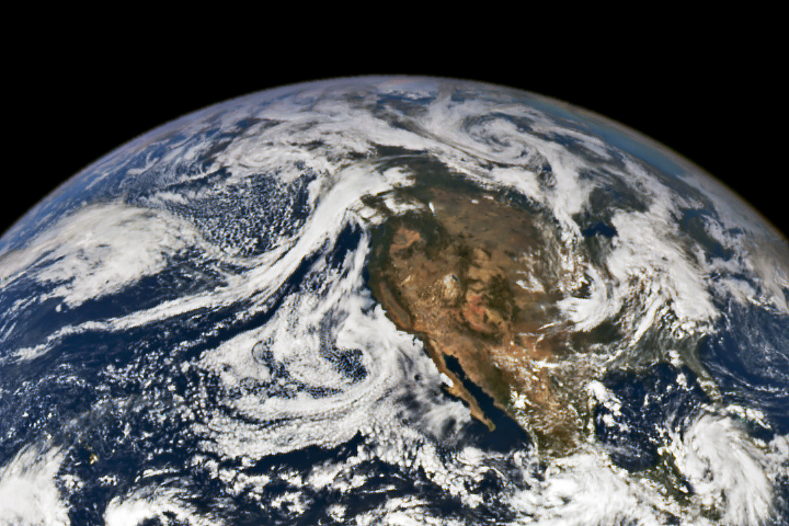
NASA satellites document how our world—forests, oceans, human landscapes, even the Sun—changes over months, seasons, and years.
Published Apr 29, 2009
Your challenge is to tell us the location of the satellite image and why it is interesting.
Published Sep 17, 2024
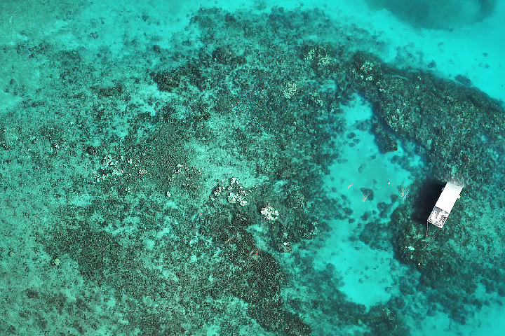
After a brutally hot summer in 2023 that caused widespread bleaching and coral death, summer 2024 was more favorable for the state’s vulnerable reefs.
Published Sep 17, 2024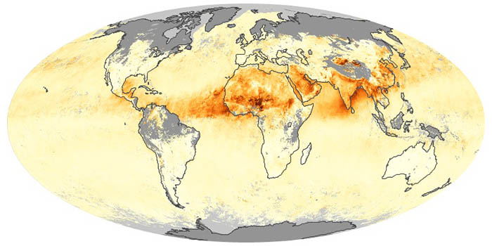
Airborne aerosols can cause or prevent cloud formation and harm human health. These maps depict aerosol concentrations in the air based on how the tiny particles reflect or absorb visible and infrared light.
Have you ever wondered what it would be like to live in a different part of the world? What would the weather be like? What kinds of animals would you see? Which plants live there? By investigating these questions, you are learning about biomes.
Published Aug 28, 2020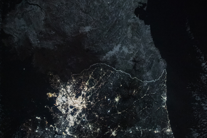
Images of nighttime lights reveal patterns in population and urban development.
Published Sep 15, 2024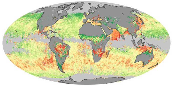
Sea salt, volcanic ash, dust, wildfire smoke, and industrial pollution are types of airborne aerosols. Natural aerosols tend to be larger than human-made aerosols. These maps show when and where aerosols come from nature, humans, or both.

Scientists at sea are making measurements to validate the observations from NASA's new ocean-observing satellite.
Published Sep 13, 2024

12 months of high-resolution global true color satellite imagery.
Published Oct 13, 2005
An extratropical storm system dropped torrential rains on parts of Morocco and Algeria.
Published Sep 13, 2024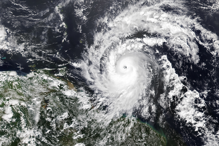
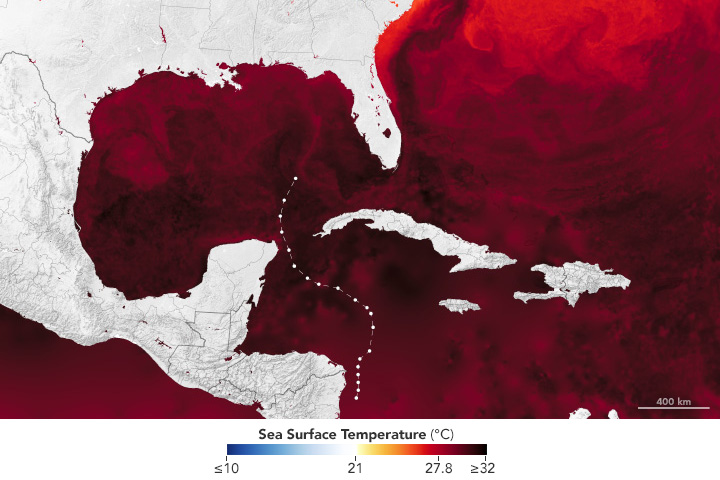
Hurricane season in the basin runs from June 1 to November 30.
Published Jul 1, 2024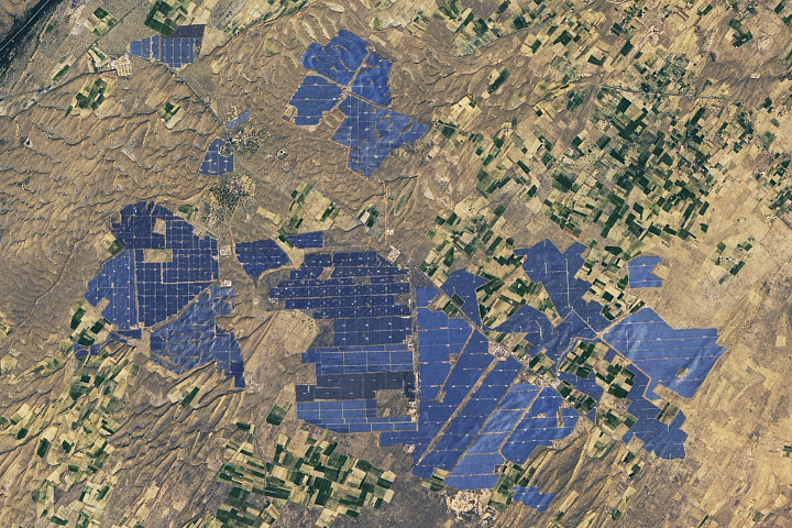
People have developed systems to harvest and store energy from sources such as wind, sunlight, and tidal action. Many of these installations are visible from orbit.
Published May 10, 2024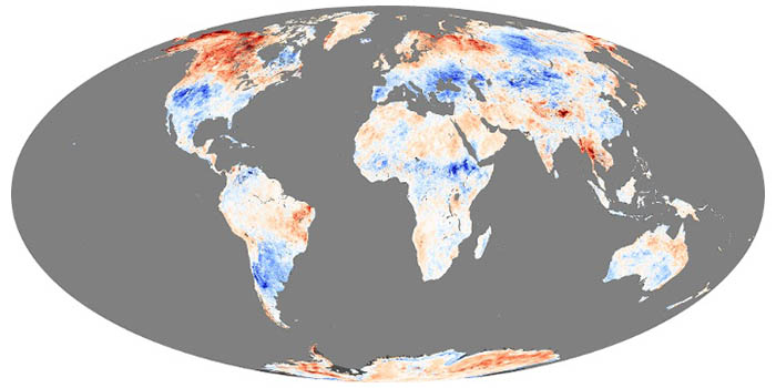
These maps depict anomalies in land surface temperatures (LSTs); that is, how much hotter or cooler a region was compared to the long-term average. LST anomalies can indicate heat waves or cold spells.
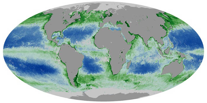
Chlorophyll is used by algae and other phytoplankton--the grass of the sea--to convert sunlight and carbon dioxide into sugars. These maps show chlorophyll concentrations in the ocean, revealing where phytoplankton are thriving.
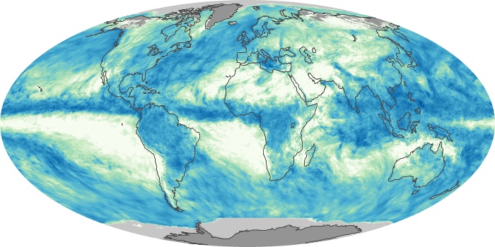
These maps depict monthly total rainfall around the world. Rainfall is the primary source of fresh water for humans, plants, and animals. Rain also moves heat between the atmosphere, oceans, and land.
From ground-level ozone to particulate matter to nitrogen dioxide, an array of gasses and particles can affect the air people breathe, with implications for human health.
Published Apr 8, 2024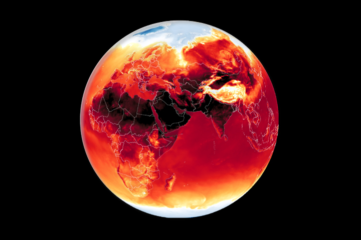
Warmer-than-average temperatures are showing up locally and globally, with consequences for people, landscapes, and ecosystems.
Published Mar 26, 2024
What do you do when presented with a new satellite image? Here's what the Earth Observatory team does to understand the view.
Published Nov 18, 2013
Satellite images of Earth at night have been a curiosity for the public and a tool of fundamental research for at least 25 years. They have provided a broad, beautiful picture, showing how humans have shaped the planet and lit up the darkness.
Published Apr 12, 2017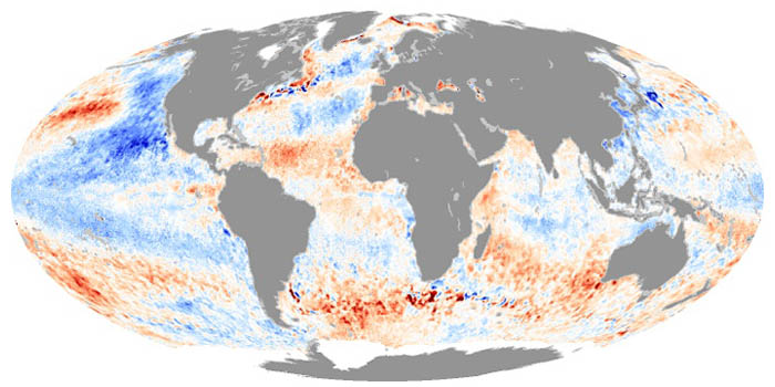
These maps depict how much hotter or cooler an ocean basin was compared to the long-term average. Temperature anomalies can indicate changes in ocean circulation or the arrival of patterns like El Niño and La Niña.

Whether sparked by lightning, intentional land-clearing, or human-caused accidents, wildland fires are burning longer and more often in some areas as the world warms.
Published Feb 27, 2024
Warmer-than-average temperatures are showing up locally and globally, with consequences for people, landscapes, and ecosystems.
Published Aug 15, 2023