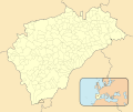
Size of this PNG preview of this SVG file: 512 × 429 pixels. Other resolutions: 287 × 240 pixels | 573 × 480 pixels | 917 × 768 pixels | 1,222 × 1,024 pixels | 2,444 × 2,048 pixels.
Original file (SVG file, nominally 512 × 429 pixels, file size: 477 KB)
File history
Click on a date/time to view the file as it appeared at that time.
| Date/Time | Thumbnail | Dimensions | User | Comment | |
|---|---|---|---|---|---|
| current | 10:26, 10 December 2010 |  | 512 × 429 (477 KB) | Miguillen | Colores según convención |
| 18:47, 13 November 2010 |  | 512 × 429 (221 KB) | Miguillen | == {{int:filedesc}} == {{Information |Description={{en|Location map of Province of Segovia}} Equirectangular projection, N/S stretching 130 %. Geographic limits of the map: * N: ° N * S: ° N * W: ° O * E: ° O {{es|Mapa |
File usage
The following 3 pages use this file:
Global file usage
The following other wikis use this file:
- Usage on ba.wikipedia.org
- Usage on eo.wikipedia.org
- Segovio
- Sankta Ildefonso (Segovio)
- Cuéllar
- Penjalaro
- Provinco Segovio
- Kokao
- Ŝablono:Geokesto lokumilo Provinco Segovio
- Orejana
- Ŝablono:Situo sur mapo Hispanio Provinco Segovio
- Sepúlveda
- Turégano
- Sotosalbos
- Municipoj de la provinco Segovio
- Adrados
- Aguilafuente
- Aldeasoña
- Cabezuela
- Calabazas de Fuentidueña
- Cantalejo
- Carbonero el Mayor
- Cobos de Fuentidueña
- Cozuelos de Fuentidueña
- Cuevas de Provanco
- Chañe
- Fresneda de Cuéllar
- Frumales
- Fuente el Olmo de Fuentidueña
- Fuente el Olmo de Íscar
- Fuentepelayo
- Fuentepiñel
- Fuenterrebollo
- Fuentesaúco de Fuentidueña
- Fuentesoto
- Fuentidueña
- Gomezserracín
- Hontalbilla
- Laguna de Contreras
- Lastras de Cuéllar
- Mata de Cuéllar
- Membibre de la Hoz
- Navalilla
- Navalmanzano
- Navas de Oro
- Olombrada
- Perosillo
- Pinarejos
- Pinarnegrillo
- Remondo
- Sacramenia
View more global usage of this file.