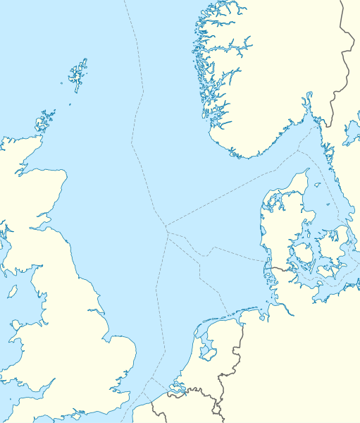
File:North Sea location map.svg
Appearance

Size of this PNG preview of this SVG file: 511 × 599 pixels. Other resolutions: 205 × 240 pixels | 409 × 480 pixels | 655 × 768 pixels | 873 × 1,024 pixels | 1,746 × 2,048 pixels | 988 × 1,159 pixels.
Original file (SVG file, nominally 988 × 1,159 pixels, file size: 582 KB)
File history
Click on a date/time to view the file as it appeared at that time.
| Date/Time | Thumbnail | Dimensions | User | Comment | |
|---|---|---|---|---|---|
| current | 08:49, 18 June 2010 |  | 988 × 1,159 (582 KB) | NordNordWest | == {{int:filedesc}} == {{Information |Description= {{de|Positionskarte der Nordsee}} Quadratische Plattkarte, N-S-Streckung 180 %. Geographische Begrenzung der Karte: * N: 62.5° N * S: 50.5° N * W: 5.2° W * O: 13.2° O {{en|Location map |
File usage
The following 32 pages use this file:
- Action of 19 August 1916
- Action of 22 August 1795
- Action of 22 September 1914
- Action of 4 May 1917
- Action off Lerwick
- Action off Noordhinder Bank
- Anglia gas field
- Armada gasfield
- Battle of Camperdown
- Battle of Dogger Bank (1915)
- Battle of Dogger Bank (1916)
- Battle of Heligoland Bight (1914)
- Battle off Texel
- Black Friday (1945)
- Frigg gas field
- German submarine U-864
- Hook of Holland
- Nordholz Naval Airbase
- Palaeo-Yare
- Raid on Yarmouth
- Rhum gasfield
- SS Narva
- Sea-Airport Cuxhaven/Nordholz
- Second Battle of Heligoland Bight
- Sinking of U-864
- Tondern raid
- Wadden Sea
- Talk:Battle of the Heligoland Bight (1939)
- User:Keith-264/sandbox2
- User:Nneube1
- Module:Location map/data/North Sea
- Module:Location map/data/North Sea/doc
Global file usage
The following other wikis use this file:
- Usage on ar.wikipedia.org
- Usage on ast.wikipedia.org
- Usage on az.wikipedia.org
- Usage on ban.wikipedia.org
- Usage on be.wikipedia.org
- Usage on ca.wikipedia.org
- Usage on ceb.wikipedia.org
- Usage on cs.wikipedia.org
- Usage on da.wikipedia.org
- Usage on de.wikipedia.org
- Piper Alpha
- Troll A
- HGÜ Troll
- Ekofisk
- Offshore-Windpark Butendiek
- Wikipedia:Kartenwerkstatt/Positionskarten/Andere
- Offshore-Windpark Rhyl Flats
- Offshore-Windpark North Hoyle
- Offshore-Windpark Borkum Riffgrund
- Offshore-Windpark Sandbank
- Offshore-Windpark DanTysk
- Offshore-Windpark Nördlicher Grund
- Offshore-Windpark Global Tech I
- BARD Offshore 1
- Trianel Windpark Borkum
- Offshore-Windpark Hohe See
- Offshore-Windpark He dreiht
- Offshore-Windpark Veja Mate
- BorWin1
- Offshore-Windpark London Array
- Offshore-Windpark Gwynt y Môr
- Vorlage:Positionskarte Nordsee
- Offshore-Windpark Riffgat
- Gannet Alpha
- Offshore-Windpark Albatros
- Offshore-Windpark Greater Gabbard
- Elgin Wellhead Platform
- Alvheim
- Wikipedia:Auskunft/Archiv/2013/Woche 27
View more global usage of this file.


