
Neustadt (Aisch)-Bad Windsheim
Neustadt (Aisch)-Bad Windsheim | |
|---|---|
 Flag  Coat of arms | |
 | |
| Country | Germany |
| State | Bavaria |
| Adm. region | Middle Franconia |
| Capital | Neustadt (Aisch) |
| Government | |
| • District admin. | Helmut Weiß (CSU) |
| Area | |
| • Total | 1,267.54 km2 (489.40 sq mi) |
| Population (31 December 2022)[1] | |
| • Total | 103,303 |
| • Density | 81/km2 (210/sq mi) |
| Time zone | UTC+01:00 (CET) |
| • Summer (DST) | UTC+02:00 (CEST) |
| Vehicle registration | NEA, SEF, UFF |
| Website | www |
Neustadt (Aisch)-Bad Windsheim (German: Landkreis Neustadt an der Aisch-Bad Windsheim, official Landkreis Neustadt a.d.Aisch-Bad Windsheim) is a Landkreis (district) in Bavaria, Germany. It is bounded by (from the west and clockwise) the districts of Würzburg, Kitzingen, Bamberg, Erlangen-Höchstadt, Fürth and Ansbach, and by the state of Baden-Württemberg (district Main-Tauber).
History[edit]
The district was established in 1972 by merging the former districts of Neustadt (Aisch), Uffenheim and Scheinfeld.
Geography[edit]
The district is covered by the Steigerwald and Frankenhöhe nature parks, both comprising large forested and hilly areas. The Aisch, a small affluent of the Regnitz River, runs through the district from southwest to northeast, with all main towns of the district on its banks.
Economy[edit]
In 2017 (latest data available) the GDP per inhabitant was €29,307. This places the district 82nd out of 96 districts (rural and urban) in Bavaria (overall average: €46,698).[2]
Coat of arms[edit]
The coat of arms displays:
- the dog from the arms of the margraves of Nuremberg
- the eagle from the arms of the Hohenzollern dynasty
- the blue and white bars from the lords of Seinsheim
Towns and municipalities[edit]
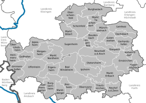
Towns:
Municipalities:
- Baudenbach
- Burghaslach
- Dachsbach
- Diespeck
- Dietersheim
- Emskirchen
- Ergersheim
- Gallmersgarten
- Gerhardshofen
- Gollhofen
- Gutenstetten
- Hagenbüchach
- Hemmersheim
- Illesheim
- Ippesheim
- Ipsheim
- Langenfeld
- Markt Bibart
- Markt Erlbach
- Markt Nordheim
- Markt Taschendorf
- Marktbergel
- Münchsteinach
- Neuhof an der Zenn
- Oberickelsheim
- Obernzenn
- Oberscheinfeld
- Simmershofen
- Sugenheim
- Trautskirchen
- Uehlfeld
- Weigenheim
- Wilhelmsdorf
References[edit]
- ^ Genesis Online-Datenbank des Bayerischen Landesamtes für Statistik Tabelle 12411-003r Fortschreibung des Bevölkerungsstandes: Gemeinden, Stichtag (Einwohnerzahlen auf Grundlage des Zensus 2011)
- ^ "VGR der Länder, Kreisergebnisse für Deutschland - Bruttoinlandsprodukt, Bruttowertschöpfung in den kreisfreien Städten und Landkreisen der Bundesrepublik Deutschland 2000 bis 2017 (German)". Statistische Ämter der Länder und des Bundes. Retrieved 4 February 2020.
External links[edit]
- Official website (German)
Towns and municipalities in Neustadt (Aisch)-Bad Windsheim | ||
|---|---|---|
| | |
49°35′N 10°30′E / 49.58°N 10.5°E
| International | |
|---|---|
| National | |