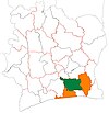
Tiassalé
Appearance
Tiassalé | |
|---|---|
Town, sub-prefecture, and commune | |
| Coordinates: 5°54′N 4°50′W / 5.900°N 4.833°W | |
| Country | |
| District | Lagunes |
| Region | Agnéby-Tiassa |
| Department | Tiassalé |
| Area | |
| • Total | 646 km2 (249 sq mi) |
| Population (2021 census)[2] | |
| • Total | 83,648 |
| • Density | 130/km2 (340/sq mi) |
| • Town | 20,057[1] |
| (2014 census) | |
| Time zone | UTC+0 (GMT) |
Tiassalé is a town in southern Ivory Coast. It is a sub-prefecture and the seat of Tiassalé Department in Agnéby-Tiassa Region, Lagunes District. Tiassalé is also a commune.
In 2021, the population of the sub-prefecture of Tiassalé was 83,648.[2]
Villages
[edit]The 19 villages of the sub-prefecture of Tiassalé and their population in 2014 are:
- Dibykro (702)
- Komenan Kpekro (1 210)
- Mafia (650)
- Niamoué (2 645)
- Taboitien (723)
- Tiassalé (20 057)
- Ahua (1 491)
- Broukro (1 248)
- Eticoon (485)
- Gnankan-Gnankanso (1 470)
- Gnanzombly (1 310)
- Kouadio-Yaokro (5 969)
- M'brimbo (3 639)
- Nanan Yassouakro (732)
- N'zianouan (12 603)
- Sindressou (732)
- Sodefor Mopri (1 723)
- Tiassalékro (300)
- Tollakro (559)
Notes
[edit]- ^ Citypopulation.de Population of cities & localities in Ivory Coast
- ^ a b Citypopulation.de Population of the regions and sub-prefectures of Ivory Coast


