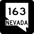
File:Nevada 163.svg
Jump to navigation
Jump to search

Size of this PNG preview of this SVG file: 600 × 600 pixels. Other resolutions: 240 × 240 pixels | 480 × 480 pixels | 768 × 768 pixels | 1,024 × 1,024 pixels | 2,048 × 2,048 pixels.
Original file (SVG file, nominally 600 × 600 pixels, file size: 13 KB)
File history
Click on a date/time to view the file as it appeared at that time.
| Date/Time | Thumbnail | Dimensions | User | Comment | |
|---|---|---|---|---|---|
| current | 00:50, 19 July 2006 |  | 600 × 600 (13 KB) | Geopgeop | |
| 10:42, 1 July 2006 |  | 600 × 600 (11 KB) | Geopgeop | {{Information |Description=32 in by 32 in (900 mm by 900 mm) Nevada State Route shield. Uses the [http://www.triskele.com/fonts/index.html Roadgeek 2005 fonts]. (United States law does not permit the copyrighting of typeface designs, and the fonts are mea |
File usage
The following 3 pages use this file:
Global file usage
The following other wikis use this file:
- Usage on en.wikipedia.org
- Clark County, Nevada
- Davis Dam
- Nevada State Route 161
- Nevada State Route 164
- Nevada State Route 163
- Arizona State Route 68
- Wikipedia:WikiProject U.S. Roads/Redirects/Nevada
- Arizona State Route 95
- List of highways numbered 163
- U.S. Route 95 in Nevada
- User:Miwasatoshi/List of crossings of the Colorado River
- List of state routes in Nevada
- User:Alexlatham96/List of State Routes in Nevada
- Usage on es.wikipedia.org
- Usage on fr.wikipedia.org
- Usage on www.wikidata.org
- Usage on zh-min-nan.wikipedia.org
