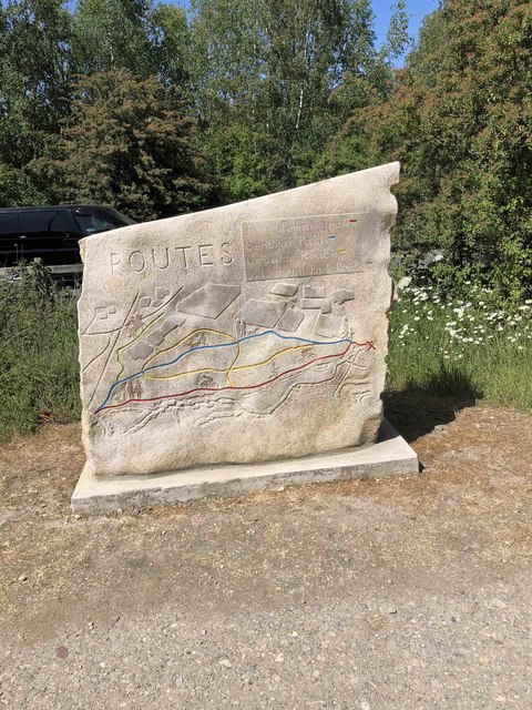
SE4401 : Route marker on Trans Pennine Trail Manvers
taken 4 years ago, near to Bolton Upon Dearne, Barnsley, England
![Creative Commons Licence [Some Rights Reserved]](https://s1.geograph.org.uk/img/somerights20.gif)
|
· Find out How to reuse this image ·
Share:
|
|||||
| Start a discussion on SE4401 | Suggest an update to this image | Contact the contributor | |||
 Map © Crown Copyright")
TIP: Click the map for more Large scale mapping
- Grid Square
- SE4401, 30 images (more nearby
 )
)
- Photographer
- Steve Fareham (find more nearby)
- Date Taken
- Thursday, 28 May, 2020 (more nearby)
- Submitted
- Sunday, 7 June, 2020
- Geographical Context
- Subject Location
-
OSGB36:
 SE 4461 0189 [10m precision]
WGS84: 53:30.7084N 1:19.7266W - Camera Location
-
OSGB36: SE 44620 01872
- View Direction
- NORTH (about 0 degrees)
Looking for a postcode? Try this page
Image Type (about):
close look
This page has been viewed about 70 times.
View this location:
KML (Google Earth) ·
Google Maps ·
Bing Maps ·
Geograph Coverage Map ·
More Links for this image