SE7079 : The old farm bridge
taken 3 months ago, near to Salton, North Yorkshire, England
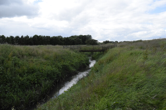
The old farm bridge
Marked on the modern open street map as a footbridge this appears more substantial and appears to be a farm access bridge over the Riccal.
![Creative Commons Licence [Some Rights Reserved]](https://s1.geograph.org.uk/img/somerights20.gif)
|
· Find out How to reuse this image ·
Share:
|
|||||
| Start a discussion on SE7079 | Suggest an update to this image | Contact the contributor | |||
 Map © Crown Copyright")
TIP: Click the map for more Large scale mapping
- Grid Square
- SE7079, 18 images (more nearby
 )
)
- Photographer
- Chris Sayles (find more nearby)
- Date Taken
- Thursday, 4 July, 2024 (more nearby)
- Submitted
- Friday, 5 July, 2024
- Geographical Context
- Subject Location
-
OSGB36:
 SE 7076 7925 [10m precision]
WGS84: 54:12.2474N 0:55.0024W - Camera Location
-
OSGB36: SE 7079 7923
- View Direction
- Northwest (about 315 degrees)
Looking for a postcode? Try this page
This page has been viewed about 5 times.
View this location:
KML (Google Earth) ·
Google Maps ·
Bing Maps ·
Geograph Coverage Map ·
More Links for this image