
I had been intending to write about surveying standards for a while but I always seemed to have better things to do. It's a complex subject, but I will try to keep things relatively simple. I'll start with the issue that encouraged me to stop putting it off.
When the SMC paid me for the current list of Grahams in 2014, it did not occur to me that they would not use it. I only found that out when I read The Grahams and the Donalds guidebook. On page 7, the editors explain why they regard Ordnance Survey as the authority on the Grahams: 'Height information has been taken from the Ordnance Survey as the national mapping authority responsible for the maintenance of the definitive record of Britain's geographic features.'
This sounds potentially reasonable to anyone who knows little or nothing about the subject, if you ignore the ethical issues.
Heights on OS maps are derived from three types of survey: a) triangulation and levelling, b) aerial photography and photogrammetry, c) differential GNSS (Global Navigation Satellite System). These methods have different degrees of accuracy. There are many variables, but as a general guide, heights of flush brackets on triangulation pillars are accurate to within 0.5m, other spot heights derived from ground surveys are usually accurate to within 1-2m, heights from aerial surveys are accurate to within 3-4m, and heights from GNSS surveys are accurate to within 0.05-0.1m. This is no secret. OS has a blog on the subject: www.ordnancesurvey.co.uk/blog/2011/08/how-do-you-measure-a-mountain. A fourth survey method, using LIDAR, is reckoned to be less accurate than GNSS surveying but more accurate than the other methods. I am not aware that it is used for OS mapping.
OS maps have their faults but for most purposes they are superbly useful and accurate. However, it is obvious that numerous hills have different heights on different scales and editions of OS maps. This is not surprising when they have different sources - co-operation between OS departments has historically not been good. OS are now trying to make their maps more consistent, though not necessarily more accurate. For example, when I informed them that Ladylea Hill is 609m, which is the ground survey height still shown on some OS mapping, they responded that:
'the various height models used in OS mapping products have different levels of precision and accuracy and this sometimes leads to small discrepancies. The value of 609 in the 1:250000 scale product will be flagged for update to 610. Hill heights and contours have nearly always been derived from aerial surveys. This is the case for Ladylea Hill and the difference between 609m and 610m is within the accuracy tolerance of the method used to capture the height with the notable exception of heights at trig pillars which come from ground based survey methods.'
OS are unlikely to know which of their spot heights is more accurate. It is common for spot heights to refer to points other than summits, and typographic errors are not unusual. We all make mistakes, including OS staff. For hill lists based on relative height, value judgements are required for col interpolation, as most cols do not have spot heights.
Anyone compiling or revising a hill list has to deal with these basic issues. The main options are to use skill, judgement and experience to analyse OS maps at various scales or to survey hills using GNSS. The stated SMC policy is impracticable. For example, according to current OS maps, Beinn Talaidh is 763m and Biod an Fhithich has a drop of only 148m, so neither should be in the SMC book if the stated editorial policy had been applied consistently.

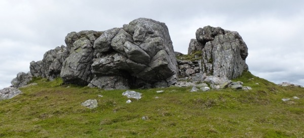
Biod an Fhithich (photo: Alan Dawson)
The SMC book is correct to state that most of my surveys have not been ratified by OS. I do not usually follow in full the OS specifications for its contractors for several reasons:
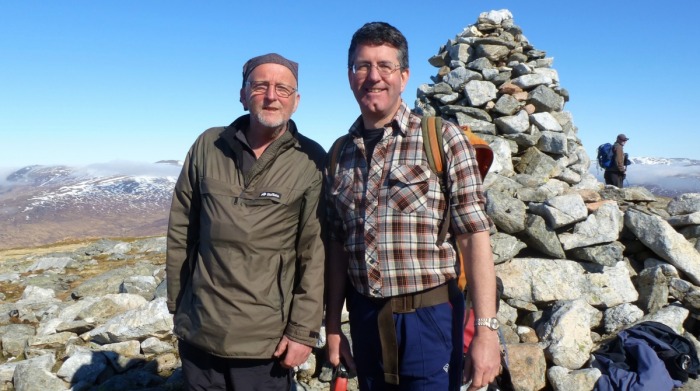
Martin Richardson, Jonathan Woods and a large cairn (photo: Alan Dawson)
So much for the words, what about the data? As I am diligent and pedantic, I am naturally interested in validation and replication as useful techniques for confirming the accuracy of my survey methods and data. To date I have used six different methods of data verification.
1. Validation against the OS fundamental benchmark (FBM) in Glen Almond. OS height is 213.365m, survey result was 213.356m, difference 0.009m.
2. Validation against flush brackets on OS trig pillars. Heights of these are not as precise as FBMs but they provide a useful and regular means of ensuring that my equipment is in good working order, as any significant inaccuracy would be obvious.
3. Validation by replication. I have so far repeated surveys of 17 points - ten summits and seven cols. The average difference between the pairs of points is 0.037m. Average survey time was 32 minutes. These findings do not prove accuracy beyond doubt, but they do show consistency and give a strong indication of accuracy.
4. Comparison with results from GJ Surveys for the same summit:
| Hill | AD mins | GJ mins | AD height | GJ height | Difference |
| Beinn Bhreac | 16 | 60 | 912.41 | 912.44 | 0.03 |
| Cairnie Hill | 60 | 60 | 228.83 | 228.85 | 0.02 |
| Carn na Caim South Top | 30 | 126 | 914.56 | 914.61 | 0.05 |
| Creag na Caillich | 25 | 128 | 914.31 | 914.30 | 0.01 |
| Creag na Caillich (resurvey) | 50 | 914.28 | 0.02 | ||
| The Fara | 22 | 120 | 911.32 | 911.36 | 0.04 |
Having the same summit surveyed by different teams on different occasions with different equipment giving results consistently within 5cm or less of each other is a strong indication of accuracy. Data collection time made little difference to these results. Conditions were good for all my surveys apart from Carn na Caim South Top, where satellite coverage was low and weather poor. GJ Surveys also resurveyed the col for this hill. They obtained a result that was 0.1m lower than mine, which increased the drop from 30.3m to 30.4m. This GJ result is likely to be more accurate than mine, as they had better overhead conditions and spent more time establishing the optimum col location amongst all the peat hags.
5. Validation of two summit heights by OS reprocessing of my survey data. The OS height for Creag an Dail Bheag was 0.004m higher than my result, and 0.001m higher for Carn Liath. OS assessment was 'the height accuracy of the survey is in the region of +-0.05m'. This was useful to know, though of course OS could not validate whether my surveys took place on the highest point of either hill.
6. Validation using a method suggested by OS. After some persistence, I was able to obtain a list of twelve criteria required by OS for acceptance of GNSS survey data. One of these is that 'Quality check on the processed baselines should be via coordinate recovery of the OS Net stations from an MCE (minimally constrained estimation) adjustment holding the nearest OS Net station fixed to its accepted ETRS89 coordinates. OS Net coordinates should be recovered to better than 0.1m in all dimensions for the solution to be acceptable.' What OS are essentially asking for is a guarantee that results are accurate to within 0.1m. That is fine, as it is about the same standard I expect from my survey results. It is 30-40 times more accurate than the 3-4m accuracy that OS and SMC accept for heights derived from aerial surveys.
Providing this guarantee using the method recommended by OS is time-consuming and fiddly. Very few of my survey results are of interest to OS, so it would be pointless for me to apply this process to most of my data, even where all eleven other criteria are met. However, it is another form of validation, so I applied this OS method to assess the level of accuracy for selected results. For example, I was able to calculate that the 609.0m height of Ben Aslak is accurate to within 0.034m, validated against seven OS Net base stations.
Inspectors checking the depth of vegetation at a critical col (photo: Alan Dawson)
I am happy to help OS make their maps more accurate, but I have found it difficult to engage their interest in heights of hills. It has been easier to do that by drawing attention to errors or discrepancies on OS maps than by submitting survey data. For example, they have corrected mapped heights for Maoile Lunndaidh, Sgurr Dubh Mor, Sgurr Dubh an Da Bheinn, Mynydd Gethin and others because of information I have supplied to them about their own maps. OS mapping of Maoile Lunndaidh is now correct, but another survey could still be useful if the cairn was removed, in order to be certain of the highest point.
I will conclude with a few thoughts on the question of rights as I see them.
OS has a right to define and apply whatever policies, standards and methods it wishes for its maps. It is a commercially-driven limited company that has a right to be wrong if it wishes, as long as it does not wilfully mislead purchasers of its products.
The SMC has a right to use whatever policies, standards and methods it wishes for the hill lists it maintains. It does not have a right to change any other hill lists that it has been given permission to reproduce.
I have a right to use whatever policies, standards and methods I see fit for my hill lists. I am not infallible and if I make a mistake I will acknowledge that, though I try to make sure that it does not happen very often. I do not have a right to impose my standards on any other list or organisation.
Anyone has a right to survey any hill at any time. Hill list compilers and maintainers have a right to ignore survey results if they wish, for example if they already have accurate data for the hills in question.
One of the things I always liked about hill walking is its sheer simplicity. Not much equipment needed, no permission necessary, no schedules or deadlines, no hassles or disputes, no corporate crap, just put one foot in front of the other and keep on doing that. Things are more complicated now with all this data and all these hill categories, and I am as responsible for that as anyone. I get satisfaction from the process of surveying and making hill lists more accurate, but I still like to keep things as simple as possible. I like to be able to pack a bag and head off at short notice when conditions are favourable. I can carry all my own gear, move quickly and get the job done well by following my own methods and backing my own judgement. I can do a lot on my own because I have access to fantastic technology, because I am interested and experienced and because I take care, in a diligent, scientific and accurate but simple way. Well, relatively simple.
Validated cairn-free summit of The Fara (photo: Alan Dawson)
