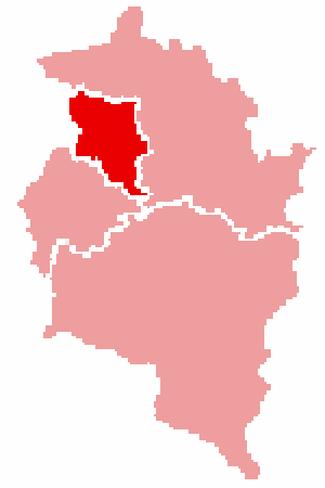
Bezirk Doarobiro
Erscheinungsbild
| Basisdato | |
|---|---|
| Bundesland: | Voradlberg |
| Sitz vo d'r V'rwaltnig: | Doarobiro |
| Fläche: | 172,37 km² |
| Iiwohnar: | 81.649 (31. März 2010) |
| Bevölkorungsdichte: | 463 Iiwohnar/km² |
| Autonummoro: | DO
|
| Intornetsitto: | Bezirk Doarobiro |
| Bezirkshäupling: | Dr. Hans Mathis |
| Karte | |

| |
| Dialäkt: Doarobirarisch |
Do Bezirk Doarobiro ist flächomäßig dar klennste Bezirk z' Voradlberg, heat abor di größt Bevölkorungsdichte. Luschnou und Ems grenzand mit-o-m Rhii at Schwitz.
Geschicht
Do Bezirk Doarobiro ist dar jüngste Vrwaltungsbezirk vo Voradlberg, er ist erst 1969 vom Bezirk Fealdkirch ab'spalto woro.
Vrwaltnig
Do Sitz vo dor Bezirkshauptmannschaft ist z'Doarobiro.
Glidornig

Mit ar Flächo vo 120,976 km² heat Doarobiro an Flächo-n-atoal vo eabba 70 % und mit 45.430 Iiwohnar ist as ou dio Gmuond mit do meisto Lütt. Ems heat 15.143 Iiwohnar und a Flächo vo 29,17 km² (17 %). Luschnou heat 21.076 Iiwohnar und a Flächo vo 22,26 km² (13 %).
D' Iiwohnarzahla siond vom 31. März 2010
|
Stadtgmoandana (rot) Marktgmoandana (blau) |
Allmänd
 Wenn dr meh züe dem Thema weisch, no schrib s dezüe und entfern nochher d Markierig {{Stumpen|1}}.Wenn de no nie e Stumpe erwitert häsch, no findsch do Hilf dezüe. |
