Category:Self-published work
Jump to navigation
Jump to search
This category contains 39,379,786 files, which is 37.2% of all 105,865,241 files on Wikimedia Commons.
English: Each work listed here was uploaded to the Commons by its creator.
Subcategories
This category has the following 30 subcategories, out of 155 total.
(previous page) (next page)S
- SVG by Filippos Fragkogiannis (12 F)
- SVG by Geralt Riv (73 F)
- Photographs by Erik Swierstra (699 F)
T
- Photographs by Alexander Tanchugin (129 F)
- Photographs by ThüringerChatte (58 F)
- Photographs by Titlutin (33 F)
- Photographs by Tomascastelazo (60 F)
- Photographs by User:Trijnstel (21 F)
U
- User:Selvakumar mallar (9 F)
V
- Photographs by User:Vysotsky (4834 F)
W
- Photographs by WashuOtaku (641 F)
- Files by Holger Weinandt (1467 F)
- Photographs by Matthias Wiegandt (197 F)
- Files by User:Wik FGK (1 P, 36 F)
- Files by Woscho (129 F)
Н
- Photographs by Наргиза Амруллаева (114 F)
Pages in category "Self-published work"
The following 6 pages are in this category, out of 35 total.
(previous page) (next page)(previous page) (next page)
Media in category "Self-published work"
The following 200 files are in this category, out of 39,379,786 total.
(previous page) (next page)-
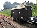
 SR "Queen Mary" brake van No. 56290.jpg 3,872 × 2,592; 3.93 MB
-
 SR 'Dancehall' brake van.jpg 3,872 × 2,592; 3.59 MB
-
 SR 'Pillbox' Brake Van No. 56506.jpg 3,872 × 2,592; 3.59 MB
-
 SR (1).jpg 6,000 × 3,376; 6.19 MB
-
 SR (2).jpg 4,032 × 2,268; 5.19 MB
-

-
 SR (Clocked) Flip-flop Diagram.svg 300 × 145; 22 KB
-
 SR (Clocked) Flip-flop.svg 100 × 100; 7 KB
-
 SR (ex-LSWR) brake van 54885 and LNER open 424123 at Washford.JPG 1,366 × 1,024; 523 KB
-
 SR (Lkr) in Bayern.svg 1,227 × 1,236; 311 KB
-
 SR (NAND) Flip-flop.svg 100 × 100; 7 KB
-
 SR (St) in Bayern.svg 1,227 × 1,236; 311 KB
-
 SR (Ziegelstempel).jpg 865 × 567; 166 KB
-
 SR 0032 through Washington Crossing.JPG 3,648 × 2,736; 3.23 MB
-
 SR 0034 in Newport.JPG 4,608 × 3,456; 3.76 MB
-
 SR 0035 through Mifflintown.JPG 4,608 × 3,456; 3.37 MB
-
 SR 0333 in Thompsontown.JPG 4,608 × 3,456; 3.38 MB
-
 SR 0333 through Mifflintown.JPG 3,456 × 4,608; 3.64 MB
-
 SR 0402 abandoned alignment.JPG 3,648 × 2,736; 1.99 MB
-
 SR 0402 at SR 2012.JPG 3,648 × 2,736; 2.47 MB
-
 SR 0453 south near Water Street.JPG 4,608 × 3,456; 3.18 MB
-
 SR 0532 through Washington Crossing.JPG 3,648 × 2,736; 3.38 MB
-
 SR 08-10-08 A Antiquiala snyderae HT 2007-11-15 img1.jpg 2,458 × 1,200; 1.03 MB
-
 SR 10-20-37 Macginicarpa 2020-09-21 img2 cropped.jpg 2,356 × 2,916; 5.87 MB
-
 SR 10-36-10 Whetwhetaksa millerae paratype img1.tif 1,056 × 778; 3.27 MB
-
 SR 10013 open goods wagon.jpg 4,032 × 3,024; 4.3 MB
-
 SR 1002 (LC) bridge.jpg 2,816 × 2,112; 1.5 MB
-
 SR 105 northbound approaching US 101 in Aberdeen, WA.jpg 3,456 × 2,304; 3.03 MB
-
 SR 106 eastbound in Skokomish, WA.jpg 3,456 × 2,304; 3.09 MB
-
 SR 107 northbound near US 101 southeast of Cosmopolis, WA.jpg 3,446 × 2,290; 2.85 MB
-
 SR 108 and SR 108 Business in McCleary, WA.jpg 3,456 × 2,304; 2.76 MB
-
 SR 108 in McCleary, WA.jpg 3,454 × 2,302; 2.86 MB
-
 SR 108 McCleary.jpg 1,563 × 1,151; 944 KB
-
 SR 109 northbound at SR 109 Spur in Hoquiam, WA.jpg 3,456 × 2,304; 5.02 MB
-
 SR 109 northern terminus in Taholah, WA.jpg 3,444 × 2,286; 3.29 MB
-
 SR 109 services sign near terminus on Quinault Reservation near Taholah, WA.jpg 3,456 × 2,304; 3.81 MB
-
 SR 10t ventilated van 44611.JPG 1,600 × 1,200; 305 KB
-
 SR 10var Padana Inferiore.png 1,546 × 813; 1.79 MB
-
 SR 110 memorial designation sign near La Push, WA.jpg 4,912 × 3,264; 7.04 MB
-
 SR 110 Spur eastern terminus near Quillayute, WA.jpg 4,912 × 3,264; 7.2 MB
-
 SR 110 Spur western terminus near Rialto Beach, WA.jpg 4,912 × 3,264; 5.96 MB
-
 SR 113 wreck, Harghita.jpg 1,600 × 1,200; 380 KB
-
 SR 114 (Grace St) 1134.jpg 4,608 × 2,592; 4.04 MB
-
 SR 114 (Grace St) 1136.jpg 4,608 × 2,592; 3.86 MB
-
 SR 114 (Grace St) 1137.jpg 4,608 × 2,592; 3.19 MB
-
 SR 114 (Grace St) 1138.jpg 4,608 × 2,592; 2.81 MB
-
 SR 114 (Grace St) 1140.jpg 4,608 × 2,592; 2.71 MB
-
 SR 116 at its western terminus in Port Hadlock, WA.jpg 3,456 × 2,304; 3.7 MB
-
 SR 116 eastbound on Indian Island, WA.jpg 3,456 × 2,304; 3.8 MB
-
 SR 116 terminates at Fort Flagler State Park.jpg 3,456 × 2,304; 3.53 MB
-
 SR 117 - POW MIA Memorial Highway in Port Angeles, WA.jpg 3,456 × 2,304; 2.99 MB
-
 SR 119 northbound near Hoodsport, WA.jpg 3,456 × 2,304; 3.96 MB
-
 SR 119 southbound at terminus in Lake Cushman, WA - 01.jpg 3,456 × 2,304; 3.5 MB
-
 SR 119 southbound at terminus in Lake Cushman, WA - 02.jpg 4,904 × 3,252; 9.27 MB
-
 SR 119 terminus at Lake Cushman, WA.jpg 4,912 × 3,264; 8.07 MB
-
 SR 12 - May 2023 - Sarah Stierch.jpg 4,032 × 3,024; 13.16 MB
-
 SR 12 C.jpg 430 × 430; 53 KB
-
 SR 120 Yosemite.jpg 1,024 × 768; 233 KB
-
 SR 121 at northern terminus in Tumwater, WA.jpg 3,456 × 2,304; 2.9 MB
-
 SR 121 near Millersylvania State Park, WA.jpg 3,424 × 2,256; 2.65 MB
-
 SR 121 southbound near Maytown, WA.jpg 3,456 × 2,304; 3.34 MB
-
 SR 122 westbound near Mossyrock, WA.jpg 3,456 × 2,304; 3.29 MB
-
 SR 123 area history.svg 1,152 × 640; 29 KB
-
 SR 125 near Walla Walla County Fairgrounds.jpg 4,752 × 3,168; 3.71 MB
-
 SR 125 Spain 1987.jpg 2,048 × 1,536; 1.38 MB
-
 Sr 126 Ventura.jpg 3,648 × 2,736; 1.49 MB
-
 SR 128 sign and road closure in Cloverdale - February 2023 - Sarah Stierch.jpg 4,032 × 3,024; 3.56 MB
-
 SR 129.jpg 2,051 × 1,400; 2.44 MB
-
 SR 134 Ventura Freeway looking west from N Pass Ave.jpg 2,400 × 1,350; 1.32 MB
-
 SR 135 (Mauckport) P5250363.jpg 800 × 600; 51 KB
-
 SR 135 (Mauckport) P5250368.jpg 3,072 × 2,304; 1.21 MB
-
 SR 135 (Mauckport) P5250374.jpg 800 × 600; 49 KB
-
 SR 135 (Mauckport) P5250375.jpg 800 × 600; 91 KB
-
 SR 135 (Mauckport) Truss work P5250369.jpg 800 × 600; 89 KB
-
 SR 135 hill from river in Indiana P6150150.jpg 3,072 × 2,304; 1.19 MB
-
 SR 135 P6150152.jpg 3,072 × 2,304; 1.02 MB
-
 SR 135 P6150153.jpg 3,072 × 2,304; 1.26 MB
-
 SR 135 P6150154.jpg 3,072 × 2,304; 1.02 MB
-
 SR 14 eastbound at SR 500 in Camas, WA.jpg 3,456 × 2,304; 2.92 MB
-
 SR 14 eastbound near Vancouver, WA.jpg 3,456 × 2,304; 3.49 MB
-
 SR 143 2016.jpg 2,480 × 3,507; 446 KB
-
 SR 155 (TN) exit 10.JPG 2,272 × 1,704; 1.18 MB
-
 SR 155 (TN) exit 11 merge.JPG 2,272 × 1,704; 1.49 MB
-
 SR 155 (TN) exit 7 overpass work.JPG 2,272 × 1,704; 1.27 MB
-
 SR 155 (TN) Gaylord Opryland.JPG 2,272 × 1,704; 1.11 MB
-
 SR 155 (TN) new exit 10 onramp.JPG 2,272 × 1,704; 1.52 MB
-
 SR 16 westbound approaching Tacoma Narrows Bridge toll plaza.jpg 3,442 × 2,282; 2.27 MB
-
 SR 160 eastbound in Port Orchard, WA.jpg 3,442 × 2,282; 3.57 MB
-
 SR 160 shield at Southworth ferry terminal.jpg 4,888 × 3,226; 4.62 MB
-
 SR 16412.svg 512 × 836; 9 KB
-
 SR 166 eastbound at SR 16 near Gorst, WA.jpg 3,456 × 2,304; 3.17 MB
-
 SR 166 eastern terminus at Whittier Avenue in Port Orchard, WA.jpg 3,456 × 2,304; 2.93 MB
-
 SR 166 heading into Maricopa, California.JPG 2,428 × 2,429; 1.48 MB
-
 SR 166 westbound in downtown Port Orchard, WA.jpg 3,380 × 2,184; 2.15 MB
-
 SR 166 westbound near Olney Street, Port Orchard, WA.jpg 3,456 × 2,304; 2.83 MB
-
 SR 166 western terminus at SR 16 near Gorst, WA.jpg 3,442 × 2,282; 2.43 MB
-
 SR 167 southbound and SR 167 northbound in Puyallup, WA.jpg 3,374 × 2,176; 2.57 MB
-
 SR 167 southbound at SR 512 and SR 161 in Puyallup, WA.jpg 3,452 × 2,298; 1.97 MB
-
 SR 17 NY.jpg 1,194 × 836; 283 KB
-
 SR 175 Hopland - Feb 2023 - Sarah Stierch.jpg 4,032 × 3,024; 4.8 MB
-
 SR 175 in Hopland - Feb 2023 - Sarah Stierch.jpg 4,032 × 3,024; 3.25 MB
-
 SR 175 in Hopland to Lakeport - Feb 2023 - Sarah Stierch.jpg 4,032 × 3,024; 3.48 MB
-
 SR 18 & I-65 - White County, Indiana, USA - October 8, 2023.jpg 8,270 × 5,514; 14.99 MB
-
 SR 18 & Meadow Lake Wind Farm - White County, Indiana, USA - October 7, 2023.jpg 43,465 × 7,639; 145.76 MB
-
 SR 18 - White County, Indiana, USA - October 8, 2023.jpg 8,256 × 5,504; 21.1 MB
-
 SR 1855.jpg 4,608 × 3,456; 3.29 MB
-
 SR 19 over barge canal N01.jpg 3,264 × 2,448; 1.18 MB
-
 SR 19 over barge canal N02.jpg 3,264 × 2,448; 778 KB
-
 SR 19 over barge canal S01.jpg 3,264 × 2,448; 1.28 MB
-
 SR 19 over barge canal S02.jpg 3,264 × 2,448; 1.04 MB
-
 SR 19 southbound at SR 116 in Port Hadlock, WA.jpg 3,456 × 2,304; 3.03 MB
-
 SR 19 southbound near Chimacum, WA.jpg 3,456 × 2,304; 3.23 MB
-
 SR 190 Panamint Springs Resort End Death Valley 2013.jpg 4,415 × 2,738; 5.42 MB
-
 SR 191; MM 24, Eva, Tennessee.jpg 2,592 × 1,944; 1.24 MB
-
 SR 1931-van no. 44611.jpg 4,032 × 3,024; 3.11 MB
-
 SR 2 & US 421 8487.jpg 3,552 × 2,217; 670 KB
-
 SR 2 & US 421 8488.jpg 2,856 × 1,982; 551 KB
-
 SR 2 eastern terminus 2022.png 2,930 × 2,353; 7.01 MB
-
 SR 2 Glendale.jpg 3,214 × 1,928; 637 KB
-
 SR 2 interchange, Edgewater Park (2).png 4,032 × 3,024; 15.96 MB
-
 SR 2 interchange, Edgewater Park (3).png 4,032 × 3,024; 17.66 MB
-
 SR 2 interchange, Edgewater Park.png 4,032 × 3,024; 12.79 MB
-
 Sr 2 Ru O 4 Layered Perovskite Structure.svg 348 × 633; 47 KB
-
 SR 2-E 001.JPG 800 × 600; 216 KB
-
 Sr 2.jpg 475 × 655; 261 KB
-
 SR 2012 cheque during final.jpg 1,000 × 667; 637 KB
-
 SR 2015 (příjmy, výdaje, saldo).jpg 1,090 × 602; 79 KB
-
 SR 202009 Bartosz Pastuszka.jpg 2,362 × 3,543; 1.61 MB
-
 SR 2023 full.png 2,000 × 1,413; 560 KB
-
 SR 206.jpg 3,024 × 4,032; 1.81 MB
-
 SR 207 northbound near Coles Corner, WA.jpg 3,456 × 2,304; 4.43 MB
-
 SR 207 northern terminus near Lake Wenatchee, WA.jpg 3,456 × 2,304; 3.71 MB
-
 SR 207 southbound crossing the Wenatchee River.jpg 4,912 × 3,264; 7.7 MB
-
 SR 215 northbound at Tyee Street in Omak, WA.jpg 4,840 × 3,152; 3.37 MB
-
 SR 24 near Lafayette with BART track and Mt Diablo in the background.JPG 4,384 × 2,466; 3.13 MB
-
 SR 29 Bridge LaBelle.jpg 4,032 × 3,024; 2.14 MB
-
 SR 3 northbound at SR 304 in Bremerton, WA.jpg 3,386 × 2,192; 2.6 MB
-
 SR 3 southbound at SR 310 in Bremerton, WA.jpg 3,456 × 2,304; 2.85 MB
-
 SR 30004 8-plank open wagon.jpg 4,032 × 3,024; 3.71 MB
-
 SR 303 northbound approaching SR 3 in Silverdale, WA.jpg 3,368 × 2,166; 2.24 MB
-
 SR 303 southbound at SR 3 in Silverdale, WA.jpg 3,456 × 2,304; 2.88 MB
-
 SR 304 at Park Avenue in Bremerton, WA.jpg 3,450 × 2,296; 2.43 MB
-
 SR 304 eastbound approaching SR 310 in Bremerton, WA.jpg 3,432 × 2,268; 1.9 MB
-
 SR 304 eastbound in Navy Yard City, WA.jpg 3,404 × 2,224; 2.6 MB
-
 SR 304 westbound at SR 303 in Bremerton, WA.jpg 3,456 × 2,304; 3.14 MB
-
 SR 304 westbound at SR 310 in Bremerton, WA.jpg 3,456 × 2,304; 2.69 MB
-
 SR 304.jpg 4,032 × 3,024; 2.14 MB
-
 SR 308 eastbound near Keyport, WA.jpg 3,456 × 2,304; 3.43 MB
-
 SR 308 westbound near SR 3 in Bangor, WA.jpg 3,450 × 2,296; 2.77 MB
-
 SR 3089 nb entering New Stanton, PA, May 2024.jpg 3,061 × 2,229; 1.35 MB
-
 SR 309.jpg 3,024 × 4,032; 2.66 MB
-
 SR 310 eastbound at its terminus in Bremerton, WA.jpg 3,456 × 2,304; 2.61 MB
-
 SR 310 eastbound in Bremerton, WA.jpg 3,456 × 2,304; 2.91 MB
-
 SR 310 westbound at its terminus in Bremerton, WA.jpg 3,456 × 2,304; 2.59 MB
-
 SR 315 offramp Olentangy bridge 2018.jpg 4,608 × 3,456; 5.25 MB
-
 SR 315 offramp Olentangy bridge underside 2018.jpg 4,608 × 3,456; 4.67 MB
-
 SR 315 Olentangy bridge 2018.jpg 4,608 × 3,456; 4.65 MB
-
 SR 315 onramp Olentangy bridge 2018.jpg 4,608 × 3,456; 4.02 MB
-
 SR 34051 Winston Churchill at Didcot.jpg 850 × 554; 632 KB
-
 SR 35 and 25 intersection01.jpg 3,264 × 2,122; 1.76 MB
-
 SR 35 and 25 intersection02.jpg 2,222 × 1,900; 1.22 MB
-
 SR 35 and 25 intersection03.jpg 3,264 × 1,564; 1.48 MB
-
 SR 35 and 441 intersection01.jpg 3,264 × 1,475; 1.38 MB
-
 SR 35 south end01.jpg 3,264 × 2,198; 1.91 MB
-
 SR 35 south end02.jpg 3,264 × 2,036; 1.88 MB
-
 SR 351 Friûl.jpg 2,832 × 2,128; 1.87 MB
-
 SR 37786 8-plank open wagon.jpg 4,032 × 3,024; 3.88 MB
-
 SR 389 AZ.JPG 2,500 × 1,500; 772 KB
-
 SR 39 CR 39 split.JPG 3,456 × 2,592; 2.33 MB
-
 SR 39 South 6619.jpg 3,072 × 4,608; 4.23 MB
-
 SR 392.jpg 4,608 × 3,456; 3.51 MB
-
 SR 4-2-1 und SR 4-4 mit Ochsenauge.jpg 4,128 × 2,322; 4.36 MB
-
 SR 401 southbound near Naselle, WA.jpg 3,456 × 2,304; 3.71 MB
-
 SR 4010 wb entering Williams Twp., PA from Porter Twp., Dec. 2023.jpg 3,554 × 2,338; 2.36 MB
-
 SR 409 southbound leaving Cathlamet, WA.jpg 4,912 × 3,264; 6.31 MB
-
 SR 411 southbound leaving Castle Rock, WA.jpg 3,438 × 2,278; 2.79 MB
-
 SR 42 Cagles Mill Lake PB260030.jpg 1,984 × 1,488; 647 KB
-
 SR 42 Cagles Mill Lake PB260032.jpg 1,984 × 1,488; 648 KB
-
 SR 42 Cagles Mill Lake PB260033.jpg 1,984 × 1,488; 687 KB
-
 SR 42 Cagles Mill Lake PB260034.jpg 1,984 × 1,488; 647 KB
-
 SR 42 Cagles Mill Lake PB260035.jpg 1,984 × 1,488; 1.79 MB
-
 SR 42 Cagles Mill Lake PB260036.jpg 1,600 × 1,200; 607 KB
-
 SR 42 Cagles Mill Lake PB260037.jpg 1,200 × 1,600; 519 KB
-
 SR 42 Portal PB260015.jpg 1,984 × 1,488; 652 KB
-
 SR 42 Portal PB260016.jpg 1,984 × 1,488; 646 KB
-
 SR 42 Portal PB260022.jpg 1,600 × 1,200; 613 KB
-
 SR 42 Portal PB260023.jpg 1,984 × 1,488; 653 KB
-
 SR 431 Scenic Overlook of Lake Tahoe.jpg 5,184 × 3,270; 6.18 MB
-
 SR 4601 General Utility Van 'Elephant Van'.jpg 3,872 × 2,592; 3.98 MB
-
 SR 49 2020-07-10 088.jpg 4,608 × 3,072; 3.28 MB
-
 SR 49 2020-07-10 091.jpg 4,608 × 2,592; 2.61 MB
-
 SR 49 North Portal 2020-07-10 003.jpg 4,608 × 3,072; 3.6 MB
-
 SR 49 North Portal 2020-07-10 004.jpg 4,608 × 3,072; 4.29 MB
-
 SR 49 North Portal 2020-07-10 005.jpg 4,608 × 3,072; 4.83 MB
-
 SR 49 South Portal 2020-07-10 084.jpg 4,608 × 3,072; 4.13 MB
-
 SR 49 South Portal 2020-07-10 085.jpg 4,608 × 3,072; 4.76 MB
-
 SR 49 South Portal 2020-07-10 086.jpg 4,608 × 3,072; 4.48 MB
-
 SR 49 South Portal 2020-07-10 087.jpg 4,454 × 2,773; 1.64 MB
-
 SR 4922 Travelling Post Office.jpg 513 × 786; 277 KB
-
 SR 4EPB 5001 on the Oxted Line 01.JPG 1,840 × 1,232; 774 KB


.jpg)
.jpg)
_electoral_symbol,_November_1917_election.svg)
_Flip-flop_Diagram.svg)
_Flip-flop.svg)
_brake_van_54885_and_LNER_open_424123_at_Washford.JPG)
_in_Bayern.svg)
_Flip-flop.svg)
_in_Bayern.svg)
.jpg)


_bridge.jpg)


_1134.jpg)
_1136.jpg)
_1137.jpg)
_1138.jpg)
_1140.jpg)


_P5250363.jpg)
_P5250368.jpg)
_P5250374.jpg)
_P5250375.jpg)
_Truss_work_P5250369.jpg)


_exit_10.JPG)
_exit_11_merge.JPG)
_exit_7_overpass_work.JPG)
_Gaylord_Opryland.JPG)
_new_exit_10_onramp.JPG)


.png)
.png)


.jpg)


