Category:1925 maps
Jump to navigation
Jump to search
| ← · 1920 · 1921 · 1922 · 1923 · 1924 · 1925 · 1926 · 1927 · 1928 · 1929 · → |
Deutsch: Karten mit Bezug zum Jahr 1925
English: Maps related to the year 1925
Español: Mapas relativos al año 1925
Français : Cartes concernant l’an 1925
Русский: Карты 1925 года
Subcategories
This category has the following 8 subcategories, out of 8 total.
Media in category "1925 maps"
The following 139 files are in this category, out of 139 total.
-
 1925 BERy system map.jpg 4,400 × 6,224; 22.82 MB
-
 1925 moscow-shestacov.jpg 3,200 × 4,876; 2.3 MB
-
 1925 Shestacov-titul.jpg 3,200 × 4,165; 1.87 MB
-
 1925 traffic chart, state highways systems - (North Central States) LOC 90682086.jpg 7,817 × 5,197; 4.75 MB
-
 1925 traffic chart, state highways systems - (North Central States) LOC 90682086.tif 7,817 × 5,197; 116.23 MB
-
 1925. Avinurme.tif 1,939 × 1,874; 1.03 MB
-
 1925. Kambja.tif 2,551 × 3,299; 1 MB
-
 1925. Kodavere - nord.TIF 3,299 × 2,551; 1.01 MB
-
 1925. Kodavere - süd.TIF 2,551 × 3,299; 1 MB
-
 1925. Kursi kihelkond.TIF 2,551 × 3,299; 1 MB
-
 1925. Laiuse - nord.TIF 3,299 × 2,551; 1.01 MB
-
 1925. Laiuse - süd.tif 3,299 × 2,551; 1.01 MB
-
 1925. Maarja-Magdaleena.TIF 2,551 × 3,299; 1 MB
-
 1925. Nõo.tif 2,551 × 3,299; 1 MB
-
 1925. Otepää - süd.TIF 2,551 × 3,299; 1 MB
-
 1925. Otepää.TIF 2,551 × 3,299; 1 MB
-
 1925. Palamuse.TIF 3,299 × 2,551; 1.01 MB
-
 1925. Puhja khk.tif 2,551 × 3,299; 8.03 MB
-
 1925. Rannu - süd.tif 3,299 × 2,551; 1.01 MB
-
 1925. Rannu.TIF 2,551 × 3,299; 1 MB
-
 1925. Rõngu.TIF 2,551 × 3,299; 1 MB
-
 1925. Tartu - ost.tif 2,551 × 3,299; 1 MB
-
 1925. Tartu - west.tif 2,551 × 3,299; 1 MB
-
 1925. Tartumaa vallad - nord.TIF 3,299 × 2,551; 1.01 MB
-
 1925. Tartumaa vallad - süd.TIF 3,299 × 2,551; 1.01 MB
-
 1925. Torma - ost.tif 2,551 × 3,299; 1 MB
-
 1925. Torma.tif 2,551 × 3,299; 1 MB
-
 1925. Võnnu - west.tif 2,551 × 3,299; 1 MB
-
 1925. Äksi khk.tif 2,551 × 3,299; 8.03 MB
-
 1925.Võnnu khk.tif 2,551 × 3,299; 1 MB
-
 A map of New York which is published by the Washington Square Bookshop (20549862440).jpg 2,000 × 1,587; 4.32 MB
-
 A medieval map of east and west.jpg 5,238 × 3,767; 4.8 MB
-
 Aero-view of Somers-Point 1925, New Jersey. LOC 75694737.tif 10,720 × 7,712; 236.53 MB
-
 Aeroview of Margate City, New Jersey 1925. LOC 75694729.jpg 10,896 × 6,688; 11.92 MB
-
 Aeroview of Margate City, New Jersey 1925. LOC 75694729.tif 10,896 × 6,688; 208.49 MB
-
 Bahnlinien (Palestine railways) (FL33141962 3713596).jpg 6,430 × 11,353; 76.77 MB
-
 Berlin Güter Bahnhof der Nordbahn Plan.jpg 895 × 1,033; 904 KB
-
 Berlin Innere Stadt Meyers Konversationslexikon ca1925.jpg 1,573 × 1,242; 1.51 MB
-
 Bourg de Guimaëc, limitrophe de Lanmeur.jpg 457 × 495; 124 KB
-
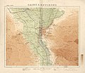 Cairo & environs. LOC 2009580101.jpg 12,377 × 10,758; 14.26 MB
-
 Cairo & environs. LOC 2009580101.tif 12,377 × 10,758; 380.95 MB
-
 Carte Bréhat archipel.jpg 503 × 468; 166 KB
-
 Carte générale des voies romaines (...)Jollois Jean-Baptiste-Prosper btv1b84389667 1.jpg 2,714 × 1,276; 716 KB
-
 Damascu (FL167486102 3841094).jpg 5,229 × 7,908; 49.65 MB
-
 East Haifa Development Company, חיפה (FL4541427 2538279).jpg 6,504 × 2,788; 26.13 MB
-
 Erez Israel Palestine. ארץ ישראל (FL147425420 3802133).jpg 3,474 × 5,512; 15.58 MB
-
 Gotanda Osaki-Hirokoji 1925.jpg 550 × 600; 187 KB
-
 Griebens Stadtplan von Berlin 1925.jpg 10,369 × 7,374; 44.25 MB
-

-
-
 Haim Goldberg, ארץ ישראל (FL147398354 2376893).jpg 3,771 × 4,993; 19.5 MB
-
 Hugo Herrmann, Palästina (FL13721009 2369405).jpg 9,875 × 16,951; 260.26 MB
-
 Hugo Herrmann, ארץ ישראל. Palästina (FL45605219 3942216).jpg 2,957 × 5,008; 4.42 MB
-
 Humboldt - Podróż po rzece Orinoko page008.jpg 1,106 × 1,652; 613 KB
-

-

-
 Jamaica rail map 1925.jpg 1,010 × 476; 195 KB
-
 Kuwait map 1925 IOR R 15 1 733 0035.jpg 5,287 × 4,800; 3.08 MB
-
 La Habana - Forestier1925.jpg 1,450 × 1,015; 157 KB
-
 Lageskizze der Hindenburgbrücke 1925-04-24.jpg 5,000 × 3,540; 1.29 MB
-
 Lanmeur Guimaëc Locquirec.jpg 388 × 410; 185 KB
-
 Map of the Crown Prince Islands, Disco (sic) Bay, Greenland LOC 2009584739.jpg 10,077 × 7,455; 8.79 MB
-
 Map of the Crown Prince Islands, Disco (sic) Bay, Greenland LOC 2009584739.tif 10,077 × 7,455; 214.93 MB
-
 Mappa del Castello Eurialo sull'Epipoli.jpg 500 × 382; 56 KB
-
 Michael Pikovsky, ארץ ישראל 01 (FL147449223 4803379).jpg 4,545 × 6,883; 37.12 MB
-
 Michael Pikovsky, ארץ ישראל 02 (FL147449224 4803379).jpg 4,555 × 6,881; 34.1 MB
-
 Michael Pikovsky, ארץ-ישראל (FL6882822 3364165).jpg 2,208 × 3,376; 11.27 MB
-
 Nordpark moenchengladbach 1925.png 1,266 × 1,268; 4.77 MB
-
 Outer Mongolia (Khalkha).jpg 2,809 × 1,847; 1.16 MB
-
 Patrick Geddes, Town planning report Tel Aviv (FL189809604 1048497).jpg 3,823 × 6,380; 17.73 MB
-
 PedraBranca-MapofMalaya-1925.jpg 621 × 458; 90 KB
-
 Pieni 2 0791 China.png 514 × 437; 611 KB
-
 Plan of Jerusalem 01 (FL155882602 3910925).jpg 4,703 × 3,530; 22.38 MB
-
 Plan of Jerusalem 02 (FL155882604 3910925).jpg 4,702 × 3,526; 18.83 MB
-
 Q30526750, Jerusalem and Environs (FL32703867 2654862).jpg 13,652 × 17,466; 329.84 MB
-
 Railroad Map of Trinidad - 1925.png 1,194 × 1,024; 1.54 MB
-
 Rice Court.jpg 600 × 600; 74 KB
-

-
 Road map, Washington and vicinity, Maryland-Virginia-District of Columbia LOC 87695633.tif 9,918 × 6,052; 171.73 MB
-
 Réseau STCRP 1925.JPG 1,212 × 831; 1.18 MB
-
 Seattle birdseye view of portion of city and vicinity. LOC 75696666.jpg 16,998 × 9,854; 23.2 MB
-
 Southampton Place Extension.jpg 600 × 600; 83 KB
-
 Sperrgebiete um Europa und Afrika LOC 2016432163.jpg 10,014 × 5,272; 5.67 MB
-
 Sperrgebiete um Europa und Afrika LOC 2016432163.tif 10,014 × 5,272; 151.04 MB
-
 Spezialkarte der Österreichisch-ungarischen Monarchie - Eisenkappel und Kanke 1925.jpg 13,279 × 10,128; 30.82 MB
-
 Spezialkarte der Österreichisch-ungarischen Monarchie - Gurkfeld, Rann und Samobor 1925.jpg 13,285 × 10,129; 26.76 MB
-
 Spezialkarte der Österreichisch-ungarischen Monarchie - Radkersburg und Luttenberg 1925.jpg 13,748 × 10,586; 28.46 MB
-
 Survey of Palestine, Jerusalem 00-INDEX (FL191853708 2367708).jpg 6,088 × 6,079; 45.9 MB
-
 Survey of Palestine, Jerusalem 01-I-E (FL191853709 2367708).jpg 14,480 × 15,755; 187.2 MB
-
 Survey of Palestine, Jerusalem 02-II-D (FL191853710 2367708).jpg 14,504 × 15,742; 204.84 MB
-
 Survey of Palestine, Jerusalem 03-II-E (FL191853711 2367708).jpg 14,535 × 15,723; 197.34 MB
-
 Survey of Palestine, Jerusalem 04-III-D (FL191853712 2367708).jpg 14,520 × 15,735; 198.99 MB
-
 Survey of Palestine, Jerusalem 05-III-E (FL191853713 2367708).jpg 14,526 × 15,749; 203.9 MB
-
 Survey of Palestine, Jerusalem 06-III-F (FL191853714 2367708).jpg 14,499 × 15,743; 197.87 MB
-
 Survey of Palestine, Jerusalem 07-IV-D (FL191853715 2367708).jpg 14,500 × 15,747; 199.85 MB
-
 Survey of Palestine, Jerusalem 08-IV-E (FL191853716 2367708).jpg 14,518 × 15,754; 211.95 MB
-
 Survey of Palestine, Jerusalem 09-IV-F (FL191853717 2367708).jpg 14,497 × 15,739; 213.08 MB
-
 Survey of Palestine, Jerusalem 10-IV-G (FL191853718 2367708).jpg 14,525 × 15,778; 199.27 MB
-
 Survey of Palestine, Jerusalem 11-V-C (FL191853719 2367708).jpg 6,104 × 6,047; 48.46 MB
-
 Survey of Palestine, Jerusalem 13-V-D-Lepers-hospital (FL191853720 2367708).jpg 6,072 × 6,071; 48.87 MB
-
 Survey of Palestine, Jerusalem 15-V-E (FL191853721 2367708).jpg 7,312 × 7,985; 75.29 MB
-
 Survey of Palestine, Jerusalem 17-V-F (FL191853722 2367708).jpg 14,511 × 15,739; 221.58 MB
-
 Survey of Palestine, Jerusalem 18-V-G (FL191853723 2367708).jpg 14,510 × 15,738; 207.7 MB
-
 Survey of Palestine, Jerusalem 19-VI-C (FL191853724 2367708).jpg 14,515 × 15,744; 200.61 MB
-
 Survey of Palestine, Jerusalem 20-VI-E (FL191853725 2367708).jpg 7,384 × 8,049; 77.95 MB
-
 Survey of Palestine, Jerusalem 22-VII-D (FL191853727 2367708).jpg 14,486 × 15,730; 245.82 MB
-
 Survey of Palestine, Jerusalem 23-VII-E (FL191853728 2367708).jpg 7,304 × 7,901; 79.3 MB
-
 Survey of Palestine, Jerusalem 25-VII-F (FL191853729 2367708).jpg 14,092 × 15,738; 203.67 MB
-
 Survey of Palestine, Jerusalem 26-VII-G (FL191853730 2367708).jpg 15,968 × 17,066; 231.55 MB
-
 Survey of Palestine, Jerusalem 27-VIII-D (FL191853731 2367708).jpg 14,496 × 15,717; 202.1 MB
-
 Survey of Palestine, Jerusalem 28-VIII-F (FL191853732 2367708).jpg 14,519 × 15,754; 201.52 MB
-
 Survey of Palestine, Jerusalem 29-IX-E (FL191853733 2367708).jpg 14,518 × 15,736; 197.15 MB
-
 Survey of Palestine, Jerusalem 30-IX-G (FL191853734 2367708).jpg 7,352 × 7,930; 72.74 MB
-
 Survey of Palestine, Jerusalem 33-Index-on-verso-vi-e (FL191853735 2367708).jpg 7,360 × 7,977; 62.15 MB
-
 Survey of Palestine, Tiberias 01 (FL4540976 2369491).jpg 9,498 × 9,481; 111.06 MB
-
 Survey of Palestine, Tiberias 02 (FL4540977 2369491).jpg 9,552 × 9,561; 105.58 MB
-
 Survey of Palestine, Tiberias 03 (FL4540978 2369491).jpg 9,182 × 11,096; 135.18 MB
-
 Survey of Palestine, Tiberias 04 (FL4540979 2369491).jpg 8,739 × 9,545; 109.14 MB
-
 Syria and Palestine (FL83894128 2369388).jpg 3,898 × 4,854; 18.19 MB
-
 T19-2.jpg 12,669 × 9,058; 6.55 MB
-
-
 The Israel Land Development Company Ltd, דרום תל אביב (FL10423494 2369602).jpg 6,072 × 5,672; 53.86 MB
-
 The Israel Land Development Company Ltd, ירושלם (FL42765507 2370083).jpg 16,783 × 18,139; 304.58 MB
-
 The North American Indian in the World War LOC 2016586524.jpg 5,920 × 4,924; 4.88 MB
-

-

-
 Touring map of the Custer Battlefield Hiway- the scenic route to the west. LOC 99466708.jpg 11,811 × 5,132; 11.83 MB
-
 Touring map of the Custer Battlefield Hiway- the scenic route to the west. LOC 99466708.tif 11,811 × 5,132; 173.42 MB
-
 Vicinity map of the suggested Cove Creek Reservoir. LOC 99446170.jpg 2,899 × 2,244; 1.2 MB
-
 Vicinity map of the suggested Cove Creek Reservoir. LOC 99446170.tif 2,899 × 2,244; 18.61 MB
-
 Virginia LOC 95682742.jpg 9,494 × 4,648; 5.33 MB
-
 Virginia LOC 95682742.tif 9,494 × 4,648; 126.25 MB
-
 Карта Майкопского округа, 1925 г.jpg 5,004 × 6,580; 34.16 MB
-
 ארץ ישראל (FL35705053 2370101).jpg 8,129 × 12,969; 161.9 MB
-
 ארץ ישראל (FL42167128 3930455).jpg 3,140 × 4,283; 16.72 MB
-
 שכונת אליהו (FL42765472 2370076).jpg 11,879 × 7,364; 116.26 MB
-
 שכונת קטמון, 1925 (FL169299364 3760157).jpg 5,077 × 7,124; 31.44 MB
-
 תל אביב (FL4536160 2367521).jpg 2,776 × 3,688; 15.52 MB
-
 תל אביב (FL4542148 3364178).jpg 2,679 × 3,534; 14.82 MB


_LOC_90682086.jpg)
.jpg)


_(FL33141962_3713596).jpg)


Jollois_Jean-Baptiste-Prosper_btv1b84389667_1.jpg)
.jpg)
.jpg)
.jpg)


.jpg)
.jpg)
.jpg)

_To_accompany_report_of_the_Battlefield_Commission_created_by_Act_of_Congress_LOC_99448880.jpg)


_Bay,_Greenland_LOC_2009584739.jpg)

.jpg)
.jpg)
.jpg)

.jpg)
.jpg)


.jpg)
.jpg)
.jpg)


.jpg)
.jpg)
.jpg)
.jpg)
.jpg)
.jpg)
.jpg)
.jpg)
.jpg)
.jpg)
.jpg)
.jpg)
.jpg)
.jpg)
.jpg)
.jpg)
.jpg)
.jpg)
.jpg)
.jpg)
.jpg)
.jpg)
.jpg)
.jpg)
.jpg)
.jpg)
.jpg)
.jpg)
.jpg)
.jpg)
.jpg)
.jpg)

_Villa_Gomes_Cardim_-_1,_Acervo_do_Museu_Paulista_da_USP.jpg)
.jpg)
.jpg)


.jpg)
.jpg)
.jpg)
.jpg)
.jpg)
.jpg)