Category:Bwlchgwyn
Jump to navigation
Jump to search
village in Wrexham County Borough, Wales  | |||||
| Upload media | |||||
| Pronunciation audio | |||||
|---|---|---|---|---|---|
| Instance of | |||||
| Location | Wrexham County Borough, Wales | ||||
| Population |
| ||||
 | |||||
Cymraeg: Mae Bwlchgwyn (neu Fwlch Gwyn)yn bentref ym mwrdeistref sirol Wrecsam. Fe'i lleolir ar y ffordd A525 rhwng Wrecsam a Rhuthun. Mae oddeutu dwy filltir o bentref Mwynglawdd ac yn ffinio â Rhostir Llandegla.
English: Bwlchgwyn is a village in Wrexham county borough, Wales, situated on the A525 road, south-east of the town of Ruthin. Bwlchgwyn is part of the community of Brymbo. In the 2001 Census the population of the village was 1,148 including the nearby village of Gwynfryn.
Subcategories
This category has only the following subcategory.
C
Media in category "Bwlchgwyn"
The following 27 files are in this category, out of 27 total.
-
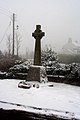
 Bwlchgwyn Cenotaph - geograph.org.uk - 43397.jpg 640 × 480; 130 KB
-
 Entrance to Bwlchgwyn village - geograph.org.uk - 1409950.jpg 640 × 470; 90 KB
-
 Kings Head Inn, Bwlchgwyn - geograph.org.uk - 1409946.jpg 640 × 474; 60 KB
-
 Nant-y-Ffrith1.jpg 2,048 × 1,536; 699 KB
-
 Old School House, Bwlchgwyn - geograph.org.uk - 606245.jpg 640 × 480; 109 KB
-
 The Cenotaph - geograph.org.uk - 336058.jpg 426 × 640; 72 KB
-
 The road to Nant y Ffrith - geograph.org.uk - 333870.jpg 640 × 426; 105 KB
-
 .summut.com - geograph.org.uk - 839393.jpg 480 × 640; 118 KB
-
 Field Gate and View - geograph.org.uk - 338673.jpg 640 × 480; 235 KB
-

-
 Footpath down to Nant y Ffrith - geograph.org.uk - 340270.jpg 480 × 640; 265 KB
-
 Footpath in Nant y Ffrith Woodland - geograph.org.uk - 340189.jpg 480 × 640; 219 KB
-
 Forestry Clearing - geograph.org.uk - 338178.jpg 640 × 480; 227 KB
-
 Gwernto Farm - geograph.org.uk - 333874.jpg 640 × 426; 90 KB
-
 Gwernto Farmyard - geograph.org.uk - 336065.jpg 640 × 426; 73 KB
-
 Lane to Werngate Farm - geograph.org.uk - 338657.jpg 640 × 480; 245 KB
-
 Nant y Ffrith Woodland - geograph.org.uk - 340204.jpg 640 × 480; 192 KB
-
 Playground in the Forest - geograph.org.uk - 338686.jpg 640 × 480; 229 KB
-
 Pylon in the Forest - geograph.org.uk - 338180.jpg 480 × 640; 158 KB
-
 Ruin in Forestry - geograph.org.uk - 338174.jpg 640 × 480; 273 KB
-
 Ruined Cottage in Nant y Ffrith Woodland - geograph.org.uk - 340120.jpg 640 × 457; 280 KB
-
 Ruined Cottage in Nant y Ffrith Woodland - geograph.org.uk - 340136.jpg 640 × 480; 271 KB
-
 Stone Bridge over Nant y Ffrith - geograph.org.uk - 340232.jpg 640 × 480; 236 KB
-
 Stone Wall and Path - geograph.org.uk - 340104.jpg 640 × 480; 234 KB
-
 Track and Path Junction near Bwlchgwyn - geograph.org.uk - 338616.jpg 640 × 480; 224 KB
-
 True Grit - geograph.org.uk - 333871.jpg 640 × 426; 125 KB
-
 Walled garden - geograph.org.uk - 336051.jpg 640 × 426; 98 KB


