Category:County Londonderry
Here nagîvasyonê
Here lêgerînê
Counties of the Republic of Ireland: Carlow · Cavan · Clare · Cork(1) · Donegal · Dún Laoghaire-Rathdown(2) · Fingal(2) · Galway(3) · Kerry · Kildare · Kilkenny · Laois · Leitrim · Limerick · Longford · Louth · Mayo · Meath · Monaghan · Offaly · Roscommon · Sligo · South Dublin(2) · Tipperary(4) · Waterford · Westmeath · Wexford · Wicklow – Separate cities: Cork(1) · Dublin(2) · Galway(3) – Former counties: Dublin(2) · South Tipperary(4) Former counties of Northern Ireland: Antrim · Armagh · Down · Fermanagh · Londonderry · Tyrone
county of Northern Ireland   | |||||
| Medya bar bike | |||||
| Mînakek ji bo | |||||
|---|---|---|---|---|---|
| Beşek ji | |||||
| Cih | Bakurê Îrlandê | ||||
| Located in or next to body of water |
| ||||
| Paytext | |||||
| Dema avabûnê |
| ||||
| Gelhe |
| ||||
| Rûerd |
| ||||
 | |||||

Binkategorî
Di vê kategoriyê de 28 binkategorî hene. Jêr 28 binkategorî tên nîşandan.
A
E
F
G
H
I
L
M
N
P
R
S
T
Medya di kategoriya "County Londonderry" de
Di vê kategoriyê de 1516 dane hene. Jêr 200 dane tên nîşandan.
rûpela berî vê ↔ rûpela pêş-

-
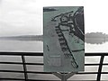 "Kapitulation", Derry - Londonderry - geograph.org.uk - 2795787.jpg 640 x 480; 34 KB
-
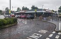 "McDonald's", Derry-Londonderry - geograph.org.uk - 5074687.jpg 640 x 417; 98 KB
-
 "No cycling on jetty" sign - geograph.org.uk - 3065027.jpg 640 x 480; 64 KB
-
 "Plessey" access cover, Coleraine - geograph.org.uk - 3332382.jpg 560 x 414; 125 KB
-
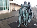 "The Emigrants", Atlantic Quay - geograph.org.uk - 2795853.jpg 640 x 480; 66 KB
-

-
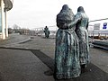 "The Emigrants", Derry - Londonderry - geograph.org.uk - 2795828.jpg 640 x 480; 57 KB
-
 "The Emigrants", Derry - Londonderry - geograph.org.uk - 2795858.jpg 640 x 480; 56 KB
-
 "Time and Tide wait for no one" - geograph.org.uk - 3065034.jpg 640 x 480; 49 KB
-
 "Welcome to Gortmore" notice - geograph.org.uk - 3094911.jpg 640 x 480; 57 KB
-
 "Whistle" sign, Castlerock station - geograph.org.uk - 3115682.jpg 640 x 414; 116 KB
-
 "You lookin' at me" - geograph.org.uk - 4681320.jpg 4000 x 2664; 5,91 MB
-
 'E-Car' charge point near Maghera - geograph.org.uk - 4059943.jpg 514 x 640; 95 KB
-
 'Foyle Metro' Bus on Glendermott Road - geograph.org.uk - 5561660.jpg 640 x 427; 393 KB
-
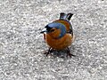 A cheeky chaffinch, Newferry - geograph.org.uk - 4998044.jpg 640 x 480; 208 KB
-

-
 A heap of scrap - geograph.org.uk - 5382976.jpg 3800 x 2568; 7 MB
-
 A Henry ^ Sons - Bamboo Garden - geograph.org.uk - 2394328.jpg 640 x 480; 52 KB
-
 A light covering of snow in Magherafelt. - geograph.org.uk - 5586632.jpg 720 x 960; 132 KB
-

-
 A piece of history - geograph.org.uk - 5364051.jpg 3200 x 2400; 3,54 MB
-
 A rough lane, Avish - geograph.org.uk - 4107278.jpg 640 x 480; 154 KB
-
 A Sperrin bog - geograph.org.uk - 3191887.jpg 640 x 464; 282 KB
-
 A track in the Loughermore Forest - geograph.org.uk - 2847226.jpg 2848 x 2136; 1,5 MB
-
 A track in the Loughermore Forest - geograph.org.uk - 2847246.jpg 2848 x 2136; 1,67 MB
-
 A view from Inishowen Head - geograph.org.uk - 5509263.jpg 2000 x 1333; 1,9 MB
-
 A view of the Sperrins - geograph.org.uk - 3199542.jpg 640 x 480; 261 KB
-
 A wet afternoon on Legavallon Road - geograph.org.uk - 3905502.jpg 640 x 480; 234 KB
-
 A wrong turning - geograph.org.uk - 4867183.jpg 4000 x 2664; 6,13 MB
-

-

-
 A2 Approaching the Culmore Roundabout - geograph.org.uk - 5683259.jpg 640 x 480; 433 KB
-

-

-
 A2, Quilly Road - geograph.org.uk - 4028167.jpg 640 x 480; 252 KB
-
 A29 Moneymore Road - geograph.org.uk - 4416891.jpg 3264 x 2448; 3,27 MB
-
 A29 Tobermore Road - geograph.org.uk - 4926032.jpg 640 x 480; 157 KB
-
 A31 Moneymore Road, Magherafelt - geograph.org.uk - 2395796.jpg 640 x 480; 49 KB
-
 A54, Ballymacombs Road - geograph.org.uk - 2693869.jpg 640 x 480; 36 KB
-
 Abandoned Church at Tamlaghtard - geograph.org.uk - 2989811.jpg 4000 x 3000; 2,97 MB
-

-
 About to go, Magherafelt^ - geograph.org.uk - 2705303.jpg 640 x 480; 36 KB
-

-

-
 Admiring the view at Gortmore - geograph.org.uk - 4998324.jpg 640 x 480; 168 KB
-
 Advertising van, Magherafelt - geograph.org.uk - 2396123.jpg 640 x 480; 63 KB
-
 Against the light, Leitrim - geograph.org.uk - 2684326.jpg 640 x 480; 58 KB
-
 Age Concern, Magherafelt - geograph.org.uk - 2394219.jpg 640 x 480; 42 KB
-
 Aghadowey Creamery - geograph.org.uk - 5374943.jpg 4608 x 3456; 7,6 MB
-
 Aircraft, City of Derry Airport - geograph.org.uk - 5080334.jpg 640 x 480; 146 KB
-
 AJ2, Magherafelt - geograph.org.uk - 2396056.jpg 640 x 480; 44 KB
-
 Along the Shore of Lough Foyle - geograph.org.uk - 5562204.jpg 640 x 481; 389 KB
-
 Altagarron Road - geograph.org.uk - 2291763.jpg 640 x 480; 51 KB
-
 Altagarron Road - geograph.org.uk - 2291774.jpg 640 x 480; 48 KB
-

-

-

-

-

-

-

-
 Altinure Road - geograph.org.uk - 3910223.jpg 640 x 480; 255 KB
-
 Altnagelvin Hospital - geograph.org.uk - 2228246.jpg 640 x 480; 63 KB
-
 Amigo - Humbugs, Magherafelt - geograph.org.uk - 2396024.jpg 640 x 480; 53 KB
-
 An interesting terrace of old houses - geograph.org.uk - 5511640.jpg 2000 x 1333; 2,33 MB
-
 An old building - geograph.org.uk - 5511635.jpg 2000 x 1297; 1,54 MB
-
 Angling along the Bann - geograph.org.uk - 4998037.jpg 640 x 480; 160 KB
-
 Another catch, Newferry - geograph.org.uk - 4998040.jpg 640 x 480; 170 KB
-
 Apartments, Castlerock - geograph.org.uk - 4107265.jpg 640 x 480; 150 KB
-
 Approaching Coleraine - geograph.org.uk - 3637594.jpg 3648 x 1960; 4,68 MB
-
-
 Ardina Bridge - geograph.org.uk - 4017054.jpg 3648 x 2736; 3,77 MB
-
 Articlave, pallets - geograph.org.uk - 5836879.jpg 1024 x 745; 146 KB
-
 At Newferry - geograph.org.uk - 2684339.jpg 640 x 480; 73 KB
-
 At Newferry - geograph.org.uk - 2684341.jpg 640 x 480; 78 KB
-
 At the crossroads - geograph.org.uk - 4681312.jpg 4000 x 2664; 4 MB
-
 Aughit Townland - geograph.org.uk - 4027238.jpg 640 x 360; 217 KB
-
 Aughrim Road - geograph.org.uk - 3540022.jpg 4000 x 3000; 4,73 MB
-
 Aughrim Road - geograph.org.uk - 4867309.jpg 4000 x 2664; 5,5 MB
-
 Automatic barriers - geograph.org.uk - 4020496.jpg 3648 x 2736; 3,91 MB
-
 Autumn leaves, Coleraine - geograph.org.uk - 3340027.jpg 640 x 480; 239 KB
-
 Autumn scene, Coleraine - geograph.org.uk - 3340040.jpg 640 x 480; 109 KB
-
 Avish Townland - geograph.org.uk - 3094925.jpg 640 x 480; 65 KB
-
 Avish Townland - geograph.org.uk - 4107269.jpg 640 x 480; 150 KB
-
 Ayrshires near Coleraine - geograph.org.uk - 4028321.jpg 640 x 480; 287 KB
-
 B47 Cavanreagh Road - geograph.org.uk - 2309639.jpg 640 x 480; 73 KB
-
 B47 Sixtowns Road, Labby - geograph.org.uk - 4865938.jpg 640 x 480; 148 KB
-
 B47 Sixtowns Road, Moyard - geograph.org.uk - 4865945.jpg 640 x 480; 135 KB
-
 Ballycairn Farms building, Ballycairn - geograph.org.uk - 6574699.jpg 1024 x 685; 237 KB
-
 Ballycairn Road - geograph.org.uk - 4017050.jpg 3648 x 2736; 3,67 MB
-
 Ballycairn Road - geograph.org.uk - 6574680.jpg 1024 x 685; 234 KB
-
 Ballycairn Road - geograph.org.uk - 6574701.jpg 1024 x 685; 214 KB
-
 Ballycairn Road - geograph.org.uk - 6574718.jpg 1024 x 685; 191 KB
-
 Ballycairn Road - geograph.org.uk - 6574801.jpg 1024 x 685; 190 KB
-
 Ballycairn Road, Ballycairn - geograph.org.uk - 6574678.jpg 1024 x 685; 205 KB
-
 Ballycairn Road, Ballycairn - geograph.org.uk - 6574700.jpg 1024 x 685; 205 KB
-
 Ballycairn Road, Ballycairn - geograph.org.uk - 6574702.jpg 1024 x 685; 212 KB
-
 Ballycairn Road, Ballycairn - geograph.org.uk - 6574728.jpg 1024 x 685; 180 KB
-
 Ballycairn Road, Waterside - geograph.org.uk - 6574669.jpg 1024 x 685; 308 KB
-
 Ballycairn Road, Waterside - geograph.org.uk - 6574675.jpg 1024 x 685; 207 KB
-
 Ballyclaber Reformed Presbyterian Church - geograph.org.uk - 5308543.jpg 4608 x 2436; 5,45 MB
-
 Ballydonegan Sweathouse - geograph.org.uk - 2292992.jpg 640 x 480; 101 KB
-
 Ballydonegan Townland - geograph.org.uk - 2292981.jpg 640 x 480; 77 KB
-
 Ballydonegan Townland - geograph.org.uk - 2292982.jpg 640 x 480; 78 KB
-
 Ballydonegan Townland - geograph.org.uk - 2292984.jpg 640 x 480; 97 KB
-
 Ballyhacket Lane near Castlerock (1) - geograph.org.uk - 1911516.jpg 640 x 371; 102 KB
-
 Ballyhacket Lane near Castlerock (2) - geograph.org.uk - 1911718.jpg 662 x 364; 101 KB
-
 Ballyhacket viewpoint near Castlerock - geograph.org.uk - 1911769.jpg 721 x 388; 102 KB
-
 Ballyhackett Primary School, County Londonderry (9836180584).jpg 596 x 461; 130 KB
-
 Ballyhenry West - geograph.org.uk - 5080494.jpg 640 x 480; 164 KB
-
 Ballyhenry West, Limavady - geograph.org.uk - 5078757.jpg 3264 x 2448; 2,38 MB
-
 Ballykelly Level - geograph.org.uk - 5469321.jpg 640 x 480; 124 KB
-
 Ballylagan Road - geograph.org.uk - 4691323.jpg 4000 x 2664; 5,48 MB
-
 Ballylagan Road - geograph.org.uk - 4691326.jpg 4000 x 2664; 4,05 MB
-
 Ballylintagh Road - geograph.org.uk - 5374934.jpg 4608 x 3456; 7,97 MB
-
 Ballylintock Road - geograph.org.uk - 5374945.jpg 4608 x 3456; 7,57 MB
-
 Ballymacombs Beg - geograph.org.uk - 2693844.jpg 640 x 480; 72 KB
-
 Ballymacombs Beg - geograph.org.uk - 2693852.jpg 640 x 480; 65 KB
-
 Ballymacombs More - geograph.org.uk - 2693838.jpg 640 x 480; 63 KB
-
 Ballymacombs Road - geograph.org.uk - 2693848.jpg 640 x 480; 73 KB
-
 Ballymoney Townland - geograph.org.uk - 2291782.jpg 640 x 480; 71 KB
-
 Ballymoney Townland - geograph.org.uk - 2291783.jpg 640 x 480; 61 KB
-
 Ballymoney Townland - geograph.org.uk - 2291784.jpg 640 x 480; 81 KB
-
 Ballymullholland Townland - geograph.org.uk - 4027142.jpg 640 x 360; 212 KB
-
 Ballynease Helton - geograph.org.uk - 2693872.jpg 640 x 480; 75 KB
-
 Ballynease Road - geograph.org.uk - 2693840.jpg 640 x 480; 54 KB
-
 Ballynease Townland - geograph.org.uk - 2693858.jpg 640 x 480; 45 KB
-
 Ballynease Townland - geograph.org.uk - 2693864.jpg 640 x 480; 53 KB
-
 Ballyreagh Road (A2) near Portrush - geograph.org.uk - 3331386.jpg 1024 x 669; 152 KB
-
 Ballyscullion Townland - geograph.org.uk - 2613653.jpg 640 x 480; 80 KB
-
 Ballyscullion West - geograph.org.uk - 2613641.jpg 640 x 480; 66 KB
-
 Ballyscullion West - geograph.org.uk - 2613644.jpg 640 x 480; 72 KB
-
 Ballyversal Road - geograph.org.uk - 4681466.jpg 4000 x 2664; 4,08 MB
-
 Ballywillin Old Church 1 - geograph.org.uk - 4691317.jpg 4000 x 2664; 6,14 MB
-
 Ballywillin Old Church 2 - geograph.org.uk - 4691319.jpg 4000 x 2664; 4,93 MB
-
 Ballywillin Old Church 3 - geograph.org.uk - 4691322.jpg 4000 x 2664; 5,38 MB
-
 Bambino's, Magherafelt - geograph.org.uk - 2396029.jpg 640 x 480; 46 KB
-
 Banagher Forest at Glenedra - geograph.org.uk - 4514392.jpg 640 x 480; 60 KB
-
 Banagher Old Church - geograph.org.uk - 6234700.jpg 3648 x 2736; 3,05 MB
-
 Banagher Old Church - geograph.org.uk - 6234702.jpg 5120 x 3840; 6,79 MB
-
 Bancran Road - Glengomma Road - geograph.org.uk - 2309631.jpg 640 x 480; 86 KB
-
 Bank, River Bann near Portstewart - geograph.org.uk - 1913342.jpg 640 x 377; 102 KB
-
 Bann floodplain - geograph.org.uk - 4028810.jpg 640 x 480; 319 KB
-
 Barley field, Castlerock (2) - geograph.org.uk - 3081827.jpg 640 x 426; 85 KB
-
 Barley fields, Castlerock - geograph.org.uk - 3081226.jpg 640 x 381; 93 KB
-

-
-

-

-
 Barmouth, Ballywollen - Grange Beg - geograph.org.uk - 5387689.jpg 640 x 480; 139 KB
-
 Baronet Street (1) - geograph.org.uk - 3065091.jpg 640 x 480; 66 KB
-
 Baronet Street (2) - geograph.org.uk - 3065098.jpg 640 x 480; 67 KB
-
 Baronet Street (3) - geograph.org.uk - 3065104.jpg 640 x 480; 63 KB
-
 Baronet Street (4) - geograph.org.uk - 3065107.jpg 640 x 480; 68 KB
-
 Baronet Street, Derry - Londonderry - geograph.org.uk - 3065078.jpg 640 x 480; 54 KB
-
 Barry Street, Derry - Londonderry - geograph.org.uk - 2796083.jpg 640 x 480; 46 KB
-
 Be aware - geograph.org.uk - 4681355.jpg 4000 x 2664; 5 MB
-
 Beacon in River Bann - geograph.org.uk - 5566339.jpg 640 x 481; 363 KB
-
 Bellarena (Sea Coast Road) - geograph.org.uk - 5564066.jpg 640 x 481; 478 KB
-
 Bellarena - Ballycarton - geograph.org.uk - 5387590.jpg 2560 x 1920; 2 MB
-
 Bellarena - geograph.org.uk - 5564068.jpg 640 x 480; 362 KB
-
-
 Bellarena Railway Station - geograph.org.uk - 2023709.jpg 640 x 480; 55 KB
-
 Bellarena Railway Station - geograph.org.uk - 5811675.jpg 1280 x 720; 1,02 MB
-
 Bellarena Railway Station - geograph.org.uk - 5811678.jpg 1280 x 720; 1020 KB
-

-
-
 Belloghry Road, Newtonhamilton - geograph.org.uk - 3053518.jpg 640 x 421; 253 KB
-
 Below Donald's Hill - geograph.org.uk - 3904343.jpg 640 x 480; 294 KB
-
 Bench Mark, Eglinton - geograph.org.uk - 1859722.jpg 640 x 437; 518 KB
-
 Benchmark on Benbradagh - geograph.org.uk - 4048968.jpg 2592 x 1944; 2,89 MB
-
 Benedy Community Association - geograph.org.uk - 587934.jpg 640 x 479; 59 KB
-
 Benone beach - geograph.org.uk - 4585788.jpg 3648 x 2736; 3,26 MB
-
 Benone Beach - geograph.org.uk - 5564726.jpg 640 x 480; 310 KB
-
 Benone from Gortmore - geograph.org.uk - 4585721.jpg 3648 x 2736; 3,7 MB
-
 Big red tractor - geograph.org.uk - 4867300.jpg 2000 x 1332; 2,61 MB
-
 Bigwood Road - geograph.org.uk - 3437807.jpg 640 x 480; 216 KB
-
 Binevenagh - geograph.org.uk - 3948140.jpg 640 x 368; 252 KB
-
 Binevenagh - geograph.org.uk - 3948189.jpg 640 x 480; 284 KB
-
 Binevenagh from Gortmore - geograph.org.uk - 4585691.jpg 3648 x 2736; 4,12 MB
-
 Binevenagh Lake - geograph.org.uk - 2522280.jpg 640 x 462; 51 KB
-
 Binevenagh Lake - geograph.org.uk - 3948103.jpg 640 x 480; 278 KB
-
 Bird watcher's hut, Grange Beg - geograph.org.uk - 5387694.jpg 640 x 480; 147 KB
-
 Bird watching along the Bann - geograph.org.uk - 2684360.jpg 640 x 480; 54 KB
-
 Bird watching, Pennyburn - geograph.org.uk - 3065016.jpg 640 x 480; 56 KB
-

-
 Birren Road, Brown Hill - geograph.org.uk - 1812753.jpg 640 x 480; 41 KB
-
 Bishop's View direction cairn - geograph.org.uk - 4107336.jpg 640 x 480; 148 KB
-
 Bishops Gate, Derry - Londonderry - geograph.org.uk - 1812892.jpg 640 x 480; 60 KB
-
 Bishops Road with Mussenden in View Downhill - geograph.org.uk - 3085957.jpg 3008 x 2000; 2,6 MB
-
 Bishops Road, Avish - geograph.org.uk - 3094920.jpg 640 x 480; 54 KB
-
 Bishops Road, Avish - geograph.org.uk - 4107274.jpg 640 x 480; 142 KB
-
 Bishops Road, Binevenagh - geograph.org.uk - 3094812.jpg 640 x 480; 43 KB
-
 Bishops Road, Burrenbeg - geograph.org.uk - 3094928.jpg 640 x 480; 48 KB
-
 Bishops Road, Gortmore - geograph.org.uk - 3094916.jpg 640 x 480; 57 KB
-
 Black-headed gull - geograph.org.uk - 3815745.jpg 640 x 480; 48 KB
-
 Blackberries, Coleraine - geograph.org.uk - 3119308.jpg 640 x 419; 86 KB
-
 Blackpark Road - geograph.org.uk - 3540033.jpg 4000 x 3000; 4,65 MB
-
 Blagh Road - geograph.org.uk - 2202352.jpg 2592 x 1944; 2,04 MB


_passing_Bellarena_Primary_School,_near_Limavady,_Co._Derry_-_geograph.org.uk_-_5958554.jpg)
,_near_Limavady,_Co._Derry_-_geograph.org.uk_-_5959606.jpg)


_-_geograph.org.uk_-_1911807.jpg)
_-_geograph.org.uk_-_1911826.jpg)
_-_geograph.org.uk_-_1911848.jpg)
_-_geograph.org.uk_-_1911867.jpg)
_-_geograph.org.uk_-_1911882.jpg)
_-_geograph.org.uk_-_1911895.jpg)
_-_geograph.org.uk_-_1911911.jpg)


_-_geograph.org.uk_-_1911516.jpg)
_-_geograph.org.uk_-_1911718.jpg)

.jpg)


_near_Portrush_-_geograph.org.uk_-_3331386.jpg)


_-_geograph.org.uk_-_3081827.jpg)

_-_geograph.org.uk_-_3080365.jpg)
_-_geograph.org.uk_-_3080378.jpg)
_-_geograph.org.uk_-_3115692.jpg)
_-_geograph.org.uk_-_3115698.jpg)

_-_geograph.org.uk_-_3065091.jpg)
_-_geograph.org.uk_-_3065098.jpg)
_-_geograph.org.uk_-_3065104.jpg)
_-_geograph.org.uk_-_3065107.jpg)


_-_geograph.org.uk_-_5564066.jpg)


