Category:Dibër County
Vai alla navigazione
Vai alla ricerca
prefettura albanese   .svg) | |||||
| Carica un file multimediale | |||||
| Istanza di | |||||
|---|---|---|---|---|---|
| Luogo | Albania | ||||
| Capitale | |||||
| Popolazione |
| ||||
| Superficie |
| ||||
| Altezza sul mare |
| ||||
| sito web ufficiale | |||||
 | |||||
Sottocategorie
Questa categoria contiene le 14 sottocategorie indicate di seguito, su un totale di 14.
A
- Allajbegi's Mosque (3 F)
D
- Dejë (7 F)
K
L
- Lurë municipality (7 F)
M
- Martanesh (21 F)
R
- Rruga e Arbërit (16 F)
S
- Lake Shkopeti (7 F)
U
- Lake Ulza (11 F)
°
File nella categoria "Dibër County"
Questa categoria contiene 70 file, indicati di seguito, su un totale di 70.
-
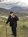 100-vjetori në Muhurr.jpg 958 × 1 280; 175 KB
-
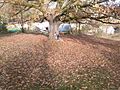
 A green field. Small area fields in a limited surface are commonly found in this park.jpg 1 960 × 4 032; 4,54 MB
-
 Afer Drinit Zi, Majtare.jpg 4 608 × 3 456; 5,2 MB
-
 ALB Qarku i Dibrës COA.png 235 × 308; 75 KB
-
 Albania (Dibër County).svg 800 × 1 169; 803 KB
-
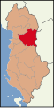 Albania location Dibër.svg 508 × 1 002; 197 KB
-
 Albania outside of Peshkopi.jpg 4 608 × 3 072; 9,3 MB
-
 AlbaniaDibërCounty.png 100 × 225; 13 KB
-
 Arras and Çidhën area.jpg 1 375 × 774; 785 KB
-
 Batrë E Vogël, Albania - panoramio.jpg 1 600 × 1 200; 736 KB
-
 Beautiful Sky in Albania.jpg 3 024 × 4 032; 2,93 MB
-
 Bjeshkët e Çajës.jpg 4 000 × 6 000; 12,06 MB
-
 Black Drin at Luzni - Mapillary (4BIfrxWB9iRwSxV3iR2tVQ).jpg 1 616 × 987; 150 KB
-
 Black Drin at Luzni - Mapillary (bpOHPRnYbZhpYWk2KKk23A).jpg 1 616 × 990; 153 KB
-
 Black Drin at Luzni - Mapillary (ponXhYLAaOsZ4WAuRwRj6A).jpg 1 616 × 982; 216 KB
-
 Black Drin in Dibra - Mapillary (zsA102PayyQfBZScR5hDSg).jpg 2 048 × 1 255; 260 KB
-
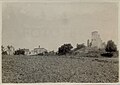 Burgajet castle field.jpg 500 × 354; 60 KB
-
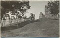 Burgajet castle other entrance.jpg 500 × 322; 84 KB
-
 Burgajet castle stairs.jpg 485 × 358; 187 KB
-
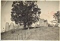 Burgajet castle tree.jpg 500 × 344; 79 KB
-
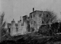 Burgajet castle.png 851 × 621; 517 KB
-
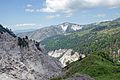
 Canyon - panoramio (6).jpg 2 304 × 3 072; 4,31 MB
-
 Dibra close to Luzni - Mapillary (dR572DN-aJ9q6a90Li96vw).jpg 1 616 × 870; 191 KB
-
 Dibra e vogel Panorama.jpg 4 000 × 1 892; 4,7 MB
-
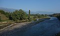
 Dibra.jpg 1 500 × 659; 624 KB
-
 Dibraalbanien.jpg 600 × 201; 37 KB
-
 Donkey, a characteristic animal of this defended zone.jpg 4 032 × 1 960; 6,33 MB
-
 Drini i Zi,Gjorice.jpg 4 608 × 3 456; 4,68 MB
-
 E851 WikipediaWeekendTirana2015 DejaMountain 666.JPG 4 912 × 3 264; 2,84 MB
-
 E851 WikipediaWeekendTirana2015 DejaMountain 678.jpg 3 000 × 1 887; 2,79 MB
-
 E851 WikipediaWeekendTirana2015 LerteshitMountain 631.JPG 4 912 × 3 264; 2,94 MB
-
 Flag of Diber.png 770 × 472; 85 KB
-
 Foggy Winter Day in Albania (WPWTR17).jpg 4 912 × 3 264; 5,1 MB
-
 Fshati Mustafe, foto nga Hajredin Toca, viti 2020.jpg 2 236 × 1 950; 3,13 MB
-
 Gips Hill kundërt fshatin Radomir. - panoramio.jpg 2 848 × 4 272; 3,92 MB
-
 Gryka e Setës - Mapillary (8kFcRnBTxS5d7HAEDB3cjw).jpg 1 977 × 1 098; 424 KB
-
 ISS016-E-9446 - View of Albania.jpg 3 032 × 2 008; 1,19 MB
-
 ISS016-E-9447 - View of Albania.jpg 3 032 × 2 008; 1,4 MB
-
 Kisha e Shpërfytyrimit Herbel frescos.jpg 1 125 × 1 750; 1,24 MB
-
 Kisha e Shpërfytyrimit Herbel.jpg 3 947 × 2 787; 5,33 MB
-
 Kulle ne fshatin e Kalase se Dodes.JPG 4 752 × 3 168; 4,48 MB
-
 Liqeni i Gramës.jpg 2 000 × 1 220; 1,04 MB
-
 Lisi i Dobit, Muhurr.jpg 640 × 480; 83 KB
-
 Lura Mountains Panorama.jpg 3 549 × 998; 2,02 MB
-
 Maja Velivarit + Maja Kërçinës.jpg 2 000 × 1 100; 1,54 MB
-
 Mali Bardhe.jpg 4 140 × 2 755; 6,53 MB
-

-
 Mali i Grames.jpg 4 592 × 3 056; 4,78 MB
-
 Mat and Skanderbeg Mountains.jpg 3 000 × 2 000; 3,45 MB
-
 Mat mountains (WPWTR17).jpg 4 912 × 3 264; 3,53 MB
-
 Mat valley Sentinel-2.jpg 2 726 × 2 560; 2,96 MB
-
 Mountains of Eastern Albania (WPWTR16).JPG 4 912 × 3 264; 3,22 MB
-
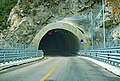
 Murriza Tunnel.jpg 3 017 × 2 106; 4,67 MB
-
 Një pishë simbol në zonën përreth parkut kombëtar Zall-Gjoçaj.jpg 1 960 × 4 032; 4,21 MB
-
 Parku Kombëtar Zall-Gjoçaj (v. 2013).jpg 720 × 540; 85 KB
-
 Peisazhi pranë Peshkopië. - panoramio.jpg 4 272 × 2 848; 4,36 MB
-
 Puka mountains (WPWTR17).jpg 4 912 × 3 264; 3,84 MB
-
 Qafa e Buallit.jpg 2 000 × 1 124; 1,46 MB
-
 Radomir ju. Pasme e Madhe Korab. - panoramio.jpg 4 272 × 2 848; 4,18 MB
-
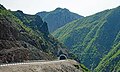 Rruga Arbrit Tunnel T3 Shkalla.jpg 4 369 × 2 624; 6,09 MB
-
 Rruga Arbrit Tunnel T6 Shkalla.jpg 5 602 × 3 801; 14,09 MB
-
 Sohodoll.jpg 4 032 × 3 024; 2,17 MB
-
 Sopanika spring - Mapillary (3lbUotqMeC5Rs9W5gzi-FQ).jpg 1 987 × 1 328; 654 KB
-
 Tuneli në Shkopet.jpg 2 000 × 3 000; 4,62 MB
-
 Ura e Drinit re Zi rruga e Arbrit, Gjorice.jpg 4 608 × 3 456; 6,94 MB
-
 Ura e Drinit te Zi, rruga e Arbrit, 2019.jpg 4 608 × 3 456; 5,36 MB
-
 Ura e Drinit te Zi, rruga e Arbrit, Gjorice.jpg 4 608 × 3 456; 5,44 MB
-
 Ura e Fshatit & Tunnel.jpg 6 000 × 4 000; 11,34 MB
-
 Карта на Голо Брдо.png 4 192 × 4 192; 6,56 MB
-
 Карта на Дебарско Поле.svg 512 × 536; 191 KB


.jpg)
.jpg)
.jpg)
.jpg)


.jpg)
.jpg)


.jpg)


.jpg)


.jpg)

.JPG)


.jpg)

.jpg)


.jpg)


