Category:Eynsford
Jump to navigation
Jump to search
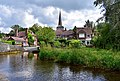
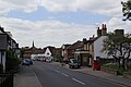
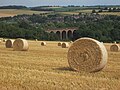
English: Eynsford (pronounced Ainsford) is a village and civil parish in the Sevenoaks District of Kent, England. It is located on the River Darent, south of Dartford in Kent.
village and civil parish in Kent, UK  | |||||
| Upload media | |||||
| Instance of | |||||
|---|---|---|---|---|---|
| Location | Sevenoaks, Kent, South East England, England | ||||
| Area |
| ||||
| Said to be the same as | Eynsford (Wikimedia duplicated page, civil parish) | ||||
 | |||||
Subcategories
This category has the following 11 subcategories, out of 11 total.
B
E
- Eynsford Bridge (24 F)
- Eynsford Ford (19 F)
- Eynsford railway station (29 F)
- Eynsford Viaduct (30 F)
- Eynsford War Memorial (4 F)
L
N
- Nature of Eynsford (2 F)
O
- Oasts in Eynsford (2 F)
Media in category "Eynsford"
The following 200 files are in this category, out of 737 total.
(previous page) (next page)-
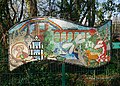 "Essence of Eynsford" Mosaic in Eynsford.jpg 4,360 × 3,121; 16.11 MB
-
 'Home Farm Business Units', Eynsford - geograph.org.uk - 2506113.jpg 800 × 702; 112 KB
-
 'Snail' in Lower Beechen Wood - geograph.org.uk - 3130565.jpg 4,000 × 3,000; 4.27 MB
-
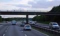
 1 mile to junction 4, M25 - geograph.org.uk - 2028736.jpg 640 × 381; 95 KB
-
 10th Tee of Pedham Place Golf Centre - geograph.org.uk - 1302822.jpg 640 × 480; 51 KB
-
 A Rainbow in Eynsford, Kent.jpg 2,304 × 1,532; 1.56 MB
-
 A Thameslink train crosses Eynsford Viaduct - geograph.org.uk - 5983419.jpg 4,000 × 3,000; 4.99 MB
-
 A view of the curtain wall at Eynsford Castle - geograph.org.uk - 4935412.jpg 5,184 × 3,888; 7.4 MB
-
 A225 - geograph.org.uk - 3541245.jpg 640 × 430; 88 KB
-
 A225 - geograph.org.uk - 3541247.jpg 640 × 430; 97 KB
-
 A225 Station Road - geograph.org.uk - 6387724.jpg 1,024 × 683; 477 KB
-
 A225, southbound - geograph.org.uk - 3541250.jpg 640 × 430; 80 KB
-
 Above the railway near Eynsford - geograph.org.uk - 3175154.jpg 4,000 × 3,000; 4.31 MB
-
 Aegen's Ford, Eynsford - geograph.org.uk - 4897371.jpg 3,264 × 2,448; 2.76 MB
-
 Aegen's Ford, Eynsford - geograph.org.uk - 4897376.jpg 3,264 × 2,448; 2.69 MB
-
 Alchin's Wood - geograph.org.uk - 1314933.jpg 640 × 480; 66 KB
-
 Along the edge of Lullingstone Country Park - geograph.org.uk - 3437241.jpg 4,000 × 3,000; 4.2 MB
-
 Alongside the Eynsford to Swanley railway line - geograph.org.uk - 5529616.jpg 4,000 × 3,000; 5.04 MB
-
 Alongside the railway - geograph.org.uk - 3175148.jpg 4,000 × 3,000; 4.31 MB
-

-

-
 Approaching the station - geograph.org.uk - 6387727.jpg 1,024 × 683; 544 KB
-
 Austin Lodge Golf Course - geograph.org.uk - 4010160.jpg 4,000 × 3,000; 4.18 MB
-
 Austin Lodge Golf Course - geograph.org.uk - 4010167.jpg 4,000 × 3,000; 4.08 MB
-
 Autumn hedge - geograph.org.uk - 2126671.jpg 640 × 428; 151 KB
-
 Avenue Cottage - geograph.org.uk - 3541241.jpg 640 × 430; 70 KB
-
 Bald Eagle at Eagle Heights, Eynsford, Kent - geograph.org.uk - 2404517.jpg 3,027 × 2,299; 2.86 MB
-
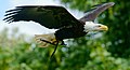 Bald Eagle at Eagle Heights, Eynsford, Kent - geograph.org.uk - 2406849.jpg 4,022 × 2,191; 3.14 MB
-
 Baldwins Cottages (extended) - geograph.org.uk - 2126538.jpg 640 × 428; 94 KB
-

-
 Banks of the river - geograph.org.uk - 6387717.jpg 1,024 × 683; 602 KB
-
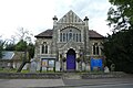 Baptist Church - geograph.org.uk - 6387537.jpg 1,024 × 683; 499 KB
-
 Base of a column at Eynsford Castle - geograph.org.uk - 5042500.jpg 4,608 × 3,456; 3.61 MB
-
 Bay Tree Cottage - geograph.org.uk - 3541243.jpg 640 × 430; 48 KB
-
 Beechen wood, March 2009 - geograph.org.uk - 1189039.jpg 618 × 404; 190 KB
-

-
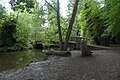
 Bench by River Darent - geograph.org.uk - 6432997.jpg 961 × 697; 254 KB
-
 Best of Friends^ - geograph.org.uk - 2406846.jpg 1,975 × 2,697; 1.87 MB
-
 Birch Close - geograph.org.uk - 1735549.jpg 640 × 427; 63 KB
-
 Birch Close, Eynsford - geograph.org.uk - 5716644.jpg 640 × 480; 72 KB
-
 Bower Cottage ,Bower Lane - geograph.org.uk - 3009568.jpg 3,264 × 2,448; 1.97 MB
-
 Bower Farm and field - geograph.org.uk - 4427901.jpg 2,560 × 1,920; 2.11 MB
-
 Bower Lane - geograph.org.uk - 3184671.jpg 4,000 × 3,000; 4.14 MB
-
 Bower Lane by Bower Park Cottage - geograph.org.uk - 4427933.jpg 2,560 × 1,920; 1.99 MB
-
 Bower Lane south of Eynsford - geograph.org.uk - 4427974.jpg 2,560 × 1,920; 1.98 MB
-
 Bower Lane, Eynsford - geograph.org.uk - 4427491.jpg 2,560 × 1,920; 2.09 MB
-
 Bower Lane, Eynsford - geograph.org.uk - 4428026.jpg 2,560 × 1,920; 1.89 MB
-
 Bower Lane, Eynsford - geograph.org.uk - 4897456.jpg 3,264 × 2,448; 2.33 MB
-
 Bower Lane, Knatts Valley - geograph.org.uk - 4427869.jpg 2,560 × 1,920; 1.97 MB
-
 Bower Lane, near Eynsford - geograph.org.uk - 1913951.jpg 2,048 × 1,536; 1.24 MB
-
 Bower Lane, Romney Street - geograph.org.uk - 4428199.jpg 2,560 × 1,920; 2.03 MB
-
 Bower Park Farm - geograph.org.uk - 1331298.jpg 640 × 480; 64 KB
-
 Boyne (geograph 6551079).jpg 1,024 × 684; 169 KB
-
 Bridge across the River Darent - geograph.org.uk - 1735303.jpg 640 × 427; 108 KB
-
 Bridge and ford at Eynsford - geograph.org.uk - 5716666.jpg 640 × 480; 118 KB
-
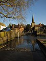
 Bridge and ford at Eynsford, Kent - geograph.org.uk - 2270584.jpg 800 × 487; 241 KB
-
 Bridge and ford in Eynsford - geograph.org.uk - 6387255.jpg 1,024 × 683; 627 KB
-
 Bridge and Ford, Eynsford, Kent - geograph.org.uk - 2406249.jpg 2,780 × 1,850; 3.8 MB
-
 Bridge at Eynsford ford - geograph.org.uk - 1956590.jpg 640 × 480; 97 KB
-
 Bridge for the pavement, Riverside - geograph.org.uk - 1735508.jpg 640 × 427; 103 KB
-
 Bridge over River Darent - geograph.org.uk - 4300167.jpg 480 × 640; 94 KB
-

-
 Bridge over the A225, Eynsford - geograph.org.uk - 5716650.jpg 640 × 480; 96 KB
-
 Bridge over the Darent - geograph.org.uk - 6387019.jpg 1,024 × 683; 620 KB
-
 Bridge Over the River Darent, Kent - geograph.org.uk - 2406668.jpg 2,780 × 1,850; 4.79 MB
-
 Bull and cows, Darent valley - geograph.org.uk - 2134969.jpg 640 × 428; 105 KB
-
 Business unit, Hame Farm - geograph.org.uk - 3541173.jpg 640 × 408; 65 KB
-
 Byway to Eynsford - geograph.org.uk - 1314935.jpg 640 × 480; 100 KB
-
 Byway to Eynsford - geograph.org.uk - 1314936.jpg 640 × 480; 81 KB
-

-

-
 Capricorn Farm - geograph.org.uk - 3802569.jpg 1,024 × 768; 201 KB
-
 Carved seat in Lullingstone Country Park - geograph.org.uk - 3130562.jpg 4,000 × 3,000; 4.03 MB
-
 Castle in Eynsford - geograph.org.uk - 6387716.jpg 1,024 × 683; 520 KB
-
 Castle Road bridge over River Darenth - geograph.org.uk - 1333206.jpg 640 × 480; 111 KB
-
 Cattle beside Lullingstone Lane - geograph.org.uk - 6387223.jpg 1,024 × 683; 661 KB
-
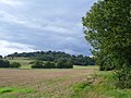
 Chalk Farmland - geograph.org.uk - 3447769.jpg 640 × 430; 52 KB
-
 Cheetah at Eagle Heights, Eynsford, Kent - geograph.org.uk - 2405140.jpg 2,195 × 2,256; 2.34 MB
-
 Church in Lullingstone Castle - geograph.org.uk - 6126778.jpg 1,024 × 768; 190 KB
-
 Church of St Martin - geograph.org.uk - 3541230.jpg 430 × 640; 52 KB
-
 Church of St Martin of Tours ^ Lychgate - geograph.org.uk - 6432829.jpg 768 × 929; 293 KB
-
 Churchyard cat, Eynsford - geograph.org.uk - 2135049.jpg 640 × 428; 174 KB
-
 Conservation Walks Notice at Castle Farm - geograph.org.uk - 6431897.jpg 1,113 × 1,600; 379 KB
-
 Corn Field off Upper Austin Lodge Road - geograph.org.uk - 1917470.jpg 1,024 × 768; 267 KB
-
 Cottage at Eynsford - geograph.org.uk - 2810259.jpg 640 × 480; 77 KB
-
 Cottage in Eynsford - geograph.org.uk - 3541238.jpg 640 × 439; 64 KB
-
 Cottages in Eynsford - geograph.org.uk - 6387248.jpg 1,024 × 683; 578 KB
-

-
 Cow parsley near Eynsford - geograph.org.uk - 6172709.jpg 4,000 × 3,000; 4.87 MB
-
 Cow parsley on the Darent Valley Path - geograph.org.uk - 6172703.jpg 4,000 × 3,000; 4.82 MB
-
 Crockenhill Lane - geograph.org.uk - 2766379.jpg 4,000 × 3,000; 4.08 MB
-
 Crockenhill Lane before Eynsford - geograph.org.uk - 4428125.jpg 2,560 × 1,920; 2 MB
-
 Crockenhill Lane bridge over the M25 - geograph.org.uk - 3802543.jpg 1,024 × 768; 261 KB
-
 Crockenhill Lane Bridge, M25 - geograph.org.uk - 2735340.jpg 640 × 389; 47 KB
-
 Crockenhill Lane Bridge, M25 - geograph.org.uk - 3729741.jpg 640 × 430; 42 KB
-
 Crockenhill Lane, Eynsford - geograph.org.uk - 1362934.jpg 640 × 480; 122 KB
-
 Crockenhill Lane, Eynsford - geograph.org.uk - 4426422.jpg 2,560 × 1,920; 2.18 MB
-
 Crockenhill Lane, Eynsford - geograph.org.uk - 4428205.jpg 2,560 × 1,920; 2.02 MB
-
 Crockenhill Lane, Eynsford - geograph.org.uk - 4897312.jpg 3,264 × 2,448; 2.81 MB
-
 Crockenhill Lane, near Eynsford - geograph.org.uk - 2766382.jpg 640 × 480; 126 KB
-
 Crockenhill Lane, near Eynsford - geograph.org.uk - 4897286.jpg 3,264 × 2,448; 1.67 MB
-
 Crockenhill Lane, near Eynsford - geograph.org.uk - 4897292.jpg 3,264 × 2,448; 2.77 MB
-
 Crockenhill Lane, near Eynsford - geograph.org.uk - 4897295.jpg 3,264 × 2,448; 1.63 MB
-
 Crockenhill Lane, near Eynsford - geograph.org.uk - 4897302.jpg 3,264 × 2,448; 2.09 MB
-
 Crockenhill.JPG 1,922 × 1,607; 2.39 MB
-
 Crop Meets Wild Flowers - geograph.org.uk - 2405961.jpg 2,984 × 1,986; 7.66 MB
-
 Cyclists, Eynsford village - geograph.org.uk - 3802699.jpg 1,024 × 768; 406 KB
-
 Darent Valley at Lullingstone - geograph.org.uk - 3126274.jpg 4,000 × 3,000; 4.09 MB
-
 Darent Valley Path - geograph.org.uk - 3801712.jpg 640 × 428; 154 KB
-
 Darent Valley Path - geograph.org.uk - 5042506.jpg 4,608 × 3,456; 3.37 MB
-
 Darent Valley Path - geograph.org.uk - 6387192.jpg 1,024 × 683; 778 KB
-
 Darent Valley Path at Castle Road - geograph.org.uk - 6431938.jpg 1,024 × 677; 252 KB
-
 Darent Valley Path crossing the railway near Eynsford - geograph.org.uk - 5042517.jpg 4,608 × 3,456; 3.4 MB
-
 Darent Valley Path near Lullingstone - geograph.org.uk - 2774641.jpg 640 × 480; 136 KB
-
 Darent Valley Path near Lullingstone - geograph.org.uk - 2774649.jpg 640 × 480; 137 KB
-

-
 Darent Valley Path, Kent, United Kingdom.jpg 1,920 × 1,080; 801 KB
-
 Darenth Valley Path to Eynsford - geograph.org.uk - 1302846.jpg 640 × 480; 86 KB
-

-
 Darrent in Eynsford - geograph.org.uk - 6387251.jpg 1,024 × 683; 677 KB
-
 Downland farming - geograph.org.uk - 3447771.jpg 640 × 430; 48 KB
-
 Driveway through Lullingstone Park - geograph.org.uk - 5716719.jpg 640 × 480; 72 KB
-
 Eagle watching - geograph.org.uk - 1302866.jpg 640 × 480; 89 KB
-
 Electricity pylons - geograph.org.uk - 6126798.jpg 768 × 1,024; 151 KB
-
 Elizabeth Cottages, Eynsford, Kent - geograph.org.uk - 1917495.jpg 1,024 × 768; 170 KB
-
 Elm Cottages - geograph.org.uk - 3541246.jpg 640 × 430; 75 KB
-
 Enclosed path - geograph.org.uk - 4009373.jpg 4,000 × 3,000; 4.48 MB
-
 Entering Eynsford - geograph.org.uk - 3541151.jpg 640 × 430; 95 KB
-
 Entrance to Eynsford Castle - geograph.org.uk - 5042490.jpg 4,608 × 3,456; 3.39 MB
-
 Entrance to the World Garden - geograph.org.uk - 2049752.jpg 640 × 480; 127 KB
-
 Eynsford (51598339352).jpg 5,865 × 3,953; 14.21 MB
-
 Eynsford , Kent , UK ........June , 2015 - panoramio.jpg 3,968 × 1,944; 3.18 MB
-
 Eynsford - geograph.org.uk - 2206709.jpg 1,168 × 788; 526 KB
-
 Eynsford - geograph.org.uk - 3535409.jpg 640 × 430; 70 KB
-
 Eynsford - geograph.org.uk - 6339929.jpg 800 × 485; 353 KB
-
 Eynsford - geograph.org.uk - 6387534.jpg 1,024 × 683; 463 KB
-
 Eynsford banner Inside Eynsford Castle.jpg 6,537 × 934; 2.91 MB
-
 Eynsford Castle - entrance - geograph.org.uk - 5034708.jpg 640 × 427; 77 KB
-
 Eynsford Castle - geograph.org.uk - 5042486.jpg 4,608 × 3,456; 3.41 MB
-
 Eynsford Castle - geograph.org.uk - 6387700.jpg 1,024 × 683; 501 KB
-
 Eynsford Castle - interior - geograph.org.uk - 5034724.jpg 640 × 427; 71 KB
-
 Eynsford Castle - solar undercroft - geograph.org.uk - 5034766.jpg 640 × 427; 120 KB
-
 Eynsford Castle - tufa dressing - geograph.org.uk - 5034740.jpg 640 × 427; 101 KB
-
 Eynsford Castle from the bridge - geograph.org.uk - 6387699.jpg 1,024 × 683; 586 KB
-
 Eynsford Castle from the riverbank - geograph.org.uk - 6387718.jpg 1,024 × 683; 502 KB
-
 Eynsford churchyard and church - geograph.org.uk - 3606939.jpg 640 × 427; 100 KB
-
 Eynsford Ford - geograph.org.uk - 3740588.jpg 3,872 × 2,592; 4.77 MB
-
 Eynsford ford and church - geograph.org.uk - 1956586.jpg 480 × 640; 100 KB
-

-
 Eynsford from the side of the valley - geograph.org.uk - 3087019.jpg 4,000 × 3,000; 3.66 MB
-
 Eynsford High Street - geograph.org.uk - 6387698.jpg 1,024 × 683; 441 KB
-
 Eynsford High Street, 2015.JPG 5,184 × 3,456; 5.46 MB
-
 Eynsford Railway Station - geograph.org.uk - 4897420.jpg 3,264 × 2,448; 1.57 MB
-
 Eynsford railway viaduct - geograph.org.uk - 5019481.jpg 640 × 427; 106 KB
-
 Eynsford Rise - geograph.org.uk - 1735555.jpg 640 × 427; 57 KB
-
 Eynsford Rise, Eynsford - geograph.org.uk - 4897426.jpg 3,264 × 2,448; 1.87 MB
-
 Eynsford Rise, Eynsford - geograph.org.uk - 5716639.jpg 640 × 480; 76 KB
-
 Eynsford Riverside Club - geograph.org.uk - 1735505.jpg 640 × 427; 91 KB
-
 Eynsford Riverside Club - geograph.org.uk - 3541215.jpg 640 × 430; 94 KB
-
 Eynsford Viaduct - geograph.org.uk - 5891125.jpg 4,608 × 3,456; 5.67 MB
-
 Eynsford Viaduct - geograph.org.uk - 6126786.jpg 1,024 × 768; 216 KB
-
 Eynsford Viaduct - geograph.org.uk - 6170107.jpg 4,000 × 3,000; 4.69 MB
-
 Eynsford Viaduct - geograph.org.uk - 6170110.jpg 4,000 × 3,000; 4.5 MB
-
 Eynsford Viaduct - geograph.org.uk - 6294430.jpg 4,160 × 3,120; 2.76 MB
-
 Eynsford viaduct - geograph.org.uk - 6387199.jpg 1,024 × 683; 504 KB
-
 Eynsford Viaduct from The Darent Valley Path - geograph.org.uk - 5287742.jpg 4,000 × 3,000; 4.77 MB
-
 Eynsford Viaduct from The Darent Valley Path - geograph.org.uk - 5287746.jpg 4,000 × 3,000; 4.59 MB
-
 Eynsford Viaduct, Lullingstone Lane - geograph.org.uk - 6339732.jpg 800 × 534; 362 KB
-
 Eynsford Village Hall - geograph.org.uk - 1236145.jpg 640 × 480; 92 KB
-
 Eynsford Village Hall - geograph.org.uk - 3009574.jpg 3,264 × 2,448; 1.77 MB
-
 Eynsford Village Sign - geograph.org.uk - 1314940.jpg 480 × 640; 74 KB
-
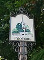 Eynsford Village Sign.jpg 3,132 × 4,290; 11.19 MB
-
 Eynsford Village, Kent, Ford and Bridge over the River Darent (14561239099).jpg 2,500 × 1,616; 2.47 MB
-
 Eynsford, Kent - geograph.org.uk - 516114.jpg 640 × 427; 91 KB
-

-
 Fallow farmland - geograph.org.uk - 3535381.jpg 640 × 382; 47 KB
-
 Farming in Britain during the Second World War TR941.jpg 2,553 × 1,772; 1.83 MB
-
 Farming in Britain during the Second World War TR942.jpg 800 × 555; 60 KB
-
 Farming in Britain during the Second World War TR943.jpg 800 × 556; 69 KB
-
 Farming in Britain during the Second World War TR944.jpg 800 × 555; 63 KB
-
 Farming in Britain during the Second World War TR946.jpg 800 × 554; 57 KB
-
 Farming in Britain during the Second World War TR947.jpg 800 × 556; 61 KB
-
 Farming in Britain during the Second World War TR948.jpg 800 × 555; 89 KB
-
 Farming in Britain during the Second World War TR949.jpg 800 × 554; 75 KB
-
 Farming in Britain during the Second World War TR950.jpg 800 × 552; 58 KB
-
 Farming in Britain during the Second World War TR951.jpg 800 × 558; 65 KB
-
 Farming in Britain during the Second World War TR954.jpg 800 × 556; 75 KB
-
 Farming in Britain during the Second World War TR956.jpg 800 × 558; 73 KB
-
 Farming in Britain during the Second World War TR957.jpg 800 × 558; 55 KB
-
 Farming in Britain during the Second World War TR958.jpg 800 × 560; 56 KB
-
 Farming in Britain during the Second World War TR959.jpg 800 × 558; 80 KB
-
 Farming in Britain during the Second World War TR960.jpg 800 × 559; 62 KB
-
 Farming in Britain during the Second World War TR961.jpg 800 × 559; 79 KB
-
 Farming in Britain during the Second World War TR962.jpg 558 × 800; 62 KB
-
 Farming in Britain during the Second World War TR964.jpg 800 × 559; 78 KB
-
 Farming in Britain during the Second World War TR965.jpg 800 × 555; 55 KB
-
 Farming in Britain during the Second World War TR966.jpg 800 × 554; 48 KB
-
 Farmland in the Darent Valley - geograph.org.uk - 3535392.jpg 640 × 430; 108 KB
-
 Farmland near the Darent - geograph.org.uk - 6387202.jpg 1,024 × 683; 532 KB
-
 Field alongside the Eynsford to Swanley railway line - geograph.org.uk - 5287681.jpg 4,000 × 3,000; 4.88 MB


_-_geograph.org.uk_-_2126538.jpg)


.jpg)


.jpg)


.jpg)


