Category:Guyhirn
Jump to navigation
Jump to search
English: Guyhirn is a small village near the town of Wisbech in Cambridgeshire, England. The village sits on the northern bank of the River Nene.
Nederlands: Guyhirn is een dorp in het Engelse graafschap Cambridgeshire. Het dorp ligt in het district Fenland en telt ca. 680 inwoners.

village in Cambridgeshire, United Kingdom  | |||||
| Upload media | |||||
| Instance of | |||||
|---|---|---|---|---|---|
| Location | Wisbech St Mary, Fenland, Cambridgeshire, East of England, England | ||||
 | |||||
Subcategories
This category has the following 6 subcategories, out of 6 total.
C
- Chapel of Ease, Guyhirn (5 F)
G
- Guyhirne railway station (3 F)
M
- St Mary Magdalene, Guyhirn (2 F)
P
- Guyhirn Primary School (2 F)
V
- Guyhirn Village Hall (2 F)
Media in category "Guyhirn"
The following 58 files are in this category, out of 58 total.
-
 A bend in the river - geograph.org.uk - 1736370.jpg 2,848 × 2,136; 3.07 MB
-
 A farm conversion on Mouth Lane - geograph.org.uk - 1550276.jpg 640 × 480; 102 KB
-
 A straight channel all the way to Peterborough - geograph.org.uk - 1736468.jpg 2,848 × 2,136; 2.89 MB
-

-
 Cabin on Adventurers' Land - geograph.org.uk - 613750.jpg 640 × 476; 87 KB
-
 Guyhirn - Below the water level of The Nene - geograph.org.uk - 1736426.jpg 2,848 × 2,136; 2.93 MB
-
 Guyhirn and The Nene - geograph.org.uk - 1736419.jpg 2,848 × 2,136; 3.14 MB
-
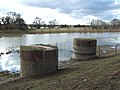
 Guyhirn railway bridge - All four columns - geograph.org.uk - 1736616.jpg 2,848 × 2,136; 3.05 MB
-
 Guyhirn railway bridge - Columns in the river - geograph.org.uk - 1736624.jpg 2,848 × 2,136; 3.13 MB
-
 Guyhirn railway bridge - Columns on the north bank - geograph.org.uk - 1736621.jpg 2,848 × 2,136; 3.05 MB
-
 Guyhirn Wash in full flood - geograph.org.uk - 1561734.jpg 640 × 422; 46 KB
-
 Horses across the River Nene - geograph.org.uk - 613383.jpg 640 × 472; 88 KB
-
 No train expected - geograph.org.uk - 623792.jpg 640 × 480; 73 KB
-
 North bank River Nene - geograph.org.uk - 296964.jpg 640 × 427; 81 KB
-

-
 Railway viaduct south of Guyhirn - geograph.org.uk - 296930.jpg 640 × 427; 53 KB
-
 Rings End Pumping Station - geograph.org.uk - 1151426.jpg 640 × 480; 73 KB
-
 The Nene Way passing through Guyhirn - geograph.org.uk - 1736225.jpg 2,848 × 2,136; 3.05 MB
-
 The Old School House South Brink. - geograph.org.uk - 1193216.jpg 640 × 480; 64 KB
-
 The Oliver Twist, Guyhirn - geograph.org.uk - 1736354.jpg 2,848 × 2,136; 2.92 MB
-
 Time Trail plaque on Mills Milepost - geograph.org.uk - 623802.jpg 640 × 480; 71 KB
-
 20ft Pump - geograph.org.uk - 1151441.jpg 640 × 480; 70 KB
-
 A47 Trunk Road - geograph.org.uk - 658136.jpg 640 × 479; 87 KB
-
 A47 west of Guyhirn - geograph.org.uk - 296931.jpg 640 × 427; 59 KB
-
 Approaching the A141 - geograph.org.uk - 296928.jpg 640 × 427; 52 KB
-
 Crossing near Dodd's Farm - geograph.org.uk - 477788.jpg 640 × 480; 175 KB
-
 Ditch and bridge beside Long Drove - geograph.org.uk - 613356.jpg 640 × 475; 69 KB
-

-
 Duncombes's Road - geograph.org.uk - 335120.jpg 640 × 480; 259 KB
-

-
 Frosted willows - geograph.org.uk - 296953.jpg 640 × 427; 109 KB
-
 Frosty view along Folly's Drove - geograph.org.uk - 296954.jpg 640 × 427; 80 KB
-
 Gall's Drove - geograph.org.uk - 177548.jpg 640 × 532; 79 KB
-
 Get back in line, number seven^ - geograph.org.uk - 613378.jpg 640 × 476; 50 KB
-
 Green field, black tree - geograph.org.uk - 623119.jpg 640 × 478; 58 KB
-
 Guyhirn Left Bank trig looking NE - geograph.org.uk - 67789.jpg 640 × 427; 82 KB
-
 Guyhirn Left Bank trig looking SW - geograph.org.uk - 67790.jpg 640 × 427; 77 KB
-

-
 Hobbs Lots Bridge. - geograph.org.uk - 232600.jpg 640 × 480; 89 KB
-
 House at Elm Tree Farm - geograph.org.uk - 296929.jpg 640 × 427; 85 KB
-
 Hundreds Farm - geograph.org.uk - 296934.jpg 640 × 427; 80 KB
-
 Just across in time^ - geograph.org.uk - 477790.jpg 640 × 480; 191 KB
-
 Mud, mud, dangerous mud^ - geograph.org.uk - 613745.jpg 640 × 477; 102 KB
-
 New track to Fort Farm - geograph.org.uk - 296935.jpg 640 × 427; 77 KB
-
 North of Towers Farm - geograph.org.uk - 296936.jpg 640 × 427; 51 KB
-
 Oliver Twist Country Inn, Guyhirn - geograph.org.uk - 613443.jpg 640 × 480; 60 KB
-

-
 Poplar House Farm - geograph.org.uk - 335111.jpg 640 × 480; 255 KB
-
 Remains of Guyhirn railway bridge - geograph.org.uk - 613504.jpg 640 × 480; 67 KB
-
 River Nene near Guyhirn - geograph.org.uk - 613412.jpg 640 × 480; 60 KB
-
 Sedge, fields and distant farms - geograph.org.uk - 623110.jpg 640 × 480; 96 KB
-
 Someone's hard work going up in smoke - geograph.org.uk - 576037.jpg 640 × 480; 62 KB
-
 Sussex Farm, Grandford Drove - geograph.org.uk - 573259.jpg 640 × 472; 74 KB
-
 The Chequers, Tholomas Drove - geograph.org.uk - 177551.jpg 619 × 608; 316 KB
-
 The Twenty Foot River, near Ring's End - geograph.org.uk - 335085.jpg 640 × 480; 237 KB
-

-
 Two barns near the River Nene - geograph.org.uk - 623125.jpg 640 × 477; 90 KB
-
 Winter flood at Moretons Leam - geograph.org.uk - 361376.jpg 640 × 480; 80 KB


