Category:Maps of Besançon
Jump to navigation
Jump to search
Wikimedia category | |||||
| Upload media | |||||
| Instance of | |||||
|---|---|---|---|---|---|
| Category combines topics | |||||
| Besançon | |||||
commune in Doubs, France      | |||||
| Pronunciation audio | |||||
| Instance of | |||||
| Patron saint | |||||
| Location |
| ||||
| Located in or next to body of water | |||||
| Head of government | |||||
| Significant event | |||||
| Population |
| ||||
| Area |
| ||||
| Elevation above sea level |
| ||||
| Follows |
| ||||
| Replaces | |||||
| official website | |||||
 | |||||
Subcategories
This category has the following 8 subcategories, out of 8 total.
A
- Attraction maps of Besançon (2 F)
H
M
- Maps of districts of Besançon (28 F)
- Maps of Planoise (36 F)
O
- OpenStreetMap maps of Besançon (17 F)
T
- Topographic maps of Besançon (5 F)
- Transport maps of Besançon (3 F)
Media in category "Maps of Besançon"
The following 20 files are in this category, out of 20 total.
-
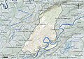 25056-Besançon-Hydro.jpeg 5,846 × 4,133; 3.86 MB
-
 25056-Besançon-Sols.png 3,270 × 2,598; 6.28 MB
-
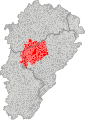 Aire urbaine de Besançon.svg 250 × 351; 674 KB
-
 Besancon dot.png 1,804 × 1,689; 164 KB
-
 Besancon indicateur fournier 1913-1914 plan carte.jpg 4,560 × 3,040; 6.84 MB
-
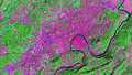
 Besancon SPOT 1139.jpg 500 × 500; 121 KB
-
 Besançon fortifications.jpg 2,308 × 1,770; 394 KB
-
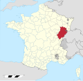
 Besançon location map.svg 877 × 986; 2.99 MB
-
 Besançon NASA.png 1,438 × 818; 2.13 MB
-
 Diocèse Besançon 1789.svg 2,000 × 1,922; 801 KB
-
 Map Besançon.jpg 1,786 × 2,179; 3.13 MB
-
 Map commune FR insee code 25056.png 756 × 605; 158 KB
-
 Plan fond des quartiers de Besançon.png 672 × 1,045; 92 KB
-
 Province de Besançon 1789.svg 2,000 × 1,922; 787 KB
-
 Quartiers besançon.jpg 552 × 721; 126 KB
-
 Quartiers Besançon.pdf 1,239 × 1,752; 234 KB
-
 Quartiers Besançon.svg 542 × 798; 253 KB
-
 Territoire de la ville libre impériale de Besançon en 1290.jpg 1,733 × 2,103; 867 KB
-
 Vesontio plan.png 923 × 778; 1.07 MB
-
 Wikipedia takes Besançon in OSM.png 635 × 634; 393 KB


