Category:Moonzie
Jump to navigation
Jump to search
Scottish parish in Fife, Scotland, UK   | |||||
| Upload media | |||||
| Instance of | |||||
|---|---|---|---|---|---|
| Part of |
| ||||
| Location |
| ||||
| Population |
| ||||
 | |||||
Media in category "Moonzie"
The following 22 files are in this category, out of 22 total.
-
 A913 junction - geograph.org.uk - 4706546.jpg 4,048 × 2,897; 1.75 MB
-
 Cattle track - geograph.org.uk - 169901.jpg 640 × 480; 69 KB
-
 Colluthie Hill - geograph.org.uk - 6706030.jpg 1,024 × 683; 463 KB
-
 Farmland by Moonzie - geograph.org.uk - 132267.jpg 640 × 480; 118 KB
-
 Farmland by Muirside - geograph.org.uk - 132276.jpg 640 × 480; 115 KB
-
 Field near Easter Kinsleith - geograph.org.uk - 4424901.jpg 640 × 480; 410 KB
-
 Hilltop, Moonzie - geograph.org.uk - 6706022.jpg 1,024 × 683; 482 KB
-
 Lordscairnie Castle - geograph.org.uk - 4833182.jpg 640 × 450; 28 KB
-
 Lordscairnie Farm - geograph.org.uk - 4829197.jpg 640 × 480; 54 KB
-
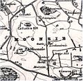 Moonzie map 1908.jpg 1,050 × 1,028; 751 KB
-
 Moonzie Parish Church - geograph.org.uk - 6270238.jpg 640 × 480; 75 KB
-
 Moonzie Parish Church - geograph.org.uk - 6302549.jpg 1,024 × 768; 256 KB
-
 Moonzie, Kirkyard - geograph.org.uk - 6706027.jpg 1,024 × 683; 460 KB
-
 Mount Hill - geograph.org.uk - 2404472.jpg 1,280 × 960; 164 KB
-
 Murdochcairnie Hill - geograph.org.uk - 4829334.jpg 640 × 480; 41 KB
-
 Newington Farm - geograph.org.uk - 3562560.jpg 2,048 × 1,536; 1.58 MB
-
 Pitbladdo Farm - geograph.org.uk - 129452.jpg 640 × 480; 89 KB
-
 Potato field, Muirside - geograph.org.uk - 1434301.jpg 640 × 480; 125 KB
-
 Ruined castle - geograph.org.uk - 3562572.jpg 2,048 × 1,536; 1.57 MB
-
 Scene near Luthrie - geograph.org.uk - 3041796.jpg 1,111 × 833; 212 KB
-
 The A913 - geograph.org.uk - 2404474.jpg 1,280 × 960; 289 KB
-
 Wind Turbine at West Myre - geograph.org.uk - 4706619.jpg 3,385 × 4,515; 2.32 MB


