Category:Ocean currents
Vai alla navigazione
Vai alla ricerca

massa di acqua marina in movimento rispetto all'acqua che la circonda   | |||||
| Carica un file multimediale | |||||
| Audio della pronuncia | |||||
|---|---|---|---|---|---|
| Sottoclasse di |
| ||||
| Parte di | |||||
| |||||
Sottocategorie
Questa categoria contiene le 13 sottocategorie indicate di seguito, su un totale di 13.
File nella categoria "Ocean currents"
Questa categoria contiene 81 file, indicati di seguito, su un totale di 81.
-
 2007 floater-release hg.jpg 1 578 × 2 322; 681 KB
-
 A56 SouthGeorgia vir 2016153 Iceberg lrg.jpg 4 272 × 3 336; 4,62 MB
-
 Amoc-index.svg 1 000 × 500; 129 KB
-
 ATL-LLWBCs-labelled.jpg 2 212 × 2 226; 290 KB
-
 BrnBldRcm8.jpg 612 × 650; 77 KB
-
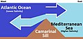 Camarinal Sill Water Mixing (Simplified).jpg 536 × 256; 34 KB
-
 Canaryislands tmo 2013166 lrg(2).jpg 2 600 × 2 000; 1 006 KB
-
 Carte generale des principaux courants marin en 1910.jpg 859 × 571; 103 KB
-
Circulation of Ocean Currents Around the Western Antarctic Ice Shelves.ogv 30 s, 1 280 × 720; 71,25 MB
-
 Coastal currents along the Atlantic coast of the United States (1942) (20035163774).jpg 3 634 × 1 586; 800 KB
-
 Coastal currents along the Atlantic coast of the United States (1942) (20035207064).jpg 4 056 × 1 882; 984 KB
-
 Coastal currents along the Atlantic coast of the United States (1942) (20035219664).jpg 2 862 × 1 532; 563 KB
-
 Coastal currents along the Atlantic coast of the United States (1942) (20036909893).jpg 2 960 × 1 550; 682 KB
-
 Coastal currents along the Atlantic coast of the United States (1942) (20469786660).jpg 3 810 × 1 802; 780 KB
-
 Coastal currents along the Atlantic coast of the United States (1942) (20469786728).jpg 3 640 × 1 602; 783 KB
-
 Coastal currents along the Atlantic coast of the United States (1942) (20470999019).jpg 3 634 × 1 636; 828 KB
-
 Coastal currents along the Atlantic coast of the United States (1942) (20664463331).jpg 3 548 × 1 678; 689 KB
-
 Columbia Glacier (Alaska) by Sentinel-2 cropped.jpg 5 550 × 5 880; 9,88 MB
-
 Corriente de Benguela-png.png 1 366 × 625; 1,45 MB
-
 Corriente de California-Feb-13-2013-20.jpg 640 × 455; 77 KB
-
 Corriente de las Canarias y tormenta de arena 1.jpg 5 428 × 6 424; 3,1 MB
-

-
 Dibujo Corrientes geostróficas.png 1 844 × 1 454; 88 KB
-
 Dibujo Corrientes geostróficas.svg 744 × 1 052; 7 KB
-
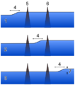
 Diurnal Flow over a Ridge - NOAA-PMEL.gif 295 × 357; 4,2 MB
-
 Downwelling NADW.svg 798 × 661; 48 KB
-
 East Australian Current.jpg 2 060 × 2 900; 1,75 MB
-

-
 Ekman meter.jpg 700 × 523; 81 KB
-
 Enrgy1.jpg 490 × 276; 31 KB
-
 Esquema corrents equatorials.png 922 × 1 026; 105 KB
-
 Expl2360 - Flickr - NOAA Photo Library.jpg 3 888 × 2 592; 1,28 MB
-
 Famous rock - panoramio.jpg 4 160 × 3 120; 2,25 MB
-
 FMIB 36682 Courants Marins de l'Ete Boreal.jpeg 1 528 × 1 097; 491 KB
-
 FMIB 36712 Courant Polaire Arctique.jpeg 1 498 × 891; 368 KB
-
 FMIB 36720 Courants Marins de l'Hiver Boreal.jpeg 1 528 × 1 097; 482 KB
-
 FMIB 53209 Drague a courant.jpeg 160 × 424; 34 KB
-
 FMIB 53210 Mesureur de courant d'Ekman.jpeg 188 × 570; 42 KB
-
 Foggy Peruvian Valleys.jpg 2 899 × 3 306; 10,05 MB
-
 Geostrophic current 1 NT.PNG 480 × 480; 37 KB
-
 Geostrophic current 2 NT.PNG 450 × 510; 33 KB
-
 Globpop.gif 1 341 × 730; 465 KB
-
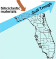 Gulf Trough dipiction.png 375 × 400; 87 KB
-
 Ind-LLWBCs-labelled.jpg 2 188 × 2 224; 356 KB
-
 Islas de Cabo Verde.jpg 5 014 × 3 598; 3,29 MB
-
 Katrina vs sea surface height.jpg 1 194 × 917; 219 KB
-
 Leaking path.jpg 800 × 600; 31 KB
-
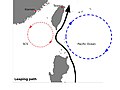 Leaping path.jpg 800 × 600; 30 KB
-
 Looping path.jpg 800 × 600; 34 KB
-
 Meandros en el océano.jpg 427 × 268; 40 KB
-
 Naruto Whirlpools taken 4-21-2008.jpg 3 456 × 2 304; 6,61 MB
-
 New-5c-20visual 39980594.png 1 600 × 1 092; 473 KB
-
 No- Ekmanspiralen.jpg 595 × 600; 160 KB
-
 Nordatlantik.jpg 4 555 × 3 974; 7,33 MB
-
 North Atlantic Temp Section 30N.gif 649 × 560; 21 KB
-
 North equatorial currents.jpg 720 × 540; 40 KB
-
 Numerical simulations of the response of intense ocean currents to atmospheric forcing. (IA numericalsimulat00adam).pdf 1 189 × 1 550, 112 pagine; 5,36 MB
-
 Ocean bottom (contour) current.webp 2 135 × 1 174; 824 KB
-
Ocean flows at surface and 2000 meters below sea level.webm 1 min 14 s, 1 920 × 1 080; 81,29 MB
-
 Oceanmotion driftmodel-Jan.png 700 × 420; 34 KB
-
 Oceanmotion driftmodel-Mar.png 700 × 420; 33 KB
-
 Oyashio SST 11mai.png 717 × 773; 38 KB
-
 Oyashio SST.png 717 × 773; 53 KB
-
 Pacific NEC.png 1 008 × 720; 150 KB
-
Perpetual Ocean.ogv 3 min 2 s, 960 × 540; 28,76 MB
-
 Recording Current Meter.jpg 507 × 1 844; 349 KB
-
 S2004341153052.L2 HCHL.MalvinasCurrent.jpg 2 711 × 3 117; 1,76 MB
-
 SeaSurfaceTopography Atlantic.gif 534 × 671; 38 KB
-
 South Atlantic Ocean currents 1943 for colorblind users.png 999 × 647; 913 KB
-
 Stiller ozean.jpg 4 555 × 3 956; 7,07 MB
-
Streamfunction 0.5x0.5 veros 275 years.webm 16 s, 1 024 × 688; 11,6 MB
-
 Termohalinni vymenik.gif 507 × 297; 5 KB
-
 The California Current System (25198382355).jpg 8 000 × 8 000; 16,96 MB
-

-

-

-
 The seasonality of the NEC in Atlantic.png 864 × 720; 105 KB
-
 The seasonality of the NEC in Indian Ocean.png 864 × 1 080; 222 KB
-
Thermohaline conveyor belt (NASA).webm 1 min 23 s, 1 280 × 720; 21,9 MB
-
 Von Karman Vortex Baja California Isla Guadalupe 1.jpg 2 239 × 2 008; 727 KB
-
 Wind and wave forcing of longshore currents across a barred beach. (IA windwaveforcingo00whit).pdf 1 187 × 1 566, 238 pagine; 12,8 MB


.jpg)
.jpg)

_(20035163774).jpg)
_(20035207064).jpg)
_(20035219664).jpg)
_(20036909893).jpg)
_(20469786660).jpg)
_(20469786728).jpg)
_(20470999019).jpg)
_(20664463331).jpg)
_by_Sentinel-2_cropped.jpg)


_current.webp)


.jpg)
_and_El_Nino_(1997)_years.png)
_and_El_Nino_(1997)_years.png)
_and_El_Nino_(1997)_years.png)


