Category:Salish Sea
Salti al navigilo
Salti al serĉilo
Deutsch: Salische See
· English: Salish Sea
· Esperanto: Saliŝa maro
· Français : Mer des Salish
· Македонски: Салишко Море
· Русский: Море Селиш
· marginal sea of the Pacific Ocean in the Canadian province of British Columbia and the U.S. state of Washington  | |||||
| Alŝuti plurmedion | |||||
| Estas |
| ||||
|---|---|---|---|---|---|
| Parto de | |||||
| Nomita laŭ | |||||
| Loko |
| ||||
| Havas parton |
| ||||
| Basena lando | |||||
 | |||||
Subkategorioj
Ĉi tiu kategorio havas la 25 jenajn subkategoriojn, el 25 entute.
B
- Bellingham Bay (46 D)
C
- Chuckanut Bay (6 D)
D
G
H
- Homfray Channel (2 D)
J
L
P
- Port Townsend Ship Canal (1 D)
R
S
- Scow Bay, Washington (1 D)
- Shaw Centre for the Salish Sea (61 D)
- Sutil Channel (4 D)
Dosieroj en kategorio “Salish Sea”
La jenaj 56 dosieroj estas en ĉi tiu kategorio, el 56 entute.
-
 2014 anti climate change rally at Peace Arch Park (15140738690).jpg 2 048 × 1 536; 1,94 MB
-
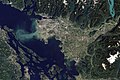
 2018-04-17 Nanaimo (39722482280).jpg 1 680 × 1 121; 898 KB
-
-

-
 CMA CGM Centaurus - Washington, USA.jpg 2 192 × 1 754; 820 KB
-
 Cortes Island sunrise.jpg 6 000 × 4 000; 14,12 MB
-
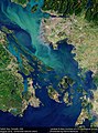
 Earth from Space Phytoplankton Bloom, Salish Sea (29103007263).jpg 7 036 × 8 674; 39,03 MB
-
 Esquimalt Lagoon from Hatley Castle.jpg 6 000 × 4 000; 13,7 MB
-
 First View North Through Dodd Narrows, B.C.jpg 1 600 × 1 057; 402 KB
-
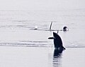
 Fishing Boat, Satellite Channel.jpg 1 600 × 1 305; 472 KB
-
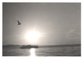
 Heading home1.jpg 3 500 × 2 798; 2,23 MB
-
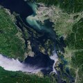
 ISS-62 Strait of Juan de Fuca and Salish Sea (16x9 crop).jpg 5 568 × 3 132; 8,84 MB
-
 ISS-62 Strait of Juan de Fuca and Salish Sea.jpg 5 568 × 3 712; 2,51 MB
-
 Mew gulls ride the waves (50900306121).jpg 3 014 × 1 446; 6,61 MB
-
 Mouth of Douglas Creek at Low Tide.jpg 2 916 × 2 187; 3,95 MB
-
-
 Northern side of Nodule Point.JPG 3 872 × 2 592; 5,3 MB
-
 Olympic Peninsula by Sentinel-2, 2018-09-28 (small version).jpg 12 135 × 9 808; 137,52 MB
-
 Olympic Peninsula with Puget Sound by Sentinel-2, 2018-09-28 (big version).jpg 24 271 × 21 933; 632,77 MB
-

-
 PLUTO MOON docked at Cherry Point.jpg 4 320 × 3 240; 2,62 MB
-
 PNW-straits.jpg 336 × 396; 128 KB
-
 Port Townsend and Admiralty Inlet.jpg 3 872 × 2 592; 5,17 MB
-
 Powell River from Savary Island.jpg 1 024 × 768; 158 KB
-
 Powell River Jetty.jpg 1 024 × 768; 231 KB
-
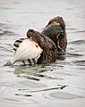 River otters and their catch - Flickr - marneejill.jpg 1 281 × 1 616; 715 KB
-
 Salish Sea (212392119).jpeg 2 048 × 1 463; 1,24 MB
-
 Salish Sea (36753380).jpg 1 798 × 727; 737 KB
-
 Salish Sea (MODIS 2021-06-03).jpg 2 225 × 1 807; 535 KB
-
 Salish Sea 432 751enh pan crop 15 (31249896256).jpg 7 170 × 9 659; 39,09 MB
-
 Salish Sea 432 pan crop 15 (30464435484).jpg 7 170 × 9 659; 41,92 MB
-
 Salish Sea 751 pan crop 15 (31171231061).jpg 7 170 × 9 659; 37,03 MB
-
 SalishSea.A2003154.1930.250m.jpg 1 200 × 1 660; 369 KB
-
-
 San Juan Islands National Monument poster- Sentinels of the Salish Sea (15812525229).jpg 5 400 × 7 200; 5,9 MB
-
 San Juan Islands NM in Washington (19254852552).jpg 1 078 × 851; 632 KB
-
 Sansum Narrows, December 2007.jpg 3 024 × 1 998; 1,56 MB
-
 Sea urchin embryo.jpg 1 430 × 1 096; 703 KB
-

-
-
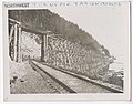
 SHIP PASSES SAN JUAN ISLAND - NARA - 545277.jpg 2 023 × 3 000; 1,15 MB
-
 SidneyClassBCFerry-Oct28-2009.png 2 469 × 1 751; 7,27 MB
-

-
 Strait of Juan de Fuca by Sentinel-2, 2018-09-28 (small version).jpg 10 400 × 4 800; 55,59 MB
-
 Swartz Bay
史 瓦 兹灣 - panoramio.jpg 1 976 × 1 235; 1,05 MB
-
 The Big Muddy, Western Edition (6987590721).jpg 5 559 × 3 706; 5,91 MB
-

-
 Vancouver, Canada ESA23172710.jpeg 8 094 × 8 094; 24,8 MB
-
 Vancouver, Canada ESA23172710.tiff 16 187 × 16 187; 550,28 MB
-
 VancouverIsland.A2003154.1930.250m.jpg 2 600 × 3 400; 1,28 MB
-
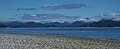
 View across Saratoga Passage.jpg 4 032 × 3 024; 10,18 MB
-
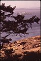
 View from Mount Tolmie 1.jpg 4 000 × 3 000; 7,89 MB
-
 View from Mount Tolmie 2.jpg 4 000 × 3 000; 8,12 MB
-
 View from Mount Tolmie 5.jpg 4 000 × 3 000; 7,21 MB
-
 View from Mount Tolmie 6.jpg 4 000 × 3 000; 9,48 MB
-
 WestsoundSailing2021.jpg 3 915 × 1 903; 797 KB
.jpg)
.jpg)
.jpg)
.jpg)


.jpg)


.jpg)

.jpg)

.jpg)

.jpg)
.jpg)
.jpg)


.jpeg)
.jpg)
.jpg)
.jpg)
.jpg)

.jpg)
.jpg)


.jpg)
.jpg)


.jpg)
.jpg)

.jpg)


.jpg)