Hoher Ifen
Jump to navigation
Jump to search
mountain of the Allgäu Alps at the border of Vorarlberg, Austria, and Bavaria, Germany | |||||
| Upload media | |||||
| Instance of | |||||
|---|---|---|---|---|---|
| Located in protected area | |||||
| Location |
| ||||
| Has part(s) |
| ||||
| Mountain range | |||||
| Topographic prominence |
| ||||
| Topographic isolation |
| ||||
| Elevation above sea level |
| ||||
 | |||||
-
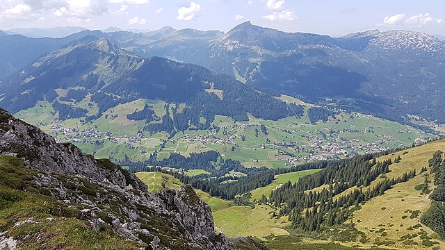
A view from mountain Walmendingerhorn
-
Hoher Ifen from South,
-
from West,
-
from East,
-
Schwarzwasseralpe und Schwarzwasserhütte, Hoher Ifen
-
Ausblick auf "Gottesacker" und die Gottesackerwände
-
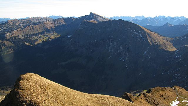
Hoher Ifen and Hählekopf from West (from mountain Diedamskopf)
Foto im Oktober, Dunkler Talgrund im Norden der Felswände -
zum Vergleich ein Foto im August
-
Foto mit dem Sevischrofen (von Schönenbachvorsäss)
-
Sevischrofen, Hoher Ifen und gebänderte Nordwände zum Hählekopf (from West)
-
Foto vom Hählekopf, dem Berlingersköpfle (Pellingerköpfle) und der Ifersgunthöhe (Südseite mit sonniger Alm),
-
Hählekopf und Hoher Ifen über dem Schwarzwassertal,
-
Alpe Melköde im Schwarzwassertal,
-
Ifenmauer.
-
Valley Kleinwalsertal, Hirschegg, Walmendingerhorn, Hoher Ifen, photo
-
vom Hahnenköpfle aufgenommenes 360-Grad-Panorama oberhalb der Bergbahn Ifenbahn mit Gottesacker und Gipfel des Hohen Ifen (Nordseite)
-
Ifenbahn construction works 2017
-
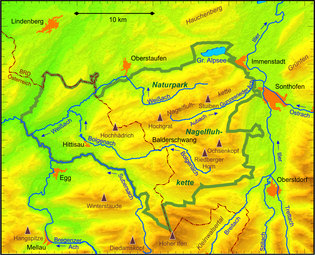
Karte des Naturparks Nagelfluhkette mit dem Hohen Ifen, dem Fluss Breitach, Oberstdorf und dem Riedberger Horn.
-
eine alte Karte mit "Hocheneifer", "Schöfeschrofen", "Mölkboden" und "Iffer Alm"
-
Nordseite des Ifenmassivs mit Unteren und Oberen Gottesackerwänden, Toreck und Torkopf
(photo from North, Gottesackerwände) -
Untere and Obere Gottesackerwände from East
-
mit Schnee in den Bergen (von der ISS gesehen), Kleinwalsertal and the region.


