Mayak
Jump to navigation
Jump to search
Overview Images and Maps
[edit]-
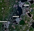
Satellite image of the Mayak nuclear facility, Ozyorsk, different lakes, and the South Urals NPP
-
Development of the Techa cascade of reservoirs between 1949 and 1964
-
Map of the East Urals Radioactive Trace (EURT): area contaminated by the Kyshtym disaster
-
Large-scale map of the East Urals Radioactive Trace (EURT): area contaminated by the Kyshtym disaster
-
Satellite image of the cities Kasli, Ozyorsk and Kyshtym in Chelyabinsk Oblast near the complex of Mayak
Mayak
[edit]-
Fence of the closed city Ozyorsk
-
Approaching the closed city Ozyorsk
-
Memorial to the Kyshtym accident
-
Eastern Urals Radioactive Track (EURT) warning sign
-
Eastern Urals State Reserve (russ.: VUGZ), established 1966 after the Kyshtym accident
Fissile Material Storage Facility (FMSF)
[edit]-
FMSF construction site: Administration building
-
FMSF construction site: Ventilation center and ventilation tunnel
-
FMSF construction site: Storage facility
-
FMSF construction site: Administration building and security building
River Techa
[edit]-
Cows and a radiation warning sign at the river Techa
-
Radiation warning sign and barbed wire at the river Techa


