Mazartag[1] (Uyghur: مازارتاغ,[2] Мазартағ, Mazartagh; Chinese:
| Mazartag | |
|---|---|
 Mazartag (area not covered by snow in the snow-covered part of the desert) | |
| Highest point | |
| Elevation | 1,635 m (5,364 ft) |
| Dimensions | |
| Length | 145 km (90 mi) |
| Width | 3 km (1.9 mi) |
| Naming | |
| Native name | مازارتاغ (Uyghur) |
| Geography | |
 Mazartag | |
| Country | China |
| Region | Xinjiang |
| District | Karakax County (Moyu), Hotan Prefecture |
| Range coordinates | 38°38′N 80°28′E / 38.64°N 80.47°E |
| Geology | |
| Type of rock | Composed mainly of sandstones |
Historical maps
editHistorical English-language maps including Mazartag:
-
 Map including Mazartag (ATC, 1971)
 -
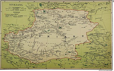 Map including Mazartag (labeled as Masartag) (1917)
 -
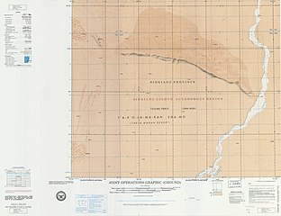
![Map including Mazartag (USATC, 1971)[a]](https://upload.wikimedia.org/wikipedia/commons/thumb/0/00/Txu-oclc-6654394-nj-44-3rd-ed.jpg/220px-Txu-oclc-6654394-nj-44-3rd-ed.jpg)
-
![From the Operational Navigation Chart; map including Mazartag (DMA, 1980)[b]](https://upload.wikimedia.org/wikipedia/commons/thumb/f/fb/Operational_Navigation_Chart_G-7%2C_6th_edition.jpg/331px-Operational_Navigation_Chart_G-7%2C_6th_edition.jpg)
-
![Map including Mazartag (DMA, 1984)[c]](https://upload.wikimedia.org/wikipedia/commons/thumb/a/a1/Txu-pclmaps-oclc-22834566_g-7a.jpg/335px-Txu-pclmaps-oclc-22834566_g-7a.jpg)

_p61_PLATE19._SINKIANG_(14597194848).jpg)
![Map including Mazartag (USATC, 1971)[a]](https://trans.hiragana.jp/ruby/https://en.m.wikipedia.org/wiki/File:Txu-oclc-6654394-nj-44-3rd-ed.jpg)
![From the Operational Navigation Chart; map including Mazartag (DMA, 1980)[b]](https://trans.hiragana.jp/ruby/https://en.m.wikipedia.org/wiki/File:Operational_Navigation_Chart_G-7,_6th_edition.jpg)
![Map including Mazartag (DMA, 1984)[c]](https://trans.hiragana.jp/ruby/https://en.m.wikipedia.org/wiki/File:Txu-pclmaps-oclc-22834566_g-7a.jpg)
See also
editNotes
editReferences
edit- ^ Mikhail Platonovich Petrov; Guy S. Alitto (18 December 2019). "Takla Makan Desert". Encyclopædia Britannica. Retrieved 25 January 2020.
The arc-shaped Mazartag Mountains, located between the Hotan and Yarkand (Ye'erqiang) river valleys, arch toward the southwest. Some 90 miles (145 km) long and 2 to 3 miles (3 to 5 km) wide, and with a maximum height of 5,363 feet (1,635 metres), they rise an average of only 1,000 to 1,150 feet (300 to 350 metres) above the surface of the sandy plain.
- ^ مازار تاغ (Variant Non-Roman Script - VS) at GEOnet Names Server, United States National Geospatial-Intelligence Agency
- ^ Мазартаг (in Russian). Great Soviet Encyclopedia. Retrieved 21 June 2020.