
Crianlarich: Difference between revisions
Iridescent 2 (talk | contribs) m Cleanup and typo fixing, typo(s) fixed: near by → nearby, long distance → long-distance |
→External links: remove link not about article subject |
||
| (9 intermediate revisions by 7 users not shown) | |||
| Line 1: | Line 1: | ||
{{Use dmy dates|date=October 2019}} |
{{Use dmy dates|date=October 2019}} |
||
{{Infobox UK place |
{{Infobox UK place |
||
|country = Scotland |
| country = Scotland |
||
|official_name= Crianlarich |
| official_name = Crianlarich |
||
|gaelic_name= A' Chrìon Làraich |
| gaelic_name = A' Chrìon Làraich |
||
|scots_name= Crianlarich |
| scots_name = Crianlarich |
||
|static_image_name= Crianlarich church.jpg |
| static_image_name = Crianlarich church.jpg |
||
|static_image_caption= Church of Scotland, Crianlarich |
| static_image_caption = Church of Scotland, Crianlarich |
||
|population = 185 |
| population = 185 |
||
|population_ref = ([[United Kingdom Census 2001|2001 Census]]) |
| population_ref = ([[United Kingdom Census 2001|2001 Census]]) |
||
|os_grid_reference= NN385062 |
| os_grid_reference = NN385062 |
||
|coordinates = {{coord|56.394|-4.617|display=inline,title}} |
| coordinates = {{coord|56.394|-4.617|display=inline,title}} |
||
|civil_parish= [[Killin]] |
| civil_parish = [[Killin]] |
||
|unitary_scotland= [[Stirling (council area)|Stirling]] |
| unitary_scotland = [[Stirling (council area)|Stirling]] |
||
|lieutenancy_scotland= [[Stirling and Falkirk]] |
| lieutenancy_scotland = [[Stirling and Falkirk]] |
||
|constituency_westminster= [[Stirling (UK Parliament constituency)|Stirling]] |
| constituency_westminster = [[Stirling (UK Parliament constituency)|Stirling]] |
||
|constituency_scottish_parliament= [[Stirling (Scottish Parliament constituency)|Stirling]] |
| constituency_scottish_parliament = [[Stirling (Scottish Parliament constituency)|Stirling]] |
||
|post_town= CRIANLARICH |
| post_town = CRIANLARICH |
||
|postcode_district = FK20 |
| postcode_district = FK20 |
||
|postcode_area= FK |
| postcode_area = FK |
||
|dial_code= 01838 |
| dial_code = 01838 |
||
|edinburgh_distance_mi = 63 |
| edinburgh_distance_mi = 63 |
||
|london_distance_mi = 384 |
| london_distance_mi = 384 |
||
}} |
}} |
||
| Line 27: | Line 27: | ||
==Etymology== |
==Etymology== |
||
The name ''Crianlarich'' is derived probably from the [[Scottish Gaelic|Gaelic]] meaning either "the wasted site" or "the aspen site" (c.f. Gaelic ''critheann'', "aspen").<ref name="lltr">{{cite web |title=Settlements - Gaelic - what's in the name |url=https://www.lochlomond-trossachs.org/discover-the-park/our-heritage-culture/our-gaelic-culture/settlements/ |website=Loch Lomond and the Trossachs |accessdate=29 July 2019}}</ref> |
The name ''Crianlarich'' is derived probably from the [[Scottish Gaelic|Gaelic]] meaning either "the wasted site" or "the [[aspen]] site" (c.f. Gaelic ''critheann'', "aspen").<ref name="lltr">{{cite web |title=Settlements - Gaelic - what's in the name |url=https://www.lochlomond-trossachs.org/discover-the-park/our-heritage-culture/our-gaelic-culture/settlements/ |website=Loch Lomond and the Trossachs |accessdate=29 July 2019}}</ref> |
||
==Situation== |
==Situation== |
||
The village lies in the |
The village lies in the valley of [[Strath Fillan]] at the north western extent of the [[Trossachs]], in the shadow of several [[Munro]] peaks, notably [[Ben More (Crianlarich)|Ben More]], but also [[Stob Binnein]] and [[Cruach Ardrain]]. Thus Crianlarich is very popular with hillwalkers. Also the village lies {{convert|40|mi|km|round=5|abbr=off}} along the long-distance footpath, the [[West Highland Way]]. |
||
Its location makes Crianlarich a popular stop for tourists and there are a variety of types of overnight accommodation including guesthouses, B&Bs a [[SYHA]] Youth Hostel and a [[Best Western]] hotel. |
Its location makes Crianlarich a popular stop for tourists and there are a variety of types of overnight accommodation including guesthouses, B&Bs a [[SYHA]] Youth Hostel and a [[Best Western]] hotel. |
||
| Line 37: | Line 37: | ||
Crianlarich has been a major crossroads for north- and westbound journeys in Scotland since [[Middle Ages|medieval]] times. |
Crianlarich has been a major crossroads for north- and westbound journeys in Scotland since [[Middle Ages|medieval]] times. |
||
In the 1750s, two [[Old military roads of Scotland|military roads]] met in the village; in the 19th century, it became a railway junction on what is now the [[West Highland Line]]; in the 20th century it became the meeting point of the major [[A82 road|A82]] and [[A85 road|A85]] roads. As such, it is designated a [[primary destination]] in Scotland, signposted from as far as [[Glasgow]] in the south, [[Perth, Scotland|Perth]] in the east, [[Oban]] in the west and [[Fort William, Scotland|Fort William]] in the north. In the 1960s there was even a direction sign for Crianlarich at Swiss Cottage at Camden in London. Since 2016 the A82 by-passes the centre of the village to avoid the low railway bridge |
In the 1750s, two [[Old military roads of Scotland|military roads]] met in the village; in the 19th century, it became a railway junction on what is now the [[West Highland Line]]; in the 20th century it became the meeting point of the major [[A82 road|A82]] and [[A85 road|A85]] roads. As such, it is designated a [[primary destination]] in Scotland, signposted from as far as [[Glasgow]] in the south, [[Perth, Scotland|Perth]] in the east, [[Oban]] in the west and [[Fort William, Scotland|Fort William]] in the north. In the 1960s there was even a direction sign for Crianlarich at Swiss Cottage at Camden in London. Since 2016 the A82 by-passes the centre of the village to avoid the low railway bridge. |
||
The village is served by [[Crianlarich railway station]] located on the [[West Highland Line]]. The routes to [[Fort William, Highland|Fort William]]/[[Mallaig]] and [[Oban]] diverge after this station. Access to the platform is via a flight of stairs from a subway that runs underneath the tracks, from the car park which is slightly lower than the station itself. |
The village is served by [[Crianlarich railway station]] located on the [[West Highland Line]]. The routes to [[Fort William, Highland|Fort William]]/[[Mallaig]] and [[Oban]] diverge after this station. Access to the platform is via a flight of stairs from a subway that runs underneath the tracks, from the car park which is slightly lower than the station itself. |
||
It is also served by a Scottish Citylink coach service up to hourly from Glasgow going on about every two hours to either Oban or Fort William. |
|||
In 2001, the village had a population of 185.<ref>{{cite web|url=http://www.stirling.gov.uk/stirling_at_a_glance.pdf|title=Stirling at a Glance: 2001 Edition|publisher=Stirling Council|archivedate=9 November 2006|url-status=dead|archiveurl=https://web.archive.org/web/20061109110425/http://www.stirling.gov.uk/stirling_at_a_glance.pdf|accessdate=10 December 2014}}</ref> |
In 2001, the village had a population of 185.<ref>{{cite web|url=http://www.stirling.gov.uk/stirling_at_a_glance.pdf|title=Stirling at a Glance: 2001 Edition|publisher=Stirling Council|archivedate=9 November 2006|url-status=dead|archiveurl=https://web.archive.org/web/20061109110425/http://www.stirling.gov.uk/stirling_at_a_glance.pdf|accessdate=10 December 2014}}</ref> |
||
| Line 62: | Line 64: | ||
{{Wikivoyage|Crianlarich}} |
{{Wikivoyage|Crianlarich}} |
||
*[http://www.crianlarich.org.uk Crianlarich local community website] |
*[http://www.crianlarich.org.uk Crianlarich local community website] |
||
*Crianlarich is in the [[Church of Scotland]] [http://www.strathfillanparish.org.uk/ Parish of Strathfillan] |
|||
{{Stirling Towns & Villages}} |
{{Stirling Towns & Villages}} |
||
{{authority control}} |
{{authority control}} |
||
Latest revision as of 15:28, 21 May 2024
Crianlarich
| |
|---|---|
 Church of Scotland, Crianlarich | |
 Crianlarich Location within the Stirling council area | |
| Population | 185 (2001 Census) |
| OS grid reference | NN385062 |
| • Edinburgh | 63 mi (101 km) |
| • London | 384 mi (618 km) |
| Civil parish | |
| Council area | |
| Lieutenancy area | |
| Country | Scotland |
| Sovereign state | United Kingdom |
| Post town | CRIANLARICH |
| Postcode district | FK20 |
| Dialling code | 01838 |
| Police | Scotland |
| Fire | Scottish |
| Ambulance | Scottish |
| UK Parliament | |
| Scottish Parliament | |
Crianlarich (/ˌkriːənˈlærɪx/ ; Scottish Gaelic: A' Chrìon Làraich) is a village in Stirling council area and in the registration county of Perthshire, Scotland, around 6 miles (10 km) north-east of the head of Loch Lomond. The village bills itself as "the gateway to the Highlands".[citation needed]
Etymology
[edit]The name Crianlarich is derived probably from the Gaelic meaning either "the wasted site" or "the aspen site" (c.f. Gaelic critheann, "aspen").[1]
Situation
[edit]The village lies in the valley of Strath Fillan at the north western extent of the Trossachs, in the shadow of several Munro peaks, notably Ben More, but also Stob Binnein and Cruach Ardrain. Thus Crianlarich is very popular with hillwalkers. Also the village lies 40 miles (65 kilometres) along the long-distance footpath, the West Highland Way.
Its location makes Crianlarich a popular stop for tourists and there are a variety of types of overnight accommodation including guesthouses, B&Bs a SYHA Youth Hostel and a Best Western hotel.
Transport connections
[edit]Crianlarich has been a major crossroads for north- and westbound journeys in Scotland since medieval times.
In the 1750s, two military roads met in the village; in the 19th century, it became a railway junction on what is now the West Highland Line; in the 20th century it became the meeting point of the major A82 and A85 roads. As such, it is designated a primary destination in Scotland, signposted from as far as Glasgow in the south, Perth in the east, Oban in the west and Fort William in the north. In the 1960s there was even a direction sign for Crianlarich at Swiss Cottage at Camden in London. Since 2016 the A82 by-passes the centre of the village to avoid the low railway bridge.
The village is served by Crianlarich railway station located on the West Highland Line. The routes to Fort William/Mallaig and Oban diverge after this station. Access to the platform is via a flight of stairs from a subway that runs underneath the tracks, from the car park which is slightly lower than the station itself.
It is also served by a Scottish Citylink coach service up to hourly from Glasgow going on about every two hours to either Oban or Fort William.
In 2001, the village had a population of 185.[2]
Lochan Saorach
[edit]In nearby Glen Dochart lies Lochan Saorach, mentioned by Thomas Pennant in 1769 on account of the floating island it once contained.
Gallery
[edit]-
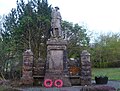 Crianlarich War Memorial
 -
 The Line to Fort William
 -
 Crianlarich station
 -
 Meeting of the ways
 -
 The Crianlarich Munros

.jpg)


References
[edit]- ^ "Settlements - Gaelic - what's in the name". Loch Lomond and the Trossachs. Retrieved 29 July 2019.
- ^ "Stirling at a Glance: 2001 Edition" (PDF). Stirling Council. Archived from the original (PDF) on 9 November 2006. Retrieved 10 December 2014.
External links
[edit]
This Stirling location article is a stub. You can help Wikipedia by expanding it. |