Brewer Street: Difference between revisions
m →top: c/e hatnote per WP:HATEXTRA |
Citation bot (talk | contribs) Alter: title. | Use this bot. Report bugs. | Suggested by Timrollpickering | Category:London road stubs | #UCB_Category 158/175 |
||
| Line 9: | Line 9: | ||
'''Brewer Street''' is a street in the [[Soho]] area of [[central London]], running west to east from [[Glasshouse Street]] to [[Wardour Street]]. |
'''Brewer Street''' is a street in the [[Soho]] area of [[central London]], running west to east from [[Glasshouse Street]] to [[Wardour Street]]. |
||
The street was first developed in the late 17th century by the landowner Sir William Pulteney.<ref>{{cite book |title=The early history of |
The street was first developed in the late 17th century by the landowner Sir William Pulteney.<ref>{{cite book |title=The early history of Piccadilly, Leicester Square, Soho & their neighbourhood |last=Kingsford |first=Charles Lethbridge |year=1925 |publisher=[[Cambridge University Press]] |oclc=277441784 |page=115}}</ref> It first appears on a map of 1664, and was built up over the following decades from east to west. It is now known for its variety of shops and entertainment establishments<ref>{{cite book |title=Frommer's Memorable Walks in London |last=Jones |first=Richard |year=2003 |publisher=[[John Wiley and Sons]] |isbn=978-0-7645-6743-8 |page=[https://archive.org/details/frommersmemorabl0000jone_z5l8/page/132 132] |url-access=registration |url=https://archive.org/details/frommersmemorabl0000jone_z5l8/page/132 }}</ref> typical of Soho. |
||
The street crosses, or meets with, Wardour Street, [[Rupert Street]], [[Walker's Court]], Greens Court, Lexington Street, Great Pulteney Street, Bridle Lane, Sherwood Street, Lower James Street, Lower John Street and Air Street, before meeting with Glasshouse Street at its western end. |
The street crosses, or meets with, Wardour Street, [[Rupert Street]], [[Walker's Court]], Greens Court, Lexington Street, Great Pulteney Street, Bridle Lane, Sherwood Street, Lower James Street, Lower John Street and Air Street, before meeting with Glasshouse Street at its western end. |
||
Revision as of 16:36, 15 December 2022


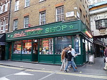
Brewer Street is a street in the Soho area of central London, running west to east from Glasshouse Street to Wardour Street.
The street was first developed in the late 17th century by the landowner Sir William Pulteney.[1] It first appears on a map of 1664, and was built up over the following decades from east to west. It is now known for its variety of shops and entertainment establishments[2] typical of Soho.
The street crosses, or meets with, Wardour Street, Rupert Street, Walker's Court, Greens Court, Lexington Street, Great Pulteney Street, Bridle Lane, Sherwood Street, Lower James Street, Lower John Street and Air Street, before meeting with Glasshouse Street at its western end.
References
- ^ Kingsford, Charles Lethbridge (1925). The early history of Piccadilly, Leicester Square, Soho & their neighbourhood. Cambridge University Press. p. 115. OCLC 277441784.
- ^ Jones, Richard (2003). Frommer's Memorable Walks in London. John Wiley and Sons. p. 132. ISBN 978-0-7645-6743-8.
External links
![]() Media related to Brewer Street at Wikimedia Commons
Media related to Brewer Street at Wikimedia Commons
51°30′41.5″N 0°8′8″W / 51.511528°N 0.13556°W
