Cordillera Central (Bolivia): Difference between revisions
Appearance
Content deleted Content added
m remove Erik9bot category,outdated, tag and general fixes |
cat |
||
| Line 17: | Line 17: | ||
{{Coord|18|30|S|64|55|W|region:BO_type:mountain|display=title}} |
{{Coord|18|30|S|64|55|W|region:BO_type:mountain|display=title}} |
||
[[Category:Mountain ranges of |
[[Category:Mountain ranges of Bolivia]] |
||
[[Category:Mountains of Bolivia]] |
|||
Revision as of 14:23, 25 March 2010


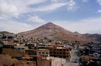
The Cordillera Central is a Bolivian mountain range that divides the three river basins in the country and also has the second highest peaks in Bolivia. It is rich in minerals and starts in the north with Chaupi Orco and the three Palomanis that were in the south up to Zapaleri, forming a border with Chile and Argentina. The Cordillera Central is divided into three sections:
- The northern section or Cordillera Real, with Chaupi Orco and the three Palomanis, also taking into account the most significant of Bolivia that you find near La Paz, Illimani, Illampu, Ancohuma, Mururata, and Huayna Potosí, all of which are more than 6,000 meters high. This section is very famous because the highest meteorological observatory in the world can be found on Chacaltaya. Some of the highest ski slopes in the world can be found here also.
- The central section contains Sumac Orcko, with the Andacava mountains and the Paso de Condor rail station, both situated at an elevation of 4,288 meters.
- The southern section is characterized by its high rate of mineralization and large deposits of tin. Its highest summit is Zapalieri on the border with Chile and Argentina.
See also
18°30′S 64°55′W / 18.500°S 64.917°W
