Bargeddie: Difference between revisions
| Line 33: | Line 33: | ||
* [http://www.saintkevins.com Saint Kevin's Church] |
* [http://www.saintkevins.com Saint Kevin's Church] |
||
* [http://www.bargeddiechurch.org.uk Bargeddie Church of Scotland] |
* [http://www.bargeddiechurch.org.uk Bargeddie Church of Scotland] |
||
* [http:// |
* [http://coatbridge.merryston.co.uk Coatbridge Museum] |
||
* [http://www.bargeddiecolts.co.uk Bargeddie Colts] |
* [http://www.bargeddiecolts.co.uk Bargeddie Colts] |
||
Revision as of 17:10, 9 April 2012
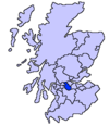
Bargeddie (Scottish Gaelic: Bàrr Geadaidh) is a village in North Lanarkshire, Scotland, just outside the suburban fringe of Glasgow, 8 miles (13 km) east of the city centre, and close to the junction of the M73 and M8 motorways. The nearest major town is Coatbridge, 2 miles (3.2 km) to the east. Despite the decline of the coal, brickworks and steel industries, its population has grown to around 3,501.
History
There was no village of Bargeddie before the 1930's when Lanark County Council built a housing estate at Dykehead. Before that the area consisted of a cluster of hamlets and villages such as Bartonshill, Braehead, and Dykehead, populated in the main by coal miners. There is, however, an amazing display of prescience available to all if they look for Bargeddie in the 1904 Ordnance Survey map, where in spite of the previous authoritative assertion that Bargeddie began in the 1930's, it clearly had some impact 30 years before this with the OS. I further assert that a Bargeddie house (and/or settlement) is identified in John Thomson's Atlas of Scotland 1832, and that this is one and the same area. In the 1950's, another housing estate was built around the site of Bargeddie House which was demolished after World War II. Bargeddie expanded as part of the overall Glasgow area expansion with the addition of the Drumpellier Lawns housing development.
Transport
The town is served by Bargeddie railway station. There are also bus stops which allow villagers to travel to Glasgow and Coatbridge. Bargeddie is served by three bus routes, two of which go to Glasgow city centre, the 213 and the 62.
Sport
The most successful club within the village is Bargeddie Carpet Bowling Club, which has run on Tuesday evenings since 1981. The club is based in the Windsor Hall, an old miners' welfare hall, now controlled by North Lanarkshire Council. The hall celebrated its 100th anniversary in 2008 with a party organised by Bargeddie Forward.
Former Scottish football player and Arsenal manager, George Graham was born in Bargeddie. Football remains an important part of life in the area. Bargeddie Amateur Football Club is well known in the Glasgow area and plays home games at Bargeddie Pavilion.
Jimmy Mallon,wbc, professional shadow boxer, lightweight (1995–2010), unorthodox southpaw (fight record - Win 56; Draw 1; Loss ), undefeated in his long career, is due to enter the MGM Grand vs. Brian Dowling of Big Brother fame. Jimmy is known widely for chanting songs on youtube under the alias "erdyskerdy" and is expected to write, produce and release his own song in-time to be used as his entrance tune for his upcoming fight in the Bargeddie Pavilion .on 13 0f spetember 2009 he out classed José Luis Castillo on that famous night and had the bargeddie crowd on there feet when he knocked out José Luis Castillo in the first round .
In 2009 "Bargeddie Colts" youth football team were reformed. By end of 2011 over 90 children between 5-12 years old were playing football in the "Monklands Soccer Sevens" leagues and the club had achieved SFA Quality Mark "Standard Award".
Religion
Saint Kevin's Catholic Church is located on Mainhill Road. Bargeddie Church of Scotland is situated on Barton's Hill, a 10-minute walk from the village. There is also a small United Free Church on the edge of the village.
Notes and references
- Rental Book Baronia de Glasgow 1513 - 1570
- RCAHMS image of Bargeddie Parish Church
- Canmore/RCAHMS image of Drumpark Brickworks, Bargeddie
- RAILSCOT images of Rutherglen and Coatbridge Railway

