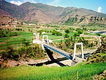
Totakan
Appearance
Jaan sami | |
|---|---|
 | |
| Country | |
| Province | Khyber Pakhtunkhwa |
| District | Malakand |
| Time zone | UTC+5 (PST) |
Malakand is an administrative unit, known as Union council, of Malakand District in the Khyber Pakhtunkhwa province of Pakistan.
District Malakand has 2 Tehsils i.e. Swat Ranizai and Sam Ranizai. Each Tehsil comprises certain numbers of Union councils. There are 28 union councils in district Malakand.

See also
[edit]External links
[edit]- Khyber-Pakhtunkhwa Government website section on Lower Dir
- United Nations
- Hajjinfo.org Uploads
- PBS paiman.jsi.com
34°37′N 71°50′E / 34.617°N 71.833°E
