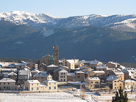
Les Angles, Pyrénées-Orientales
Les Angles
Els Angles | |
|---|---|
 Les Angles in winter | |
| Country | France |
| Region | Occitania |
| Department | Pyrénées-Orientales |
| Arrondissement | Prades |
| Canton | Mont-Louis |
| Government | |
| • Mayor (2014–2020) | Michel Poudade |
| Area 1 | 43.20 km2 (16.68 sq mi) |
| Population (2009) | 564 |
| • Density | 13/km2 (34/sq mi) |
| Time zone | UTC+01:00 (CET) |
| • Summer (DST) | UTC+02:00 (CEST) |
| INSEE/Postal code | 66004 /66210 |
| Elevation | 1,531–2,808 m (5,023–9,213 ft) |
| 1 French Land Register data, which excludes lakes, ponds, glaciers > 1 km2 (0.386 sq mi or 247 acres) and river estuaries. | |
Les Angles (Catalan: Els Angles) is a commune in the Pyrénées-Orientales department in southern France.
Geography
Les Angles is located in the canton of Mont-Louis and in the arrondissement of Prades.

Government and politics
Mayors
| Mayor | Term start | Term end |
|---|---|---|
| Christian Blanc | 2001 | 2014 |
| Michel Poudade | 2014 |
Population
| Year | Pop. | ±% |
|---|---|---|
| 1962 | 255 | — |
| 1968 | 277 | +8.6% |
| 1975 | 351 | +26.7% |
| 1982 | 475 | +35.3% |
| 1990 | 528 | +11.2% |
| 1999 | 590 | +11.7% |
| 2007 | 565 | −4.2% |
| 2009 | 564 | −0.2% |
See also
References
External links
Wikimedia Commons has media related to Les Angles (Pyrénées-Orientales).

