Guinean Forests of West Africa: Difference between revisions
No edit summary Tags: Mobile edit Mobile app edit iOS app edit |
|||
| (8 intermediate revisions by 8 users not shown) | |||
| Line 1: | Line 1: | ||
{{Short description|Biodiversity hotspots of West Africa}} |
|||
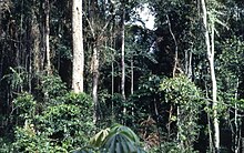
[[File:Tropical rainforest near Konimbo, Liberia (West Africa) 1968 (614744484).jpg|thumb|right|Tropical rainforest near Konimbo, [[Liberia]], 1968]] |
|||
[[File:An aerial view of the Afi River Forest Reserve, Cross River State.jpg|thumb|An Aerial view of the [[Afi River Forest Reserve]] in [[Cross River State]], Nigeria]] |
|||
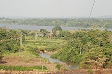
[[file:Alentour fleuve sanaga 09.jpg|thumb|right|Forest along the [[Sanaga River]] at [[Edéa]], Cameroon]] |
|||
The '''Guinean forests of West Africa''' is a [[biodiversity hotspot]] designated by [[Conservation International]], which includes the belt of [[Tropical and subtropical moist broadleaf forests|tropical moist broadleaf forests]] along the coast of [[West Africa]], running from [[Sierra Leone]] and [[Guinea]] in the west to the [[Sanaga River]] of [[Cameroon]] in the east. The [[Dahomey Gap]], a region of savanna and dry forest in [[Togo]] and [[Benin]], divides the Guinean forests into the [[Upper Guinean forests]] and [[Lower Guinean forests]]. |
The '''Guinean forests of West Africa''' is a [[biodiversity hotspot]] designated by [[Conservation International]], which includes the belt of [[Tropical and subtropical moist broadleaf forests|tropical moist broadleaf forests]] along the coast of [[West Africa]], running from [[Sierra Leone]] and [[Guinea]] in the west to the [[Sanaga River]] of [[Cameroon]] in the east. The [[Dahomey Gap]], a region of savanna and dry forest in [[Togo]] and [[Benin]], divides the Guinean forests into the [[Upper Guinean forests]] and [[Lower Guinean forests]]. |
||
The Upper Guinean forests extend from Sierra Leone and Guinea in the west through [[Liberia]], [[Côte d'Ivoire]], and [[Ghana]] to Togo in the east. The [[Lower Guinean forests]] extend east from Benin through [[Nigeria]] and Cameroon. The Lower Guinean forests also extend south past the Sanaga River, the southern boundary of the hotspot, into southern Cameroon, Equatorial Guinea, [[Gabon]], [[Republic of the Congo]], [[Cabinda (province)|Cabinda]], and [[Democratic Republic of the Congo]]. |
The Upper Guinean forests extend from Sierra Leone and Guinea in the west through [[Liberia]], [[Côte d'Ivoire]], and [[Ghana]] to Togo in the east. The [[Lower Guinean forests]] extend east from Benin through [[Nigeria]] and Cameroon. The Lower Guinean forests also extend south past the Sanaga River, the southern boundary of the hotspot, into southern Cameroon, Equatorial Guinea, [[Gabon]], [[Republic of the Congo]], [[Cabinda (province)|Cabinda]], and [[Democratic Republic of the Congo]]. |
||
According to some sources, [[deforestation]] has already wiped out roughly 90% of [[West Africa]]'s original forests.<ref>{{cite web|title=Forest Holocaust|url=http://www.nationalgeographic.com/eye/deforestation/effect.html|work=National Geographic|access-date=16 October 2008|archive-date=22 April 2009|archive-url=https://web.archive.org/web/20090422132805/http://www.nationalgeographic.com/eye/deforestation/effect.html|url-status=dead}}</ref><ref>[http://www.afrol.com/features/10278 Forests and deforestation in Africa - the wasting of an immense resource] {{webarchive|url=https://web.archive.org/web/20090520182556/http://www.afrol.com/features/10278 |date=2009-05-20 }}, afrol News</ref> |
|||
==Ecoregions== |
==Ecoregions== |
||
| Line 12: | Line 18: | ||
'''[[Lower Guinean forests]]''' |
'''[[Lower Guinean forests]]''' |
||
* [[Nigerian lowland forests]] ( |
* [[Nigerian lowland forests]] (Benin, Nigeria) |
||
* [[Niger Delta swamp forests]] (Nigeria) |
* [[Niger Delta swamp forests]] (Nigeria) |
||
* [[Cross-Niger transition forests]] (Nigeria) |
* [[Cross-Niger transition forests]] (Nigeria) |
||
| Line 18: | Line 24: | ||
* [[Cameroonian Highlands forests]] (Nigeria, Cameroon) |
* [[Cameroonian Highlands forests]] (Nigeria, Cameroon) |
||
* [[Mount Cameroon and Bioko montane forests]] (Cameroon, Equatorial Guinea) |
* [[Mount Cameroon and Bioko montane forests]] (Cameroon, Equatorial Guinea) |
||
==See also== |
|||
* [[Guineo-Congolian region]] |
|||
== References == |
|||
{{Reflist}} |
|||
==External links== |
==External links== |
||
Latest revision as of 21:05, 6 November 2023


The Guinean forests of West Africa is a biodiversity hotspot designated by Conservation International, which includes the belt of tropical moist broadleaf forests along the coast of West Africa, running from Sierra Leone and Guinea in the west to the Sanaga River of Cameroon in the east. The Dahomey Gap, a region of savanna and dry forest in Togo and Benin, divides the Guinean forests into the Upper Guinean forests and Lower Guinean forests.
The Upper Guinean forests extend from Sierra Leone and Guinea in the west through Liberia, Côte d'Ivoire, and Ghana to Togo in the east. The Lower Guinean forests extend east from Benin through Nigeria and Cameroon. The Lower Guinean forests also extend south past the Sanaga River, the southern boundary of the hotspot, into southern Cameroon, Equatorial Guinea, Gabon, Republic of the Congo, Cabinda, and Democratic Republic of the Congo.
According to some sources, deforestation has already wiped out roughly 90% of West Africa's original forests.[1][2]
Ecoregions[edit]
The World Wide Fund for Nature divides the Upper and Lower Guinean forests into a number of distinct ecoregions:
- Western Guinean lowland forests (Guinea, Sierra Leone, Liberia, Côte d'Ivoire)
- Guinean montane forests (Guinea, Sierra Leone, Côte d'Ivoire)
- Eastern Guinean forests (Côte d'Ivoire, Ghana, Togo, Benin)
- Nigerian lowland forests (Benin, Nigeria)
- Niger Delta swamp forests (Nigeria)
- Cross-Niger transition forests (Nigeria)
- Cross-Sanaga-Bioko coastal forests (Nigeria, Cameroon, Equatorial Guinea)
- Cameroonian Highlands forests (Nigeria, Cameroon)
- Mount Cameroon and Bioko montane forests (Cameroon, Equatorial Guinea)
See also[edit]
References[edit]
- ^ "Forest Holocaust". National Geographic. Archived from the original on 22 April 2009. Retrieved 16 October 2008.
- ^ Forests and deforestation in Africa - the wasting of an immense resource Archived 2009-05-20 at the Wayback Machine, afrol News
External links[edit]
