
Asō Bay
| Asō Bay | |
|---|---|
 Asō Bay, Tsushima | |
 Asō Bay | |
| Coordinates | 34°20′24″N 129°15′3″E / 34.34000°N 129.25083°E |
| Basin countries | Japan |
| Max. width | 4.18 km (2.60 mi) (at mouth) |
| Surface area | 58 km2 (22 sq mi) |
| Max. depth | 80 m (260 ft) |
| Settlements | Tsushima, Nagasaki Prefecture |
Asō Bay (
Manzeki Channel
[edit]The Manzeki Channel (
- Gallery
-
 Top of Mount Shiroyama and Asō Bay, Tsushima
 -
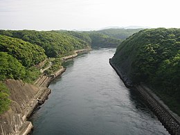 Manzeki Channel (
万関瀬戸 , Manzeki seto)


References
[edit]- ^ Rowlett, Russ. "Lighthouses of Japan: Tsushima". The Lighthouse Directory. University of North Carolina at Chapel Hill.
- ^ "A Profile of Tsushima shi (Tsushima City)". Tsushima City. Archived from the original on 10 September 2020. Retrieved 15 February 2012.
- ^ "
浅茅湾 ". Ministry of the Environment. Retrieved 15 February 2012. - ^ Nicol, C. W. (7 March 2010). "Hark ye to the Donkey's Ears". The Japan Times. Retrieved 15 February 2012.