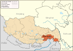
Bamda
Appearance
Bamda Township
帮达乡 | |
|---|---|
| Coordinates: 29°26′42″N 98°42′14″E / 29.4449°N 98.7040°E | |
| Country | People's Republic of China |
| Autonomous region | Tibet Autonomous Region |
| Prefecture-level city | Nyingchi |
| County | Markam |
| Elevation | 3,805 m (12,486 ft) |
| Population | |
| • Total | 789 |
| • Major Nationalities | Tibetan |
| • Regional dialect | Tibetan language |
| Time zone | UTC+8 (CST) |
Bamda (Tibetan: སྤངམདའ།, Wylie: spang mdav;[1] simplified Chinese: 帮达乡; traditional Chinese: 幫達
Footnotes
[edit]- ^ 陈观胜;
安 才 旦 (April 2004). 《常 见藏语人名 地名 词典》 (in Simplified Chinese) (1 ed.). Beijing:外 文 出版 社 [Foreign Languages Press]. p. 24. ISBN 7-119-03497-9. - ^ Buckley, Michael and Strauss, Robert. Tibet: a travel survival kit, p, 217. (1986) Lonely Planet Publications, Victoria, Australia. ISBN 0-908086-88-1.
See also
[edit]


