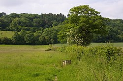
Dawcombe
Appearance
| Dawcombe | |
|---|---|
 | |
 | |
| Type | Nature reserve |
| Location | Reigate, Surrey |
| OS grid | TQ 215 525 |
| Area | 23 hectares (57 acres) |
| Managed by | Surrey Wildlife Trust |
Dawcombe is a 23-hectare (57-acre) nature reserve north-west of Reigate in Surrey. It is managed by the Surrey Wildlife Trust.[1] It is part of the Mole Gap to Reigate Escarpment Site of Special Scientific Interest[2] and Special Area of Conservation.[3]
This site is mainly chalk grassland with large areas of hawthorn scrub and woodland. The grassland provides a habitat for many species of orchids, including pyramidal, fly, common spotted, man, greater butterfly, fragrant and bee.[1]
There is no public access.
References
[edit]- ^ a b "Dawcombe". Surrey Wildlife Trust. Retrieved 30 November 2018.
- ^ "Designated Sites View: Mole Gap to Reigate Escarpment". Sites of Special Scientific Interest. Natural England. Retrieved 9 November 2018.
- ^ "Designated Sites View: Mole Gap to Reigate Escarpment". Special Areas of Conservation. Natural England. Retrieved 28 October 2018.
