Farquhar Airport
Appearance
Farquhar Airport | |||||||||||
|---|---|---|---|---|---|---|---|---|---|---|---|
| Summary | |||||||||||
| Airport type | Private | ||||||||||
| Operator | Islands Development Corporation (IDC)[1] | ||||||||||
| Location | Farquhar Atoll, Seychelles | ||||||||||
| Elevation AMSL | 10 ft / 3 m | ||||||||||
| Coordinates | 10°06′35″S 51°10′35″E / 10.10972°S 51.17639°E | ||||||||||
| Map | |||||||||||
 | |||||||||||
| Runways | |||||||||||
| |||||||||||
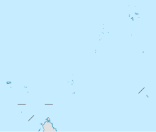
Farquhar Airport (ICAO: FSFA) is an airport serving Farquhar Atoll, part of the Farquhar Group of islands in the Outer Islands of the Seychelles.
The atoll comprises several islands; the airstrip is on Île du Nord (North Island).[5][6] The runway length includes a 130 metres (430 ft) displaced threshold on Runway 31.
See also
[edit]References
[edit]- ^ "Islands Development Corporation". Archived from the original on 2013-07-12. Retrieved 2017-06-22.
- ^ Airport information for FSFA[usurped]
- ^ Airport information for Farquhar Airport at Great Circle Mapper.
- ^ Google Maps - Farquhar Airport
- ^ "Wikimapia - Let's describe the whole world!". www.wikimapia.org. Retrieved 2018-08-24.
- ^ "Farquhar history". Archived from the original on 2017-07-14. Retrieved 2017-06-23.
External links
[edit]- OurAirports - Farquhar
- FallingRain - Farquhar Airport
- Accident history for Farquhar Airport at Aviation Safety Network

