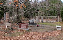
Inverhuron Provincial Park
Appearance
This article needs additional citations for verification. (December 2021) |
| Inverhuron Provincial Park | |
|---|---|
 Shoreline and beach area, Lake Huron | |
Location in Bruce County | |
| Location | Bruce County, Ontario, Canada |
| Nearest city | Tiverton |
| Coordinates | 44°17′59″N 81°35′17″W / 44.29972°N 81.58806°W |
| Area | 288 ha (710 acres) |
| Established | 1956 |
| Visitors | 132,251 (in 2022[2]) |
| Governing body | Ontario Parks |
| Website | ontarioparks |
 | |
Inverhuron Provincial Park is a provincial park located on the shores of Lake Huron beside the small village of Inverhuron, Ontario, near Tiverton, Ontario, Canada. The park opened in 1956.

With the construction of a heavy water "deuterium oxide" plant at the Bruce Nuclear Power Development, Ontario Hydro purchased the park from the Ministry of Natural Resources in 1973 for issues of safety and security.[3]
See also
[edit]References
[edit]- ^ UNEP-WCMC. "Protected Area Profile for Inverhuron Provincial Park". World Database on Protected Areas. Retrieved 2024-11-02.
- ^ Parks, Ontario. "Ontario_Parks-Visitation-Statistics 2022 - Ministries". data.ontario.ca. Retrieved 2024-11-02.
- ^ Inverhuron Provincial Park Final Environmental Study Report [dead link]
External links
[edit]


