Kalinkovo
Kalinkovo | |
|---|---|
Municipality | |
 | |
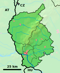
Location of Kalinkovo in the Bratislava Region | |
| Coordinates: 48°04′N 17°15′E / 48.067°N 17.250°E | |
| Country | Slovakia |
| Region | Bratislava |
| District | Senec |
| First mentioned | 1258 |
| Area | |
| • Total | 12.91[2] km2 (4.98[2] sq mi) |
| Elevation | 129[3] m (423[3] ft) |
| Population (2021) | |
| • Total | 1,478[1] |
| Postal code | 900 43[3] |
| Area code | +421 15[3] |
| Car plate | SC |
| Website | www.obeckalinkovo.sk |
Kalinkovo (Hungarian: Szemet) is a village and municipality in western Slovakia in Senec District in the Bratislava Region.[5][6]
History
[edit]The village was first mentioned in 1258 as Dénešdi village and later in 1288 as Šemet.[7] In 1948 the name was changed to Kalinkovo that carries today.[8]
Geography
[edit]The municipality lies at an altitude of 131 meters and covers an area of 12.912 km².[9] It has a population of 1193 people.[10]
Facilities
[edit]The village has a public library, post office, gas distribution network and a football pitch.[10] In the centre of the village is one big church (in comparison with other neighbour villages) called Kostol sv. Františka z Assisi.In this village you can also find a small graveyard with 3 meters tall jesus on the cross statue.[11]
Genealogical resources
[edit]The records for genealogical research are available at the state archive "Statny Archiv in Bratislava, Slovakia"
- Roman Catholic church records (births/marriages/deaths): 1672-1896 (parish B)
- Lutheran church records (births/marriages/deaths): 1706-1895 (parish B)
See also
[edit]External links/Sources
[edit] Media related to Kalinkovo at Wikimedia Commons
- Official page
- https://web.archive.org/web/20070513023228/http://www.statistics.sk/mosmis/eng/run.html
- ^ "Počet obyvateľov podľa pohlavia - obce (ročne)". www.statistics.sk (in Slovak). Statistical Office of the Slovak Republic. 2022-03-31. Retrieved 2022-03-31.
- ^ a b "Hustota obyvateľstva - obce [om7014rr_ukaz: Rozloha (Štvorcový meter)]". www.statistics.sk (in Slovak). Statistical Office of the Slovak Republic. 2022-03-31. Retrieved 2022-03-31.
- ^ a b c d "Základná charakteristika". www.statistics.sk (in Slovak). Statistical Office of the Slovak Republic. 2015-04-17. Retrieved 2022-03-31.
- ^ a b "Hustota obyvateľstva - obce". www.statistics.sk (in Slovak). Statistical Office of the Slovak Republic. 2022-03-31. Retrieved 2022-03-31.
- ^ "Obec Kalinkovo | Oficiálne stránky obce | Obec Kalinkovo". Archived from the original on 2014-08-18. Retrieved 2012-11-01.
- ^ "Titulná stránka -... - UPVS".
- ^ "Obec Kalinkovo | Oficiálne stránky obce | História". www.obeckalinkovo.sk. Archived from the original on 2013-10-21.
- ^ "Home". kalinkovo.cestovanie.biz.
- ^ "Kalinkovo - Okres Senec - E-OBCE.sk".
- ^ a b "Kalinkovo - Súčasnosť obce - Okres Senec - E-OBCE.sk".
- ^ "Pamiatky - Kalinkovo (Okres Senec) - informácie, turistika, bývanie, pamiatky".


