
Mita, Minato, Tokyo
Mita
| |
|---|---|
District | |
 Mitsui Tsunamachi Club in Mita | |
 Mita Location of Mita in Minato ward, Tokyo | |
| Coordinates: 35°38′51″N 139°44′26″E / 35.64750°N 139.74056°E | |
| Country | Japan |
| City | Tokyo |
| Ward | Minato |
| Area | Shiba Area (1, 2, 3-chōme) Takanawa Area (4, 5-chōme) |
| Population (January 1, 2016) | |
| • Total | 18,760 |
| Time zone | UTC+9 (JST) |
| Area code | 03 |
Mita (
Mita is bordered by Higashi-Azabu on the north, Azabu-Jūban and Minami-Azabu to the west, and Shirokane and Takanawa to the south.
Mita is home to Keio University, Mita Hachiman Jinja, and the diplomatic missions of Kuwait, Italy, Hungary, Papua New Guinea, and Australia.
Geography
[edit]Mita consists of five chōme:
- Mita 1-chōme and 5-chōme are low lands by Furu River and consist of a mix of both residential and commercial areas.
- Mita 2-chōme, once known as Mita Tsunamachi (
三田 綱 町 ), is on high, elevated land and is a historically wealthy part of Mita, once home to grand estates of several Daimyo. Some of these estates remain to this day: the Tsunamachi Mitsui Club, Australian Embassy, and Italian Embassy are all on former Daimyo estates. - Mita 3-chōme mostly consists of commercial buildings.
- Mita 4-chōme consists of many historic temples.
Economy
[edit]The Yazaki Group has its corporate headquarters in the Mita-Kokusai Building (
Transportation
[edit]As a historically quiet, upscale, residential area, Mita does not have any train or subway stations within its borders. However, it is located near:
- Akabanebashi Station on the Toei Ōedo Line
- Azabu-juban Station on the Toei Ōedo Line and Tokyo Metro Namboku Line
- Mita Station on the Toei Mita Line and Toei Asakusa Line (Despite its name, Mita Station is not located in Mita, but in the neighboring Shiba district.)
- Shirokane-takanawa Station on the Tokyo Metro Namboku Line and Toei Mita Line
- Tamachi Station on the Yamanote Line and Keihin-Tōhoku Line
Notable places in Mita
[edit]Slopes
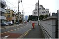
[edit]Many roads up to the Mita plateau have named slopes of historical significance. Each is marked by a wooden post which explains the name.
- Hijiri zaka (
聖 坂 ) corresponds to the ancient Tōkaidō road (東海道 ). The slope's name changes between the top of Isarago zaka (伊 皿 子 坂 ) and the Nihon enoki dori (二本榎 通 り).
- Gyoran zaka (
魚 藍 坂 ) is a hill road in Mita 4-chōme. It reaches the promontory from Gyoranzaka Crossing which results from the summit in Isaragozaka.
- Katsura zaka (
桂坂 ) (from katsura (桂 , lit. 'katsura tree')) is a hill road which lies between Takanawa 2-chōme and 3-chōme. Its name possibly originates from the fact that ivy and vines historically covered the surface of this hill, though an alternate etymology says that a Buddhist priest who wore a wig (鬘 , katsura) died along this slope suddenly on a return trip from Shinagawa. [citation needed]
- Zakuro zaka (
石榴 坂 ) is a hill road which crosses between Takanawa 3-chōme and 4-chōme. The street was probably named because there was a pomegranate tree (石榴 , zakuro) in the middle of a slope a long time ago. The area has many hotels.
- Hebi zaka (
蛇 坂 ) (from hebi (蛇 , lit. 'snake')) is a slope which is in Mita 4-chōme.
- Anzenji zaka (
安全 寺坂 ) is a hill road crossing between Mita 3-chōme and 4-chōme. The temple of Anzenji was built here in the Edo era.
- Hora zaka (
洞 坂 , lit. 'cavernous slope') is a hill road in Takanawa 3-chōme. It is alternatively called Hora zaka (法螺 坂 , lit. 'conch shell slope')) and Bora zaka (鯔 坂 , lit. 'herring slope').
- Hiyoshi zaka (
日吉 坂 ) is a hill road which forms the border of Shirokane 2-chōme and 4-chōme. It goes from Meguro-dori in the southwest to Sakurada-dori in the northeast, and goes past the Kuwahara zaka (桑原 坂 ) to the south. The name originates from the Noh actor Hiyoshi Kahei who lived nearby.
-

-
-
-
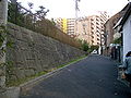
 Top of Hora zaka
 -
 Katsura zaka
 -
 Hiyosi zaka


Shinto shrines and temples
[edit]In the early stages of the Edo period, the shōgun decided to extend Edo Castle and ordered temples around the castle to move to Mita. From this reason, there were many temples on the hill, especially in area named Tera machi (


Parks
[edit]
In the Edo period, Mita was home to the estates of daimyō (most were tozama daimyō (
- Mitadai Kōen (
三田 台 公園 ) - Toyouka-cho Jidou Yuuen (
豊岡 町 児童 遊園 ). Its former name is Toyooka Kōen (豊岡 公園 ).- Children's park which exists in Mita 5-11-6 Minato, Tokyo, Japan. Its former name is Toyooka Kōen (
豊岡 公園 ). - Area: 191 m2 (2,060 sq ft)
- Nearby subway station: Shirokane-takanawa (
白金 高輪 ) - Although a swing, sandbox, launching platform, box type swing, and drinking fountain once existed here, all except the drinking fountain have been removed.
- Children's park which exists in Mita 5-11-6 Minato, Tokyo, Japan. Its former name is Toyooka Kōen (
Embassies
[edit]- Australian embassy
- Italian embassy
Universities
[edit]Tertiary schools
[edit]Primary and secondary schools
[edit]Minato City Board of Education operates public elementary and junior high schools.
Mita 1–2 chōme are zoned to Akabane Elementary School (
Full list of primary and secondary schools:
- Minato City Mita Junior High School (
港 区立 三田 中学校 ) - Minato City Mita Elementary School (
港 区立 御田 小学校 ) - Minato City Akabane Elementary School (
赤羽 小学校 ) - Friends Girls Junior & Senior High School
- Tokai University Takanawadai Junior & Senior High School (
東海大学 付属 高 輪 台 高等 学校 ・中等 部 ) - Takanawa Junior / Senior High School (
高輪 中学 高等 学校 ) - Kindergarten Teacher Training College, Seitoku University (
聖徳大学 幼児 教育 専門 学校 ) - Laurus International School of Science Primary School
-
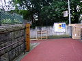
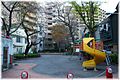 Mita Matsuzaka Children's Park
(松坂 児童 公園 , Matsuzaka Jido Kōen) -
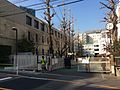 Akabane Elementary School
(赤羽 小学校 ) -
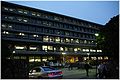
 Mita Elementary School
(港 区立 御田 小学校 ) -
 Mita Junior High School
(港 区立 三田 中学校 ) -
![Meiji Gakuin University (明治学院大学) [1]](https://upload.wikimedia.org/wikipedia/commons/thumb/d/df/Meiji_Gakuin_University.jpg/120px-Meiji_Gakuin_University.jpg)
-


![Meiji Gakuin University (明治学院大学) [1]](https://trans.hiragana.jp/ruby/https://en.wikipedia.org/wiki/File:Meiji_Gakuin_University.jpg)

Public libraries
[edit]Minato City Library operates Mita Library in nearby Shiba.[4]
See also
[edit]- Edo Meisho Zukai (
江戸 名所 図解 ) - Hasegawa Settan (
長谷川 雪 旦 )
References
[edit]- ^ Inc, ITmedia (2020-12-01). "【2020
年 最新 版 】社長 の住 む街 ランキングTOP10". ねとらぼ調査 隊 (in Japanese). Retrieved 2021-04-03.{{cite web}}:|last=has generic name (help) - ^ "Japan." Yazaki. Retrieved on June 18, 2015. "Headquarters 17th Floor, Mita-Kokusai Bldg., 4-28 Mita 1-chōme, Minato-ku, Tokyo, 108-8333 Japan" - Japanese address: "
本 社 〒108-8333東京 都 港 区 三田 1-4-28三田 国際 ビル17F" - ^ "
港 区立 小・中学校 通学 区域 一覧 表 (令 和 4年 4月 以降 )" (PDF). City of Minato. Retrieved 2022-10-08. - ^ "Mita Library". Minato City Library. Retrieved 2023-01-18.
Fudanotsuji Square 5-36-4 Shiba, Minato City, Tokyo 108-0014

| Authority control databases: Geographic |
|---|