
Nanri Island
Native name: | |
|---|---|
 Nanri Island Location in the Taiwan Strait  Nanri Island Nanri Island (Southeast Asia)  Nanri Island Nanri Island (Asia) | |
| Geography | |
| Location | In the Taiwan Strait, southeast of the Asian mainland in Nanri Town, Xiuyu District, Putian, Fujian, China |
| Coordinates | 25°12′08″N 119°29′53″E / 25.202288°N 119.498077°E |
| Area | 42.1 km2 (16.3 sq mi) |
| Administration | |
| Province | Fujian |
| Prefecture-level city | Putian |
| District | Xiuyu |
| Town | Nanri |
| Additional information | |
| Time zone | |

Nanri Island[1] (Chinese: simplified Chinese:
History
[edit]In October 1952, the island was the site of the Battle of Nanri Island between the People's Liberation Army and the Republic of China Army; the engagement ended in an ROC victory and resulted in the ROC occupying Nanri. However, ROC forces later withdrew to Taiwan, and the island was re-occupied by the People's Republic of China.[6]
Administrative divisions
[edit]The town of Nanri (which includes nearby islands) is divided into seventeen villages:[3][7]
- Haishan (
海山 村 ), Yunwan (云 万 村 ), Yanxia (岩下 村 ), Shipan (石 盘村 ), Shanchu (山初 村 ), Wanfeng (万 峰 村 ), Sandun (三 墩村 ), Xigao (西高 村 ), Shayang (沙 洋 村 ), Gangnan (港南 村 ), Fuye (浮叶村 ), Houye (后 叶 村 ), Dongdai (东岱村 ), Xiaori (小 日 村 ), Aoyu (鳌屿村 , also known as Ta-ao Hsü (大 嶅㠘)), Luopan (罗盘村 ), Chishan (赤山 村 )
Other populated places include Fou-tou (浮斗), Hsi-hu (
Economy
[edit]The island is heavily involved in the fishing industry, and several fish farms have been established off the coast of the island.[9][10] The island's mudflats are cultivated for seaweed and kelp production.[10] Other important sectors are tourism and the energy sector.[5] In 2015, a wind farm was established on the island.[11][12]
Gallery
[edit]Maps including Nanri Island:
-
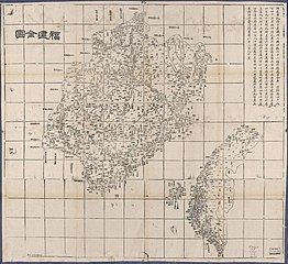 Map including Nanri Island (labeled as
南 日 嶼) -
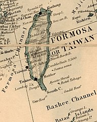 Map of the area including Lamyit I. (Nanjih or Nanri Island) (1880)
 -
 Japanese map including Nanri Island (labeled as
南 日 島 ) (1943) -
 Map including Nanri Island (labeled as NAN-JIH TAO
南 日 島 ) (AMS, 1954) -
 Map including Nanri Island (labeled as Nan-jih Tao (Lam Yit)) (AMS, 1954)
 -
 Map including Nanri Island (labeled as NANRI DAO) (DMA, compiled 1971, revised 1996)

_in_1880,_from-_Stanford%27s_map_of_the_empires_of_China_and_Japan_with_the_adjacent_parts_of_the_Russian_Empire,_India,_Burma_etc._LOC_2006458442_(cropped).jpg)


References
[edit]- ^ Huang, Faming; Lin, Yanhong; Liang, Huixin; Zhao, Rongrong; Chen, Qiuming; Lin, Jie; Huang, Jinliang (3 December 2019). "Coordination of Marine Functional Zoning Revision at the Provincial and Municipal Levels: A Case Study of Putian, China". Journal of Marine Science and Engineering. 7 (12): 5. doi:10.3390/jmse7120442.
- ^ Edward Stanford (1908). Atlas of the Chinese Empire (1 ed.). pp. 24, 82.
Nanjisü{...}Nanjisü, Fukien . . 25.14 N 119.30 E
- ^ a b c
南 日 镇. 莆田市 秀 屿区人民 政府 (in Simplified Chinese). 7 September 2017. Retrieved 10 February 2020.南 日 岛古称 南 匿山,又 名 南 日山 ,{...}全 镇陆域 总面积56平方 千 米 ,由 111个岛屿组成 ,面 积在0.1平方 千米以上的岛屿有18个,有 "十 八 列 岛"之 称 ,较大的 有 小 日 、鳌屿、罗盘、赤山 等 岛。{...}全 岛有17个村, - ^
海 岛资源 . 莆田市 秀 屿区人民 政府 (in Simplified Chinese). 7 September 2017. Retrieved 8 February 2020. - ^ a b Jiang, Mengzhen; Pang, Xiaoping; Wang, Jianjun; Cao, Chao (2018). "Islands ecological integrity evaluation using multi sources data". Ocean & Coastal Management. 158: 134–143.
- ^ High Seas Buffer: The Taiwan Patrol Force, 1950-1979 By Bruce A. Elleman p60 Naval War College Newport Papers. 2012
- ^ 2018
年 统计用 区 划代码和城 乡划分 代 码:南 日 镇 [2018 Statistical Area Numbers and Rural-Urban Area Numbers: Nanri Town] (in Simplified Chinese). National Bureau of Statistics of the People's Republic of China. 2018. Retrieved 15 February 2020.统计
用 区 划代码城 乡分类代码名称 350305107201 121海山 村 委 会 350305107202 220云 万 村 委 会 350305107203 220岩下 村 委 会 350305107204 220石 盘村委 会 350305107205 220山初 村 委 会 350305107206 220万 峰村 委 会 350305107207 220三 墩村委 会 350305107208 220西高 村 委 会 350305107209 220沙 洋 村 委 会 350305107210 220港 南村 委 会 350305107211 220 浮叶村 委 会 350305107212 220后 叶 村 委 会 350305107213 220 东岱村 委 会 350305107214 220小 日村 委 会 350305107215 220 鳌屿村 委 会 350305107216 220 罗盘村 委 会 350305107217 220赤 山村 委 会 - ^ "NG 50-12 P'U-T'IEN" (in English and Chinese). Washington, D. C.: Army Map Service. 1954 – via Perry–Castañeda Library Map Collection.
- ^ Alerts | 29/09/15 (2015-09-29). "Fishing farms around NanRi Island, China". SAFETY4SEA. Retrieved 2019-03-22.
{{cite web}}: CS1 maint: numeric names: authors list (link) - ^ a b
苗 明媚 . "Total fishery output in Nanri Island of SE China's Fujian up 6.2 percent - Xinhua | English.news.cn". www.xinhuanet.com. Archived from the original on March 22, 2019. Retrieved 2019-03-22. - ^ "Nanri Island Offshore Wind Power Project | Reconnecting Asia". reconnectingasia.csis.org. Retrieved 2019-03-22.
- ^ 杨懿. "In pics: wind farm on SE China's Nanri Island - Xinhua | English.news.cn". www.xinhuanet.com. Archived from the original on March 4, 2019. Retrieved 2019-03-24.