Salahlay
Salahley
Sallaxley | |
|---|---|
City | |
| Salahlay | |
| Coordinates: 9°01′36″N 44°12′26.9″E / 9.02667°N 44.207472°E | |
| Country | |
| Region | Marodi Jeh |
| District | Salahlay District |
| Government | |
| • Type | Council Government |
| • Mayor | Eng Maxamed Cabdi Haariye bulaale |
| Elevation | 1,215 m (3,986 ft) |
| Time zone | UTC+3 (EAT) |
| Area code | +252 |
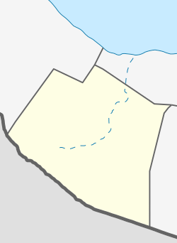
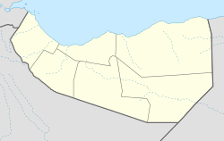
Salahley (Somali: Sallaxley), (Arabic: سلحلي), is a city in the Maroodi Jeex region of Somaliland and is the seat of the Salahlay District. It is south of Hargeisa, the capital of the country.[1]
Location
[edit]The City located around 56 km southeast of Hargeisa and 15 km from the border with the Somali Region of Ethiopia.
Climate
[edit]The climate in Salahley is called a desert climate. There is virtually no rainfall during the year. The climate here is classified as BWh by the Köppen-Geiger system. In Salaxley, the average annual temperature is 22.7 °C. About 367 mm of precipitation falls annually. The driest month is December. There is 1 mm of precipitation in December. In April, the precipitation reaches its peak, with an average of 72 mm. With an average of 24.7 °C, May is the warmest month. At 19.5 °C on average, January is the coldest month of the year. The precipitation varies 71 mm between the driest month and the wettest month. The variation in annual temperature is around 5.2 °C
| Climate data for Salaxley | |||||||||||||
|---|---|---|---|---|---|---|---|---|---|---|---|---|---|
| Month | Jan | Feb | Mar | Apr | May | Jun | Jul | Aug | Sep | Oct | Nov | Dec | Year |
| Mean daily maximum °C (°F) | 27.4 (81.3) |
29 (84) |
30.8 (87.4) |
30.1 (86.2) |
31.4 (88.5) |
31.2 (88.2) |
29.2 (84.6) |
29.9 (85.8) |
31.6 (88.9) |
30.1 (86.2) |
28.3 (82.9) |
27.1 (80.8) |
29.7 (85.4) |
| Mean daily minimum °C (°F) | 11.6 (52.9) |
13.3 (55.9) |
15.6 (60.1) |
16.9 (62.4) |
18 (64) |
18 (64) |
17.7 (63.9) |
17.8 (64.0) |
17.9 (64.2) |
15.5 (59.9) |
13.6 (56.5) |
12.6 (54.7) |
15.7 (60.2) |
| Average precipitation mm (inches) | 3 (0.1) |
4 (0.2) |
26 (1.0) |
72 (2.8) |
65 (2.6) |
29 (1.1) |
29 (1.1) |
41 (1.6) |
54 (2.1) |
34 (1.3) |
9 (0.4) |
1 (0.0) |
367 (14.3) |
| Source: Climate-Data.org,[2] | |||||||||||||
See also
[edit]References
[edit]- ^ "Countries That Aren't Really Countries".
- ^ "Climate: Salaxley- Climate graph, Temperature graph, Climate table". Retrieved 17 November 2019.
https://en.climate-data.org/africa/somalia/woqooyi-galbeed/salaxley-643964


