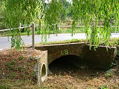
Walderton
Appearance
| Walderton | |
|---|---|
 River Ems, Walderton | |
Location within West Sussex | |
| OS grid reference | SU790106 |
| Civil parish | |
| District | |
| Shire county | |
| Region | |
| Country | England |
| Sovereign state | United Kingdom |
| Post town | Chichester |
| Postcode district | PO18 |
| Police | Sussex |
| Fire | West Sussex |
| Ambulance | South East Coast |
| UK Parliament | |
Walderton is a hamlet in the Chichester district of West Sussex, England. It lies on the B2146 road 4 miles (6.4 km) northeast of Emsworth. It is in the civil parish of Stoughton. The name Walderton derives from the town of Wealdhere's people.[1]
The village lies just below the source of the River Ems.[2][3] It is crossed by the Monarch's Way long-distance footpath,[4] and has a pub named the Barley Mow.[5]
References
[edit]- ^ Ekwall, Eilert (1960). The concise Oxford dictionary of English place-names (4 ed.). Oxford: Oxford University Press. p. 492. ISBN 0-19-869103-3.
- ^ "Ems | Catchment Data Explorer | Catchment Data Explorer". environment.data.gov.uk. Retrieved 1 February 2024.
- ^ George, David (13 January 2021). "Emsworth river becoming 'not much more than a chain of puddles' say campaigners". The News. Retrieved 1 February 2024.
- ^ "Octagon Walk; Walderton to Watergate" (PDF). southdowns.gov.uk. p. 4. Retrieved 1 February 2024.
- ^ Williamson, Richard (27 January 2022). "Country Walk; Walderton Down". Chichester Observer. p. 33. ISSN 0963-3723.
External links
[edit]![]() Media related to Walderton at Wikimedia Commons
Media related to Walderton at Wikimedia Commons

