Mount Sterling (Kentucky)
Apparence
| Mount Sterling | ||||
 Centre-ville de Mount Sterling | ||||
| Administration | ||||
|---|---|---|---|---|
| Pays | ||||
| État | ||||
| Comté | Montgomery | |||
| Code ZIP | 40353 | |||
| Code FIPS | 21-54084 | |||
| GNIS | 0498865 | |||
| Démographie | ||||
| Population | 6 895 hab. (2010) | |||
| Densité | 775 hab./km2 | |||
| Géographie | ||||
| Coordonnées | 38° 03′ 24″ nord, 83° 56′ 40″ ouest | |||
| Altitude | 297 m |
|||
| Superficie | 890 ha = 8,9 km2 | |||
| · dont terre | 8,9 km2 (100 %) | |||
| · dont eau | 0 km2 (0 %) | |||
| Fuseau horaire | EST (UTC-5) | |||
| Localisation | ||||
 Carte du comté de Montgomery. | ||||
| Géolocalisation sur la carte : États-Unis
Géolocalisation sur la carte : États-Unis
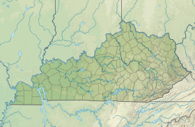
Géolocalisation sur la carte : Kentucky
| ||||
| modifier |
||||
Mount Sterling est le siège du comté de Montgomery, dans l'État du Kentucky, aux États-Unis. Selon le recensement de 2010, sa population est de 6 895 habitants.


