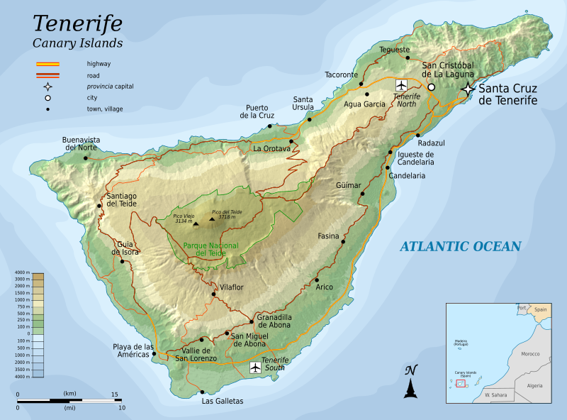
चित्र:Topographic map of Tenerife-en.svg
Appearance

Size of this PNG preview of this SVG file: ८०० × ५९२ पिक्सेल. इतर resolutions: ३२० × २३७ पिक्सेल | ६४० × ४७३ पिक्सेल | १,०२४ × ७५७ पिक्सेल | १,२८० × ९४७ पिक्सेल | २,५६० × १,८९४ पिक्सेल | १,०४५ × ७७३ पिक्सेल.
मूळ संचिका (SVG संचिका, साधारणपणे १,०४५ × ७७३ pixels, संचिकेचा आकार: ५०५ कि.बा.)
संचिकेचा इतिहास
संचिकेची त्यावेळची आवृत्ती बघण्यासाठी त्या दिनांक/वेळेवर टिचकी द्या.
| दिनांक/वेळ | छोटे चित्र | आकार | सदस्य | प्रतिक्रीया | |
|---|---|---|---|---|---|
| सद्य | ११:५५, ६ ऑगस्ट २०१० |  | १,०४५ × ७७३ (५०५ कि.बा.) | Mysid | more roads + north reference |
| ०३:१५, ६ ऑगस्ट २०१० |  | १,०४५ × ७७३ (४६६ कि.बा.) | Mysid | add northern airport | |
| ०२:००, ६ ऑगस्ट २०१० |  | १,०४५ × ७७३ (४६३ कि.बा.) | Mysid | fonts | |
| ०१:५६, ६ ऑगस्ट २०१० |  | १,०४५ × ७७३ (४६३ कि.बा.) | Mysid | {{Information |Description={{en|1=Topographic map of Tenerife, and island of the Canary Islands of Spain.}} |Source=Self-made in Inkscape. |Author=Mysid |Date=2010-08-05 |Permission= |other_versions= }} {{translation possib |
दुवे
खालील पाने या संचिकेला जोडली आहेत:
जागतिक संचिका उपयोग
संचिकाचे इतर विकिपीडियावरील वापरः
- cs.wikipedia.org वरील उपयोग
- en.wikipedia.org वरील उपयोग
- fi.wikipedia.org वरील उपयोग
- fr.wikipedia.org वरील उपयोग
- hr.wikipedia.org वरील उपयोग
- hu.wikipedia.org वरील उपयोग
- ko.wikipedia.org वरील उपयोग
- nl.wikipedia.org वरील उपयोग
- pnb.wikipedia.org वरील उपयोग
- ru.wikipedia.org वरील उपयोग
- sl.wikipedia.org वरील उपयोग
- tr.wikipedia.org वरील उपयोग
- zh.wikipedia.org वरील उपयोग


