Castlethorpe
Uiterlijk
| Civil parish in Engeland | |||
|---|---|---|---|
| Situering | |||
| Regio | South East England | ||
| Graafschap | Buckinghamshire | ||
| District | Milton Keynes | ||
| Coördinaten | 52° 6' NB, 0° 50' WL | ||
| Algemeen | |||
| Oppervlakte | 10,0937 km² | ||
| Inwoners (2011) |
1047 (104 inw./km²) | ||
| Overig | |||
| Postcode(s) | MK19 | ||
| Netnummer(s) | 01908 | ||
| Grid code | SP795445 | ||
| Post town | MILTON KEYNES | ||
| ONS-code | E04001249 | ||
| Foto's | |||

| |||
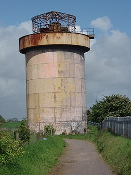
| Oude watertoren van Castlethorpe | |||
| |||
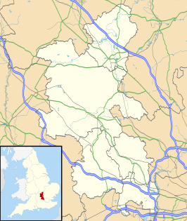
Castlethorpe is een civil parish in het bestuurlijke gebied Milton Keynes, in het Engelse graafschap Buckinghamshire. De plaats telt 1047 inwoners.
De rivier Tove scheidt de plaats met graafschap Northamptonshire. De West Coast Main Line gaat door de plaats.
Geplaatst op:
14-07-2007
14-07-2007
Dit artikel is een beginnetje over landen & volken. U wordt uitgenodigd om op bewerken te klikken om uw kennis aan dit artikel toe te voegen.

