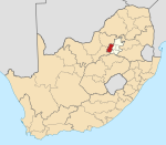
Blyvooruitzicht
Appearance
| Blyvooruitzicht | |
|---|---|
| Coordinates: 26°24′S 27°24′E / 26.400°S 27.400°E | |
| Naga | Afrika Borwa |
| Porofense | Gauteng |
| Mmasepala wa Selete | West Rand |
| Mmušôselegae | Merafong City |
| Sekgôba[1] | |
| • Total | 3.71 km2 (1.43 sq mi) |
| Setšhaba (2011)[1] | |
| • Total | 698 |
| • Phitlaganyo | 190/km2 (490/sq mi) |
| Dipersente tša merafe (2011)[1] | |
| • Bathobaso | 84.2% |
| • Makgowa | 15.8% |
| Dipolelo tša ntlha (2011)[1] | |
| • Sethosa | 26.8% |
| • Afrikaans | 15.2% |
| • Setswana | 12.3% |
| • Sesotho | 10.5% |
| • Šele | 35.2% |
| Nomoro ya poso (Setarata) | Molaô la pôsô |
| Nomoro ya poso (Lepokisi) | Molaô la pôsô |
Blyvooruitzicht ke mining village hleng wa Carletonville go feta Gauteng ka moka Afrika Borwa.
Ditšhupetšo
[lokiša | edit source]- ↑ 1.0 1.1 1.2 1.3 "Main Place Blyvooruitzicht". Census 2011.
Bomasepala ba le metseng ea Mmasepala Setereke tša West Rand, Gauteng | ||
|---|---|---|
| District seat: Randfontein | ||
| Mogale City | Kagiso • Krugersdorp • Lindley • Magaliesburg • Muldersdrift • Munsieville • Rietvallei |  |
| Merafong City | Blyvooruitzicht • Carletonville • East Driefontein • Elandsrand • Fochville • Khutsong • Oberholzer • West Driefontein | |
| Rand West City | Bekkersdal • Mohlakeng • Randfontein • Venterspos • Westonaria • Zuurbekom | |

