ਹਵਾਈ
ਦਿੱਖ
21°18′41″N 157°47′47″W / 21.31139°N 157.79639°W
| ਹਵਾਈ ਦਾ ਰਾਜ Mokuʻāina o Hawaiʻi | |||||
| |||||
| ਉੱਪ-ਨਾਂ: ਅਲੋਹਾ ਰਾਜ (ਅਧਿਕਾਰਕ), ਸੁਰਗ, ਅਲੋਹਾ ਦੇ ਟਾਪੂ | |||||
| ਮਾਟੋ: Ua Mau ke Ea o ka ʻĀina i ka Pono ("The Life of the Land is Perpetuated in Righteousness") ਰਾਜ ਗੀਤ: Hawaiʻi Ponoʻī | |||||
 | |||||
| ਦਫ਼ਤਰੀ ਭਾਸ਼ਾਵਾਂ | ਅੰਗਰੇਜ਼ੀ, ਹਵਾਈ | ||||
| ਵਸਨੀਕੀ ਨਾਂ | ਹਵਾਈ[1] | ||||
| ਰਾਜਧਾਨੀ (ਅਤੇ ਸਭ ਤੋਂ ਵੱਡਾ ਸ਼ਹਿਰ) |
ਹੋਨੋਲੁਲੂ | ||||
| ਸਭ ਤੋਂ ਵੱਡਾ ਮਹਾਂਨਗਰੀ ਇਲਾਕਾ | ਓਆਹੂ ਮਹਾਂਨਗਰੀ ਇਲਾਕਾ | ||||
| ਰਕਬਾ | ਸੰਯੁਕਤ ਰਾਜ ਵਿੱਚ ੪੩ਵਾਂ ਦਰਜਾ | ||||
| - ਕੁੱਲ | 10931 sq mi (28311 ਕਿ.ਮੀ.੨) | ||||
| - ਚੁੜਾਈ | n/a ਮੀਲ (n/a ਕਿ.ਮੀ.) | ||||
| - ਲੰਬਾਈ | 1,522 ਮੀਲ (2,450 ਕਿ.ਮੀ.) | ||||
| - % ਪਾਣੀ | 41.2 | ||||
| - ਵਿਥਕਾਰ | 18° 55′ N ਤੋਂ 28° 27′ N | ||||
| - ਲੰਬਕਾਰ | 154° 48′ W ਤੋਂ 178° 22′ W | ||||
| ਅਬਾਦੀ | ਸੰਯੁਕਤ ਰਾਜ ਵਿੱਚ ੪੦ਵਾਂ ਦਰਜਾ | ||||
| - ਕੁੱਲ | 1392313 (੨੦੧੨ ਦਾ ਅੰਦਾਜ਼ਾ)[2] | ||||
| - ਘਣਤਾ | 214/sq mi (82.6/km2) ਸੰਯੁਕਤ ਰਾਜ ਵਿੱਚ ੧੩ਵਾਂ ਦਰਜਾ | ||||
| - ਮੱਧਵਰਤੀ ਘਰੇਲੂ ਆਮਦਨ | $63746 (੫ਵਾਂ) | ||||
| ਉਚਾਈ | |||||
| - ਸਭ ਤੋਂ ਉੱਚੀ ਥਾਂ | ਮਾਓਨਾ ਕੀਆ[3][4][5][6] 13,796 ft (4205.0 m) | ||||
| - ਔਸਤ | 3,030 ft (920 m) | ||||
| - ਸਭ ਤੋਂ ਨੀਵੀਂ ਥਾਂ | ਪ੍ਰਸ਼ਾਂਤ ਮਹਾਂਸਾਗਰ[4] sea level | ||||
| ਸੰਘ ਵਿੱਚ ਪ੍ਰਵੇਸ਼ | ੨੧ ਅਗਸਤ, ੧੯੫੯ (੫੦ਵਾਂ) | ||||
| ਰਾਜਪਾਲ | ਨੀਲ ਐਬਰਕਰੌਂਬੀ (ਲੋ) | ||||
| ਲੈਫਟੀਨੈਂਟ ਰਾਜਪਾਲ | ਸ਼ਾਨ ਤਸੂਤਸੂਈ | ||||
| ਵਿਧਾਨ ਸਭਾ | ਵਿਧਾਨ ਸਭਾ | ||||
| - ਉਤਲਾ ਸਦਨ | ਸੈਨੇਟ | ||||
| - ਹੇਠਲਾ ਸਦਨ | ਪ੍ਰਤੀਨਿਧੀਆਂ ਦਾ ਸਦਨ | ||||
| ਸੰਯੁਕਤ ਰਾਜ ਸੈਨੇਟਰ | ਬਰਾਇਨ ਸ਼ਾਟਜ਼ ਮਾਜ਼ੀ ਹਿਰੋਨੋ | ||||
| ਸੰਯੁਕਤ ਰਾਜ ਸਦਨ ਵਫ਼ਦ | ੧: ਕੋਲੀਨ ਹਨਾਬੂਸਾ (ਲੋ) ੨: ਟਲਸੀ ਗਬਾਰਡ (ਲੋ) (list) | ||||
| ਸਮਾਂ ਜੋਨ | ਹਵਾਈ: UTC−੧੦ (ਕੋਈ DST ਨਹੀਂ) | ||||
| ਛੋਟੇ ਰੂਪ | HI US-HI | ||||
| ਵੈੱਬਸਾਈਟ | www | ||||
ਹਵਾਈ (/həˈwaɪ.iː/ (![]() ਸੁਣੋ) ਜਾਂ /həˈwaɪʔiː/; ਹਵਾਈ: Hawaiʻi ਹਵਾਈ ਉਚਾਰਨ: [hɐˈvɐiʔi]) ੫੦ ਅਮਰੀਕੀ ਰਾਜਾਂ ਵਿੱਚੋਂ ਸਭ ਤੋਂ ਨਵਾਂ ਹੈ ਜੋ ਸੰਘ ਵਿੱਚ ੨੧ ਅਗਸਤ, ੧੯੫੯ ਨੂੰ ਦਾਖ਼ਲ ਹੋਇਆ। ਇਹ ਇੱਕੋ ਇੱਕ ਅਮਰੀਕੀ ਰਾਜ ਹੈ ਜੋ ਪੂਰੀ ਤਰ੍ਹਾਂ ਟਾਪੂਨੁਮਾ ਹੈ।
ਸੁਣੋ) ਜਾਂ /həˈwaɪʔiː/; ਹਵਾਈ: Hawaiʻi ਹਵਾਈ ਉਚਾਰਨ: [hɐˈvɐiʔi]) ੫੦ ਅਮਰੀਕੀ ਰਾਜਾਂ ਵਿੱਚੋਂ ਸਭ ਤੋਂ ਨਵਾਂ ਹੈ ਜੋ ਸੰਘ ਵਿੱਚ ੨੧ ਅਗਸਤ, ੧੯੫੯ ਨੂੰ ਦਾਖ਼ਲ ਹੋਇਆ। ਇਹ ਇੱਕੋ ਇੱਕ ਅਮਰੀਕੀ ਰਾਜ ਹੈ ਜੋ ਪੂਰੀ ਤਰ੍ਹਾਂ ਟਾਪੂਨੁਮਾ ਹੈ।
ਹਵਾਲੇ
[ਸੋਧੋ]- ↑ Local usage generally reserves Hawaiian as an ethnonym referring to Native Hawaiians. Hawaii resident or islander is the preferred local form to refer to state residents in general regardless of ethnicity. The Associated Press Stylebook, 42nd ed. (2007), also prescribes this usage (p. 112).
- ↑ "Annual Estimates of the Resident Population for the United States, Regions, States, and Puerto Rico: April 1, 2010 to July 1, 2011" (CSV). 2011 Population Estimates. United States Census Bureau, Population Division. December 2011. Retrieved December 21, 2011.
- ↑ "Summit USGS 1977". NGS data sheet. U.S. National Geodetic Survey. http://www.ngs.noaa.gov/cgi-bin/ds_mark.prl?PidBox=TU2314. Retrieved October 20, 2011.
- ↑ 4.0 4.1 "Elevations and Distances in the United States". United States Geological Survey. 2001. Archived from the original on ਅਕਤੂਬਰ 15, 2011. Retrieved October 21, 2011.
{{cite web}}: Unknown parameter|dead-url=ignored (|url-status=suggested) (help) Archived November 2, 2011[Date mismatch], at the Wayback Machine. - ↑ Elevation adjusted to North American Vertical Datum of 1988.
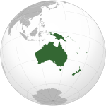
- ↑ The summit of Mauna Kea is the highest point in Oceania. Mauna Kea is also the tallest mountain on Earth as measured from base to summit. The shield volcano sits on the floor of the Pacific Ocean at a depth of 5,998 meters (19,678 ft) for a total height of 10,205.3 meters (33,482 ft)


